“Refreshing. It functions in a way that isn’t necessarily part of our vocabulary. There are
different moments in the design.”
—2012 Professional Awards Jury“别开生面。功能方式耳目一新,与众不同的设计。”
2012年专业奖评审委员会
来自土人设计 北大景观研究所 对gooood的分享。更多关于他们:Turenscape on gooood
Appreciation towards Turenscape 北大景观研究所 for providing the following description:
All Image © Kongjian Yu
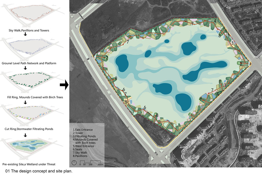
▲概念和总平面图
1. 引言:雨涝困扰当代城市
全球气候变化导致了前所未有的极端天气,强暴雨时有发生,由此导致的城市洪水已经成为了全球性问题。在中国,由于中国不断扩大的城市建设区,而且多数城市都处在季风气候中,70-80%的年降水都集中在夏季,在一些极端的例子中,每年20%的自然降水可以在一天内完成。以北京为例,年平均降水只有500mm,但在2011年,仅一天的降水就达到了50到120mm。因为不渗水铺装的增加,即使在常态降雨情况下,城市雨涝在中国的各主要城市中仍然娄见不鲜。
通常,人们会借助于市政排水工程的方法来解决城市雨涝问题:铺设大型排水管道,更大的泵或者建更坚固的堤坝,这种单一的方法带来着很多的问题:
(1).经济方面:建造足够大容量的地下管道系统来排放极端暴雨,是十分浪费和昂贵的,而且也会增加我们的子孙们的城市管理和维护负担。
(2) 水资源短缺方面:中国淡水资源短缺,大都市区域的地下水位下降是一个严重的问题。在中国660多个城市里,有400多个正经历着水资源短缺的困扰。比如,在中国的华北地区每年地下水位下降达2米之多。由于过度使用地下水,几乎没有给地下含水层以足够的补给,可以看到北京在过去三十年间,地下水位平均每年下降1.5米。所有落到城市的雨水都经由管道排走或引入河流。
(3) 生态系统服务方面:工程雨水排放系统的广泛使用,造成了地表水体的消失,包括水生生境尤其是城市湿地的消失。另外,当所有这些雨水被排走的时候,城市里的公园和绿色空间就需要更多的灌溉,于是就更加剧了水资源短缺问题。在这种情况下,公园绿地是昂贵的消费者,而非生产者和生态服务的供给者。利用景观滞留和净化雨水,起到海绵的作用,是常规市政工程以外的、能对城市雨洪水管理发挥很大作用的很好途径。这种方法的一个例子是本文介绍的哈尔群力滨雨洪公园。 它整合了大尺度雨洪景观管理和城市乡土生境的保护、地下水补充、居民休憩和审美体验等多种功能,对综合而明智地解决城市雨洪问题,进行了有益的探索。
2. 设计内容与目标
2006年,位于中国北方城市哈尔滨市的东部新城——群力开始建设,总占地2733公顷。在接下来的13到15年里,将有3200万平方米的建筑全部建成,约30万人将在这里居住。仅有16.4%的城市土地被规划为永久的绿色空间,原先大部分的平坦地将被混凝土覆盖。当地的年降水量是567mm,60%-70%集中在6-8月份,历史上该地区洪涝频繁。
2009年中,受当地政府委托,北京土人景观承担了这个新城中心一个主要公园的设计,占地34.2公顷,原为一块被保护的区域湿地。受周边道路建设和高密度城市发展的影响,湿地面临着严重威胁。最初委托方只要求设计师能想办法维护湿地的存在,土人的设计改变了为保护而保护的单一目标,而是从解决城市问题出发,利用城市雨洪,将公园转化为城市雨洪公园,从而为城市提供了多重生态系统服务:它可以收集、净化和储存雨水,经过湿地净化后的雨水补充地下水含水层;受雨水的侵润,可以使茂盛的乡土生境在城市中央繁衍; 同时,通过巧妙设计,雨洪公园可以成为市民休憩的良好去处,并带动城市的发展。从上述目标出发,该项目中,创新性地运用了以下几个设计策略:
3.设计理念与策略
总体的设计理念是,通过最少的工程量,来实现城市、建筑及人的活动与洪涝过程的和谐共生,实现城市绿地的综合生态系统服务功能。
(1)保留现存湿地中部的大部分区域,作为自然演替区。这样,既可以大大减少工程量,同时,可以让本土的自然景观得以充分地繁育。
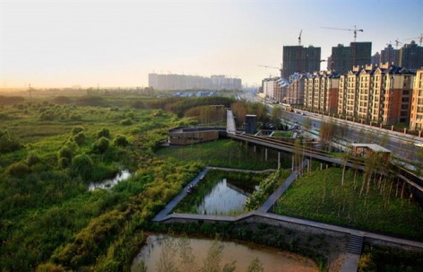
(2)沿四周通过挖填方的平衡技术,创造出一系列深浅不一的水坑和高低不一的土丘,成为一条蓝-绿宝石项链,作为雨水过滤和净化带,是城市与自然湿地之间的缓冲区,形成自然与城市之间的一层过滤膜和体验界面。沿湿地四周布置雨水进水管,收集新城市区的雨水,使其经过沉淀和过滤后进入核心区的自然湿地。不同深度的水泡为乡土水生和湿生植物群落提供多样的栖息地,开启自然演替进程。土丘上密植白桦林((Betula pendula),步道网络穿梭于丘林和水泡之间,给游客带来林穿越山林的体验。水泡中设临水平台和座椅,使人们可以更加贴近自然。
(3) 高架栈桥连接山丘,给游客们带来凌空于树冠之上的体验。多个观光平台,5个亭子(竹、木、砖、石和金属)和两个观光塔(一个是钢质高塔,位于公园的东端;另外一个是木质的树状高塔,坐落在西北角)在山丘之上,通过空中走廊连接,通过这些体验空间的设计,使人远可眺公园之泱泱美景,近可体验公园内各自然景观之元素。
4. 结果
通过场地的转换设计,使湿地的多种功能的以彰显:包括收集、净化、储存雨水和补给地下水。昔日的湿地得到了恢复和改善,乡土生物多样性得以保存,同时为城市居民营造了舒适的居住环境。原来被城市发展所包围的省级湿地公园,通过本设计和工程,目前已经晋升为国家城市湿地公园。建筑与雨洪得以和谐共生,自然和城市发展得以同时发展。
哈尔滨群力雨洪公园
群力新区, 哈尔滨, 黑龙江, 中国
项目面积:34公顷
设计时间:2009年6-11月;建成时间:2010年11月
设计团队:俞孔坚、宋本明、龙翔、韩晓烨、李宏丽、 张文娟、孟繁鑫、孟祥芸、李果、
张莉、官苗苗、徐波、袁文宇、何冲、陈枫、凌宏
Contemporary cities are not resilient when faced with inundations of surface water. Landscape architecture can play a key role in addressing this problem. This project demonstrates a Stormwater park that acts as a green sponge, cleansing and storing urban stormwater and can be integrated with other ecosystem services including the protection of native habitats, aquifer recharge, recreational use, and aesthetic experience, in all these ways fostering urban development.
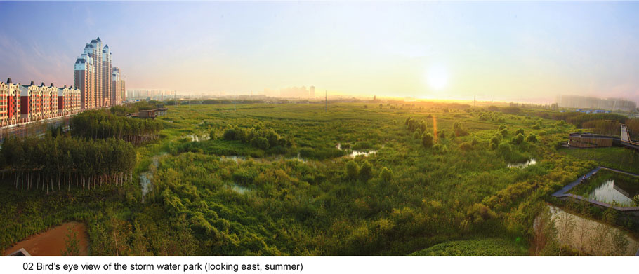
▲鸟瞰,夏季往东。
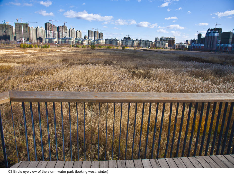
▲鸟瞰,冬季往西。
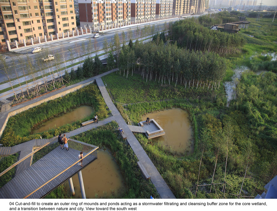
▲沿四周通过挖填方的平衡技术,创造出一系列深浅不一的水坑和高低不一的土丘,作为雨水过滤和净化带,是城市与自然湿地之间的缓冲区,形成自然与城市之间的一层过滤膜和体验界面。往西南方向看。
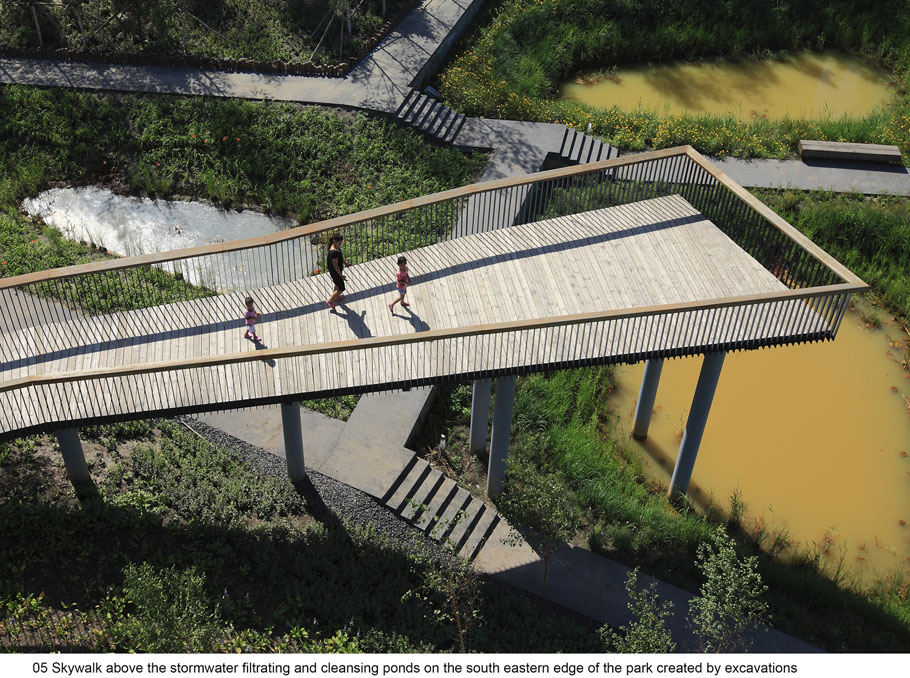
▲雨水过滤清洁池塘上面的人行天桥。
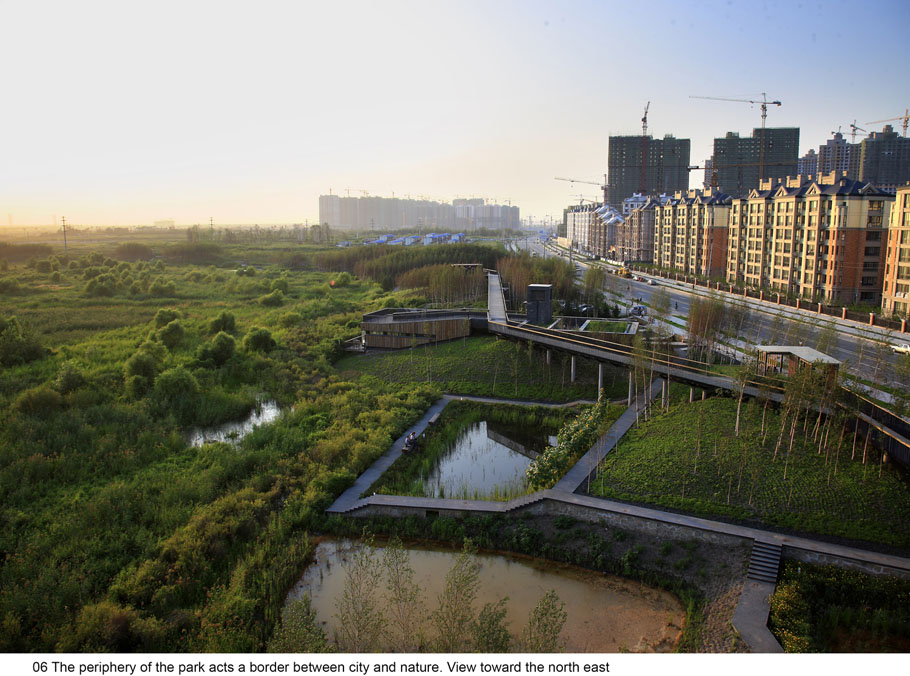
▲公园与城市间的边界。东北向。
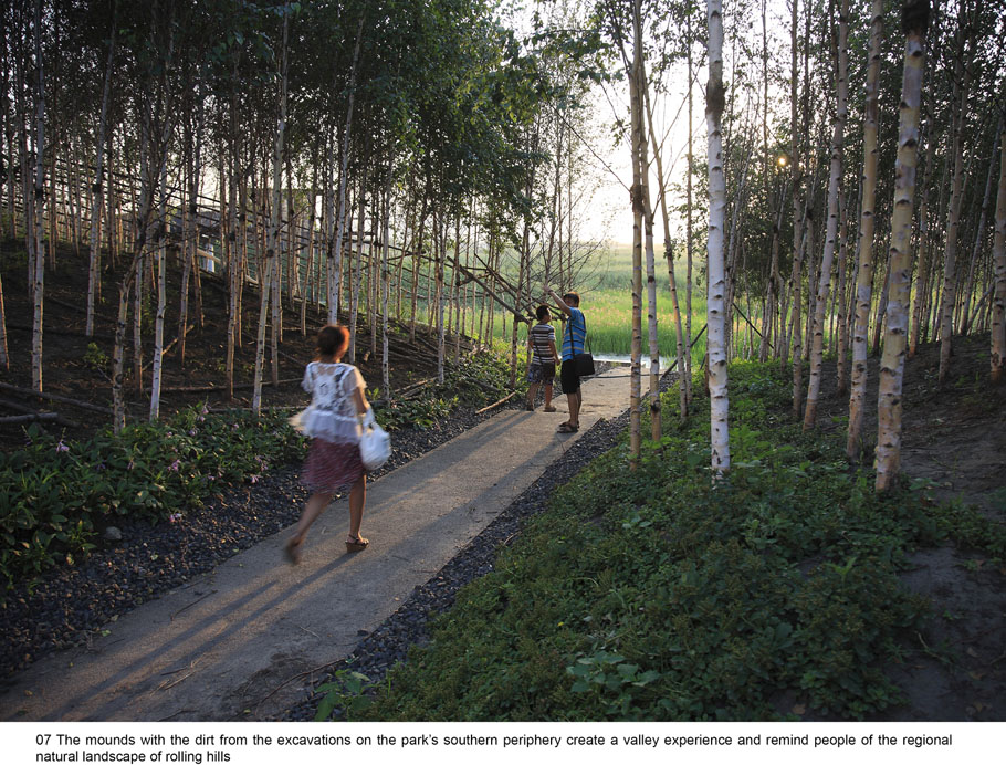
▲挖方平衡土丘形成的连绵起伏的丘陵山谷自然景观。
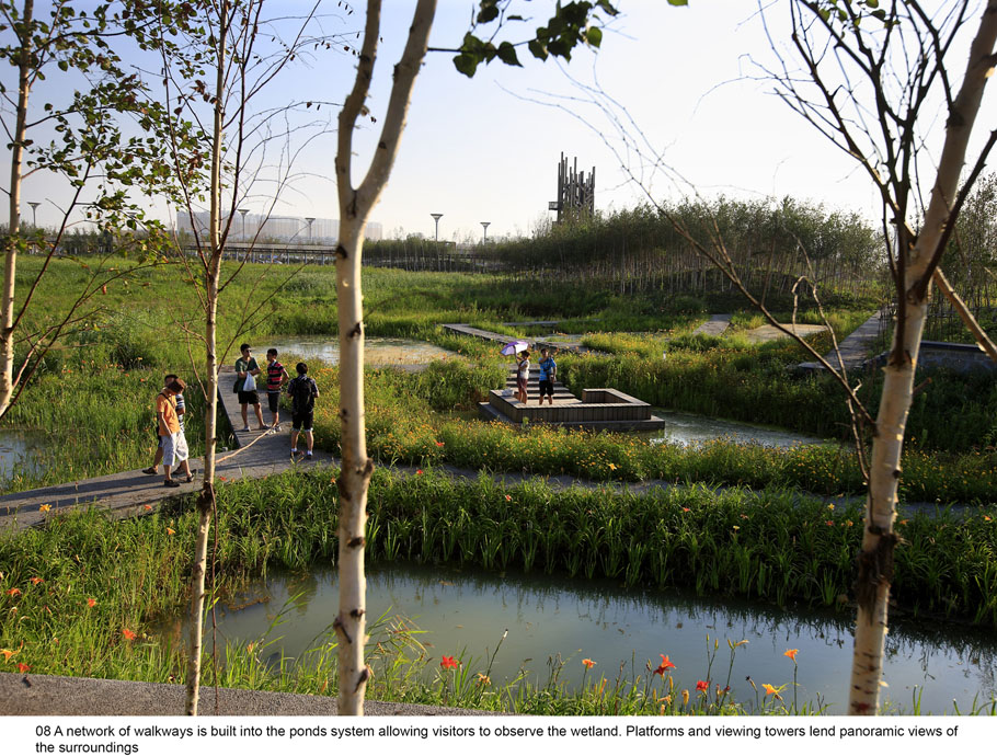
▲步行网络系统让人们观察湿地,通过平台和观景塔饱览公园全景。
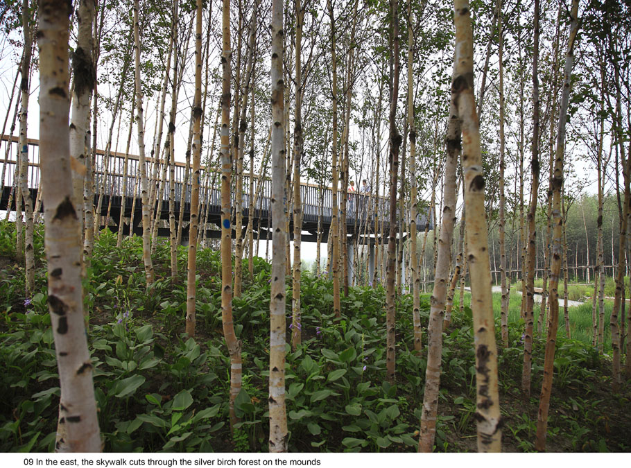
▲东边传过土丘上桦树林的人行天桥。
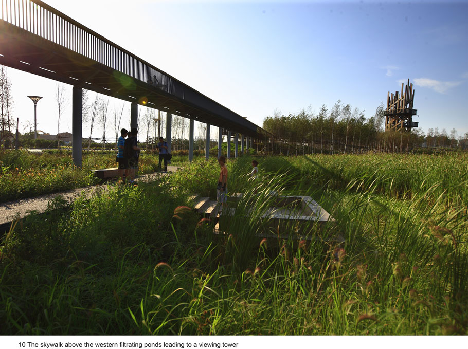
▲传过过滤池通往景观塔的人行天桥。
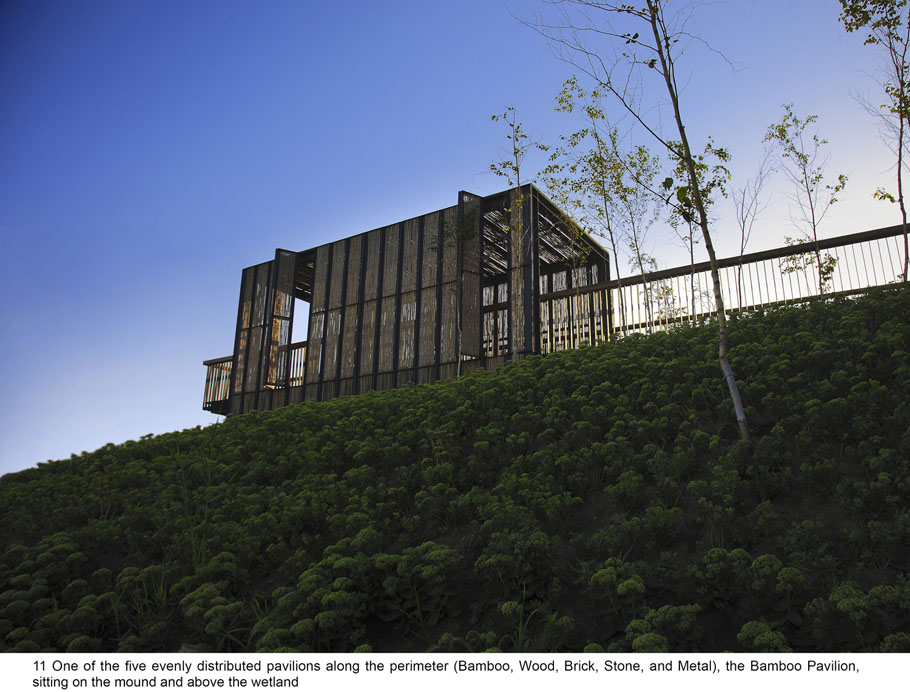
▲土丘之上,均匀分布在人行天桥的五亭之一:竹亭。(有竹亭,木亭,砖亭,石亭,金属亭共五种亭子)
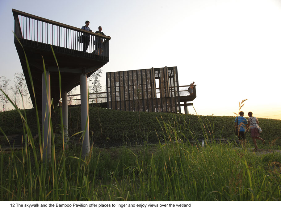
▲人行天桥和竹亭放置在湿地中让人流连忘返之处。
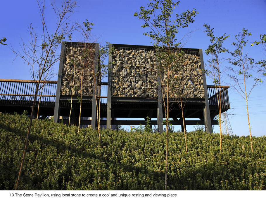
▲石亭,用当地的石材创建出一个宁静的休憩和观景之处。
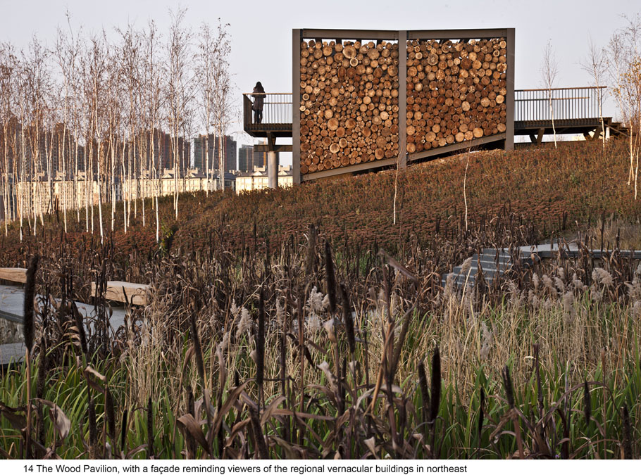
▲木亭,东北面是连绵建筑群。
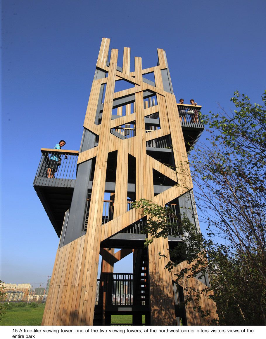
▲公园西北角像树木般,有两个观景平台的观景塔,能领略整个公园的胜景。
Challenges and Objectives
Beginning in 2006, a 2,733 hectare (6,753 acres) new urban district, Qunli New Town, was planned for the eastern outskirts of Haerbin in northern China. Thirty-two million square meters (344,445,133 sq. ft.) of building floor area will be constructed in the next 13 to 15 years. More than one third of a million people are expected to live there. While about 16 percent of the developable land was zoned as permeable green space, the majority of the former flat plain will be covered with impermeable concrete. The annual rainfall there is 567 millimeters (22 inches), with the months of June, July, and August accounting for 60 to 70 percent of annual precipitation. Floods and waterlogging have occurred frequently in the past, while at the same time the ground water table continues to drop due to its overuse.
In mid-2009, the landscape architect was commissioned to design a park of 34 hectares (84 acres) right in the middle of this new town, which is listed as a protected regional wetland. The site is surrounded on four sides by roads and dense development. This wetland had thereby been severed from its water sources and was under threat. The original task given by the client was to preserve this wetland. Going beyond the original task of preserving the wetland, the landscape architect proposed to transform the area into an urban stormwater park that will provide multiple ecosystems services, and will collect, cleanse, and store stormwater and infiltrate it into the aquifer, protect and recover the native habitats, proved a public space for recreational use and aesthetics experience, as well as foster urban development.
The challenges are obvious: How can a disappearing wetland be preserved in the middle of the city when its ecological and biological processes have been cut off by the urban context? How such an urban wetland ecosystem can be designed to provide multiple ecosystems for the city? And what is the economic way to deal with such a big landscape?
Design Strategy
Several design strategies and elements were employed:The central part of the existing wetland is left along to allow the natural habitats to continue to evolve.
Cut-and-fill strategy to create an outer ring of mounds and ponds. The cut-and-fill around the perimeter is a minimum earthwork strategy to transform the site. Earth is excavated and used to build up a necklace of ponds and mounds around the perimeter of the park. This ring acts as a stormwater filtrating and cleansing buffer zone for the core wetland, and a transition between nature and city. Stormwater from the newly built urban area is collected around the perimeter of the wetland and then released evenly
into the wetland after having being filtered through the ponds. Native wetland grasses and meadows are grown on ponds of various depths, and natural processes are initiated. Groves of native silver Birch trees (Betula pendula) grow on mounds of various heights and create a dense woodland. A network of paths links the ring of ponds and mounds, allowing visitors to have a walking-through-forest experience. Platforms and seats are put near the ponds to enable people to have close contact with nature.
The network of paths and platforms: A network of paths links the ring of ponds and mounds, allowing visitors to have a walking-through-forest experience. Platforms and seats are put near the ponds to enable people to have close contact with nature.
A skywalk links the scattered mounds allowing residents to have an above-the-wetland and in-the-canopy experience. Platforms, five pavilions (Bamboo, Wood, Brick, Stone, and Metal), and two viewing towers (one made of steel and located at the east corner, the other one made of wood and looking like a tree at the north-west corner) are set on the mounds and connected by the skywalk, allowing visitors to have views into the distance and observation of nature in the center of the park.
Conclusion
The completely transformed site performs many functions, including collecting, cleansing, and storing stormwater, and recharging underground aquifers. The pre-existing wetland habitat has been restored and native biodiversity preserved. Potentially flooding stormwater now contributes to an environmental amenity in the city. The storm water park has not only become a popular urban amenity but has also been upgraded to a National Urban Wetland Park because of its improvement to ecological and biological conditions.
More: 土人设计, 更多关于他们,请至:Turenscape on gooood








能这么低程度地干预这片自然,真是功德无量
还得专业的来
帅哥
本地的,去调研过,三十万人居住是扯淡的,群力没啥人,建筑比人多多了OO
群力没啥人???哥们是不是本地人啊。。。
很现代的感觉
haodongxi
这种纯自然的景观应该多一点!!!
和桥园如出一辙
I like it!
不错,具体位置在哪啊,去哈尔滨的时候可以去看看。。
哇!!!!!!!!!!!
俞大师的作品就是不同凡响
我外婆家油菜花田边上也有一片类似的土地~
理念很棒!
俞大师的
喜欢俞孔坚
一直很挺土人的可持续设计理念,不知道整套雨水收集过滤系统是怎么落实的。
挖坑堆坡罢了
原地形应该是平的吧,通过挖坑堆坡还是显得有些突兀。不过,俞老师的作品,都是很显眼的。
很好的方案,有很多可以借鉴的东西,俞老师树立的好榜样~~[开心][开心]