更多ASLA获奖案例请点击
All ASLA Awarded Projects Click Below
ASLA Awarded Projects
每年,ASLA(美国景观设计师协会)都会为来自全世界的最佳景观项目颁发专业奖项, 分为专业奖项和学生奖项,其中专业奖项涵盖6个类别:通用设计类、住宅设计类、城市设计类、分析和规划类、传播交流类以及研究类。
“传播交流类”奖项旨在向目标受众展示和传播景观设计作品、方法、技术、历史、理论以及教育方面的成就。这个类别的正式参赛者可以不是景观设计专业人士,这也让该类别的项目涵盖了更加多元的领域,同时与大众的日常生活更为贴近。
在实施景观实践乃至推进景观行业发展的过程中,只依赖景观设计师的苦心钻研显然是不够的,树立公众意识、普及景观学价值、提高公众的参与度是一个与前者同等重要的环节。本文精选了15个近年获得ASLA传播交流类奖项的案例,包含书籍、印刷出版物、网站、电影、品牌设计、展览和公众活动等多种形式,从这些优秀的案例中我们得以感受到多元的传播媒介在推动景观设计中所发挥的巨大作用。
Each year, the ASLA Professional Awards honor the best in landscape architecture from around the globe, divided into main categories: General Design, Residential Design, Urban Design,Analysis and Planning, Communications and Research.
The Professional Awards Communications category recognizes achievements in communicating landscape architecture works, techniques, technologies, history, or theory, and the lesson value to an intended audience. An official entrant in this category is not required to be a landscape architecture professional, which allows for a more diverse range of formats for the entries, as well as being more relevant to the everyday life of the general public.
In the process of the implementation and promotion of landscape practices, it is also a significant part to increase public understanding of environmental and land-use issues and principles. This article presents a selection of 15 winner projects in ASLA Professional Awards Communications category, from which we could have a look on how these diverse communication methods play a huge role in promoting landscape design.
1.
《LA+》跨学科景观设计期刊 / 宾夕法尼亚大学Stuart Weitzman设计学院
全球唯一的跨学科景观设计期刊
LA+ Interdisciplinary Journal of Landscape Architecture / University of Pennsylvania Stuart Weitzman School of Design
The world’s only interdisciplinary journal of landscape architecture
点击蓝色链接查看更多 Click the link for more details
《LA+》(Landscape Architecture Plus)是全球唯一的跨学科景观设计期刊,由宾夕法尼亚大学景观设计系于2014年发行,其使命是通过对每期主题的多角度探讨来揭示景观设计与其他学科之间的联系并建立二者之间的协作。因而除了设计行业之外,还有大量来自不同领域的作者为之供稿,包括历史学家、艺术家、地理学家、人类学家、心理学家、规划师、科学家和哲学家等等。这种跨学科的模式不仅丰富了景观设计学本身,还有助于将景观设计学推广至其他领域的新读者群。
LA+ (Landscape Architecture Plus) is the world’s only interdisciplinary journal of landscape architecture. Launched in 2014 by the Landscape Architecture Department at the University of Pennsylvania, the journal’s mission is to reveal connections and build collaborations between landscape architecture and other disciplines by exploring each issue’s theme from multiple perspectives.Therefore, in addition to the design professions, each issue includes works by a range of disciplinary authors, including historians, artists, geographers, anthropologists, psychologists, planners, scientists, and philosophers. This interdisciplinary approach not only enriches landscape architecture, it also introduces landscape architecture to new audiences in other fields.
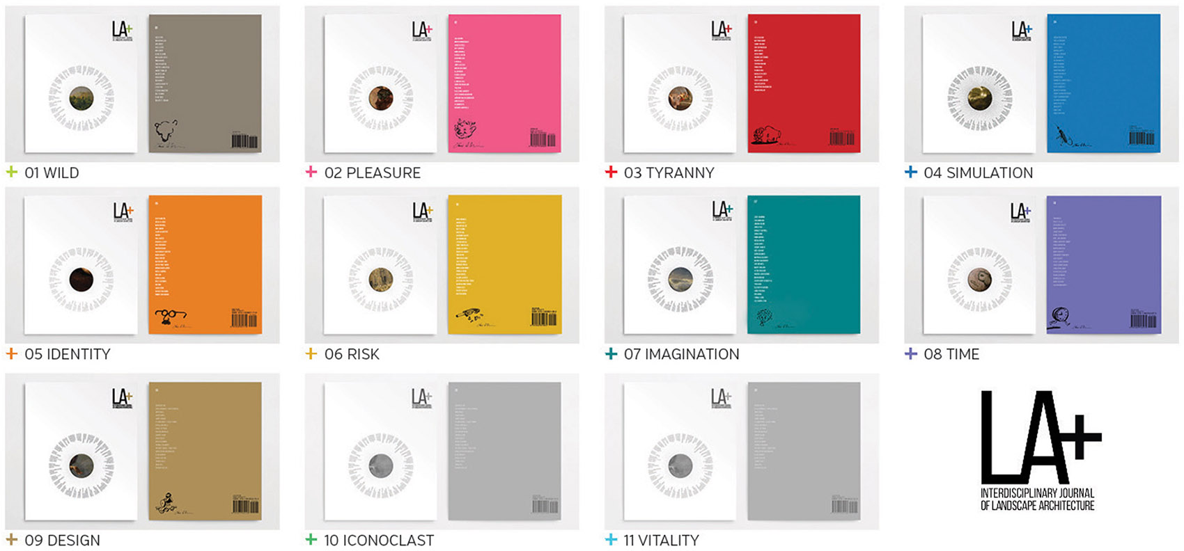
▲《LA+》1-9期封面和封底一览,LA+ Interdisciplinary Journal of Landscape Architecture Covers: LA+ Journal issues 1 – 9 front and back covers
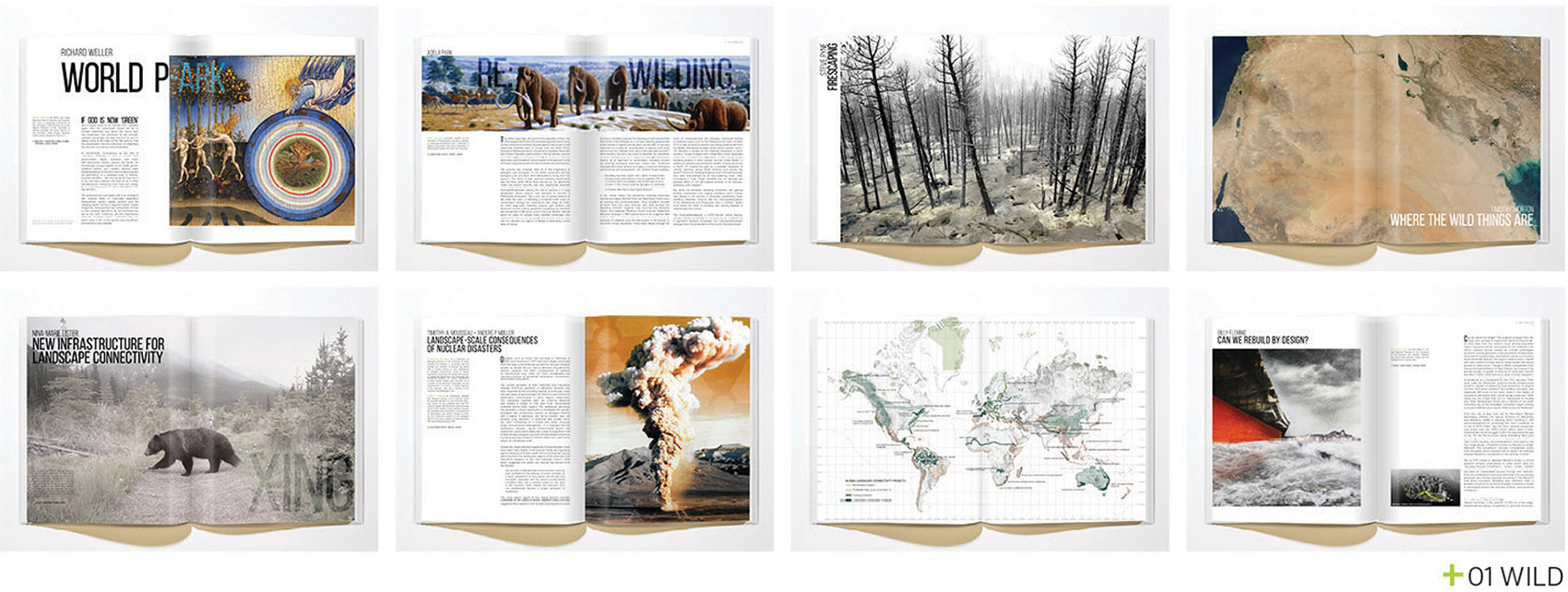
▲《LA+ WILD》(第一期)内页展示,以“野生”为主题。LA+ WILD: Selected spreads from LA+ Journal issue #1 on the theme WILD
▲《LA+ DESIGN》(第九期)内页展示,以“设计”为主题。LA+ DESIGN: Selected spreads from LA+ Journal issue #9 on the theme DESIGN
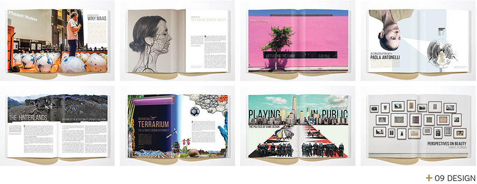
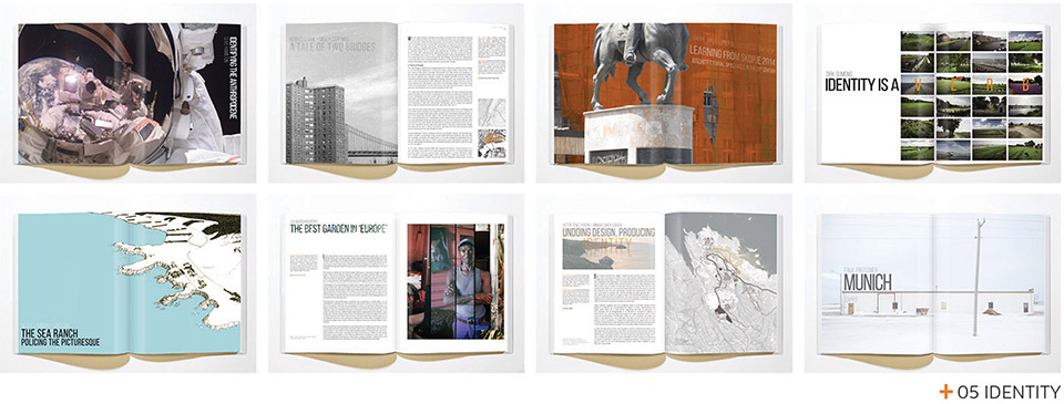
▲《LA+ IDENTITY》(第五期)内页展示,以“身份认同”为主题。LA+ IDENTITY: Selected spreads from LA+ Journal issue #5 on the theme IDENTITY
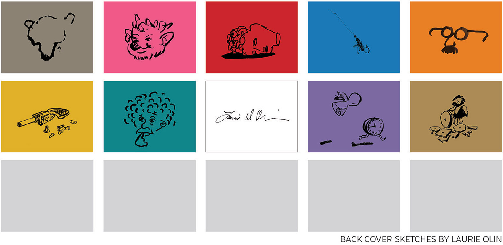
▲Laurie Olin绘制的《LA+》封底插画,LA+ back cover sketches by Laurie Olin
2.
The FloMo: 海平面上升信息传播车 / Bionic
在气候变化的时代里,洪水的发生将影响每件事、每个人
The FloMo: A Mobile Messenger for Sea Level Rise by Bionic
In an era of climate change, flooding will affect everything and everyone
点击蓝色链接查看更多 Click the link for more details
FloMo旨在向那些因洪水和海平面上升而面临灾害威胁的移民社区即时传达有用的信息。
加利福尼亚圣拉斐尔的运河区是成千上万移民的家园。这里的社区之间保持着紧密的联系,并且凭借强大的社会结构保持着自身的独立性。然而,仅靠日渐老化的水泵和堤坝提供微弱的保护,哪怕一场洪水都将使社区面临被毁灭的危险。随着时间的推移,若再不采取任何行动,社区将不可避免地受到海平面上升带来的灾难。
FloMo正是在这样的情况下诞生,它能够向社区居民传达有关气候变化和洪水的信息。这些信息丰富而有趣,简单而又意义重大,同时还能满足两种语言使用者的需要。
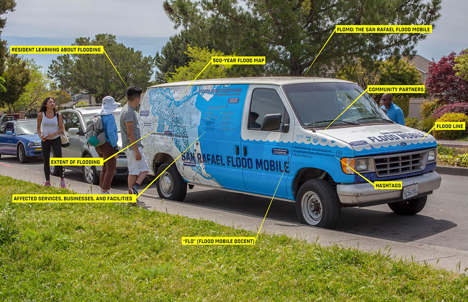
▲面包车的侧面绘有一张地图,解释了500年一遇的洪水灾害将导致的后果。社区居民可以借助它来判断自己生活和工作的地方是否位于洪泛区。Flooding Affects Everything: The passenger side of the van features a 500-year flood map, with individual structures, for community members to identify if they live or work in the flood zone.
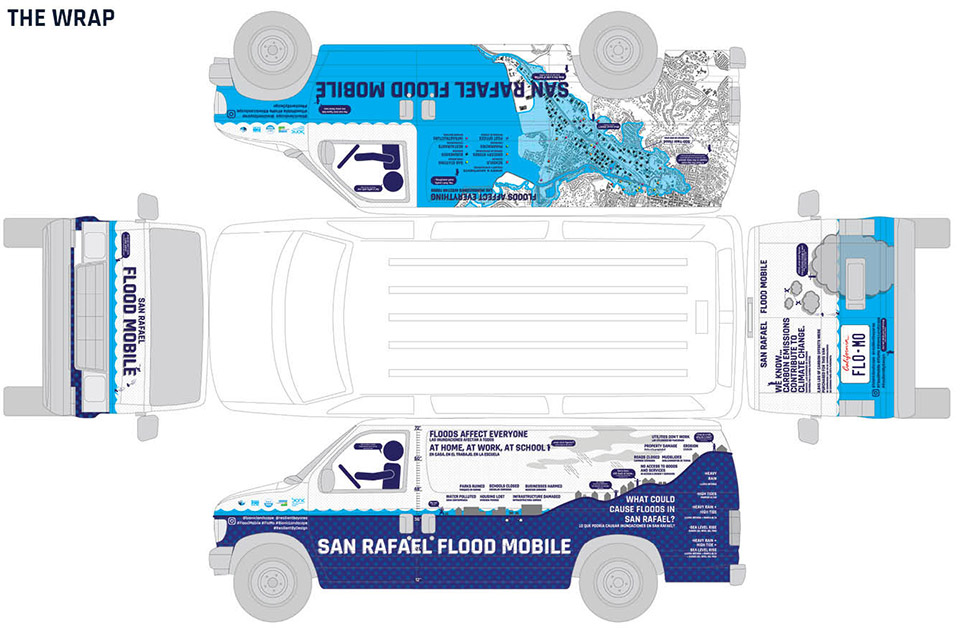
▲定制的侧面图案使FloMo能够最大程度地以有趣和高效的方式传播关于洪水的知识。The FloMo features a custom vehicle wrap on all four sides for maximum fun, learning, and flood awareness.
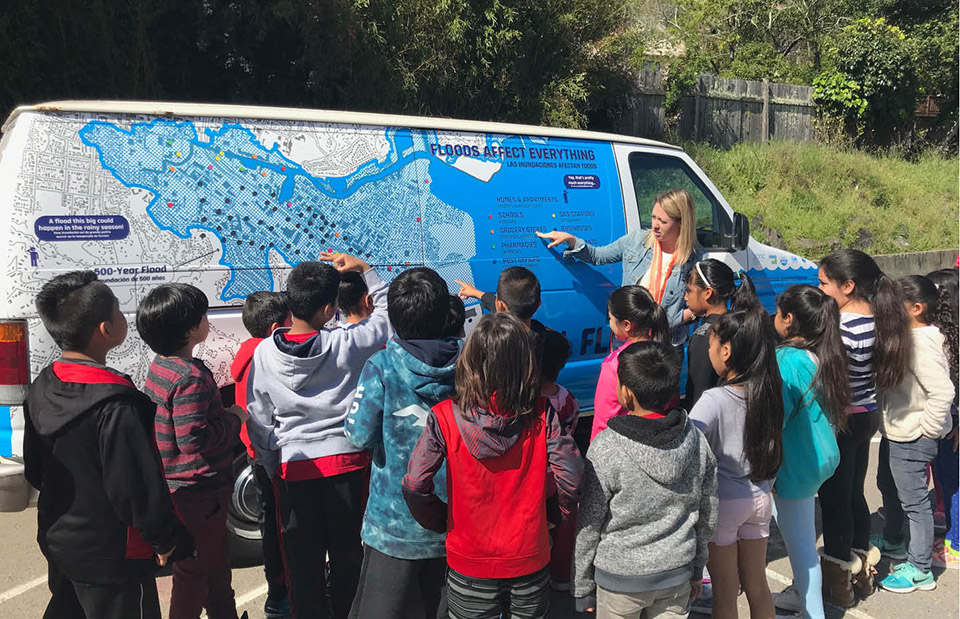
▲学生们正在参与和洪水和气候变化相关的课程。FloMo如今介入了数十种活动,已吸引数百位学生观看,并且在当地新闻中也有报道。Students getting an out-of-class lesson on flooding and climate change. The FloMo has been to dozens of events, seen by hundreds of students, and even been featured on the local news.
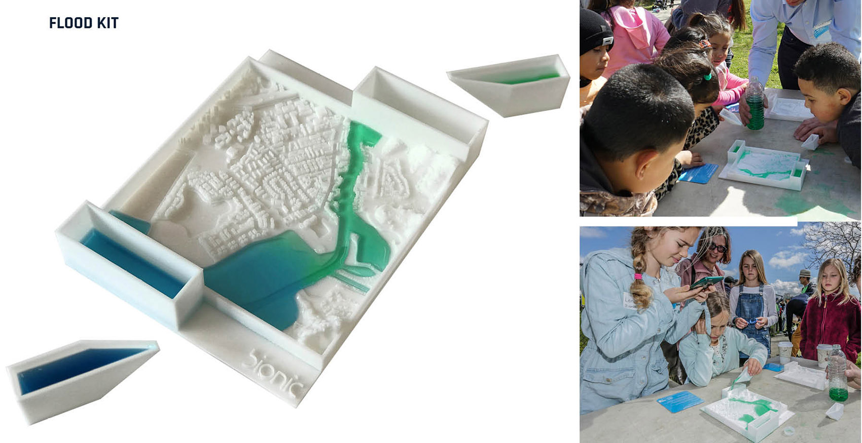
▲Flood Kit工具箱:除了向外输出图文信息外, FloMo还提供一个“工具套装”(Flood Kit),其中包括一个运河区的3D模型。可以将两种不同颜色的液体倒入模型,以模拟陆上径流和风暴潮的相互作用。Flood Kit: In addition to its own graphics, the FloMo travels with a Flood Kit, which includes a 3D model of the Canal District, onto which two different colored liquids can be poured to simulate the interaction between overland flooding and storm surge.
3.
EnvisionColumbus.org网站 / David Rubin Land Collective
鼓励公众积极投身城市建设的新媒体平台
EnvisionColumbus.org: A Conduit for Alignment & Empathetic Outreach in Community Building, Columbus by David Rubin Land Collective
New media conduit encouraging public to participate in city development
点击蓝色链接查看更多 Click the link for more details
EnvisionColumbus.org是一个交互式网站,旨在号召印第安纳州哥伦布市不同地区的选民,参与制定新的市区战略发展计划。该网站的建立得益于哥伦布市鼓励市民参与城市建设的优良传统。网站呈现出21世纪城市建设与社区民众协调交流的新方式,并以此重新定义了哥伦布市规划史。该网站是整个战略规划中重要的一环,传统的线下面对面交流模式升级后,网站成功吸引了成百上千名市民的参与。
EnvisionColumbus.org is an interactive website designed to facilitate broad public engagement across a wide range of diverse constituencies during the creation of the new Downtown Strategic Development Plan for Columbus, Indiana. The website builds upon the City’s legacy of centering the voices of citizens in shaping the City itself. It represents a twenty-first-century approach to the kind of community building and alignment that has defined Columbus’s planning history. The website was a critical component in a robust overall strategy, complementing traditional analog exercises that engaged hundreds of citizens during in-person meetings.
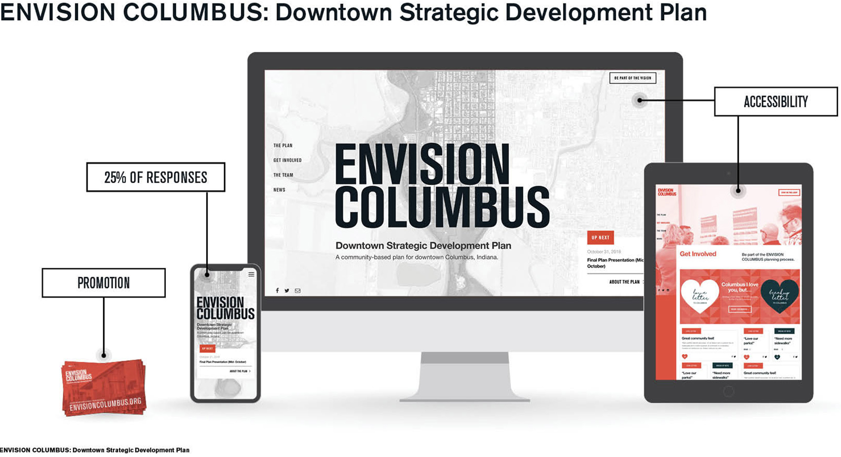
▲EnvisionColumbus.org:一个交互式的网站平台,EnvisionColumbus.org, an interactive website
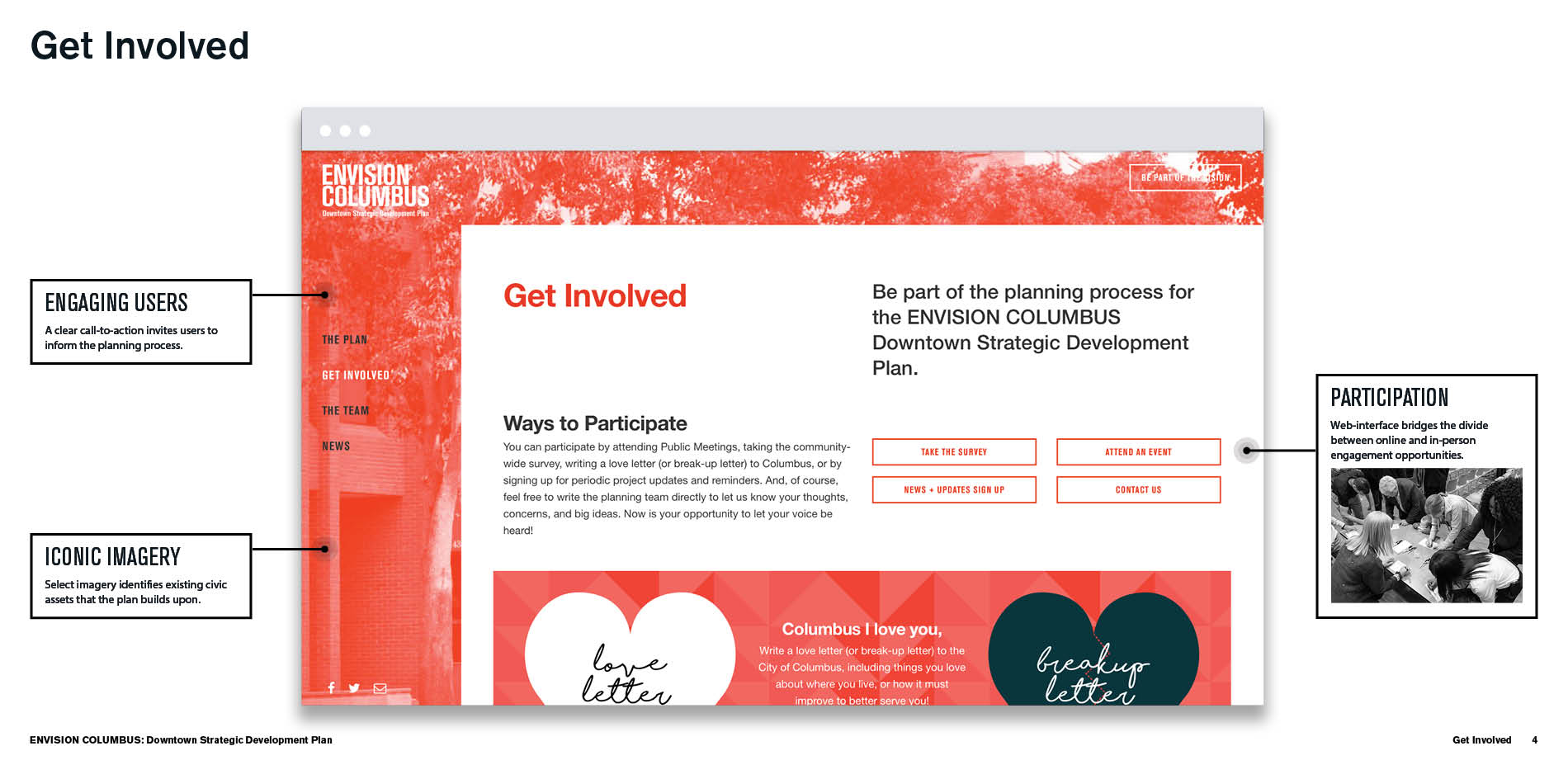
▲该网站以收集民众对城市的生活需求与情感夙愿为宗旨,广泛征集民众反馈意见,并鼓励民众参与规划设计的全过程。Designed to serve as a communication tool for soliciting both measured and emotional input, a core goal of the website was to gather feedback from the public and invite their involvement in the planning process.
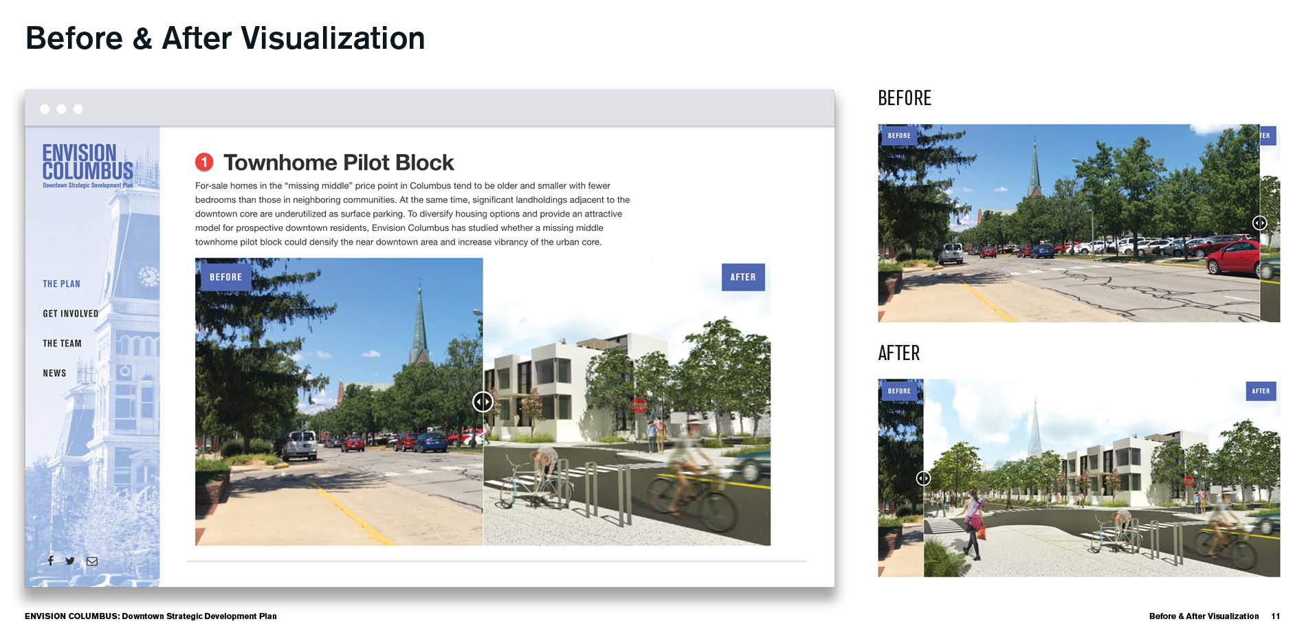
▲规划前后对比可视化,公众可以通过设计前后的对比图纸和效果图,直观了解能够促进经济及社会发展的改造措施。Before & after visualization, activating before/after imagery and rendered perspectives not only engaged users but also helped citizens to visualize specific proposed interventions identified as catalysts for economic and social stimulation.
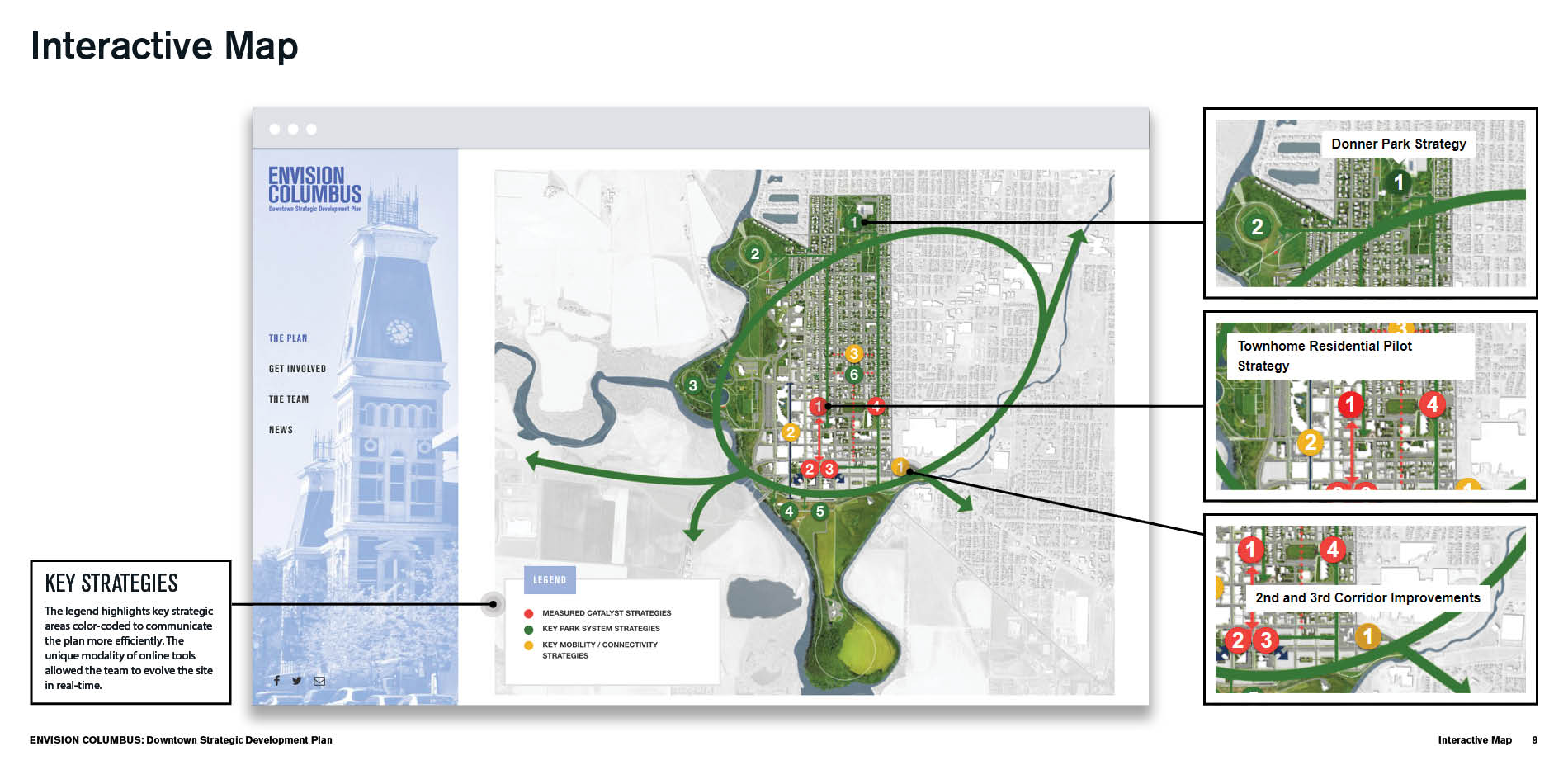
▲交互式地图,随着项目分发展,网站上的交互式地图会持续更新,以保证设计过程的公开透明。Interactive map, as the project developed, the interactive map continued to advance in real-time allowing for transparency in the design process.
4.
俄亥俄州立大学景观设计学院100年宣传计划 / The Ohio State University
为了解学院的历史提供创新性的视角
100 Years of Landscape Architecture at The Ohio State University
An innovative look at the profession’s history through the institution that has reliably represented its heart
点击蓝色链接查看更多 Click the link for more details
为庆祝学院成立100周年,俄亥俄州立大学景观设计专业从2015年起发起了一个多线程的倡议,旨在围绕建造这一共同的主题,将档案资料和精心制作的新物品汇聚成册,以此来讲述专业的历史故事。
这项倡议由四部分相互关联的内容组成。首先是在学院所在的诺尔顿大楼(Knowlton Hall)内张贴一系列带有信息的横幅;随后这些横幅将被收录到为毕业生和未来校友们准备的学院手册当中;第三部分是举办一场纪念展览,将学院100年来的学生作品进行汇总;最后一个部分则是出版一本记录学院历史的名为《试验场:俄亥俄州立大学景观设计学院100年》的书籍。
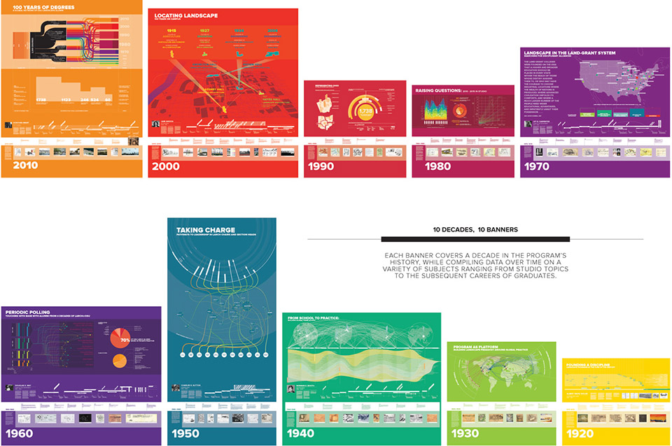
▲十个横幅以十年为单位讲述了学院百年来的发展,a series of ten banners representing each of the ten decades of the program
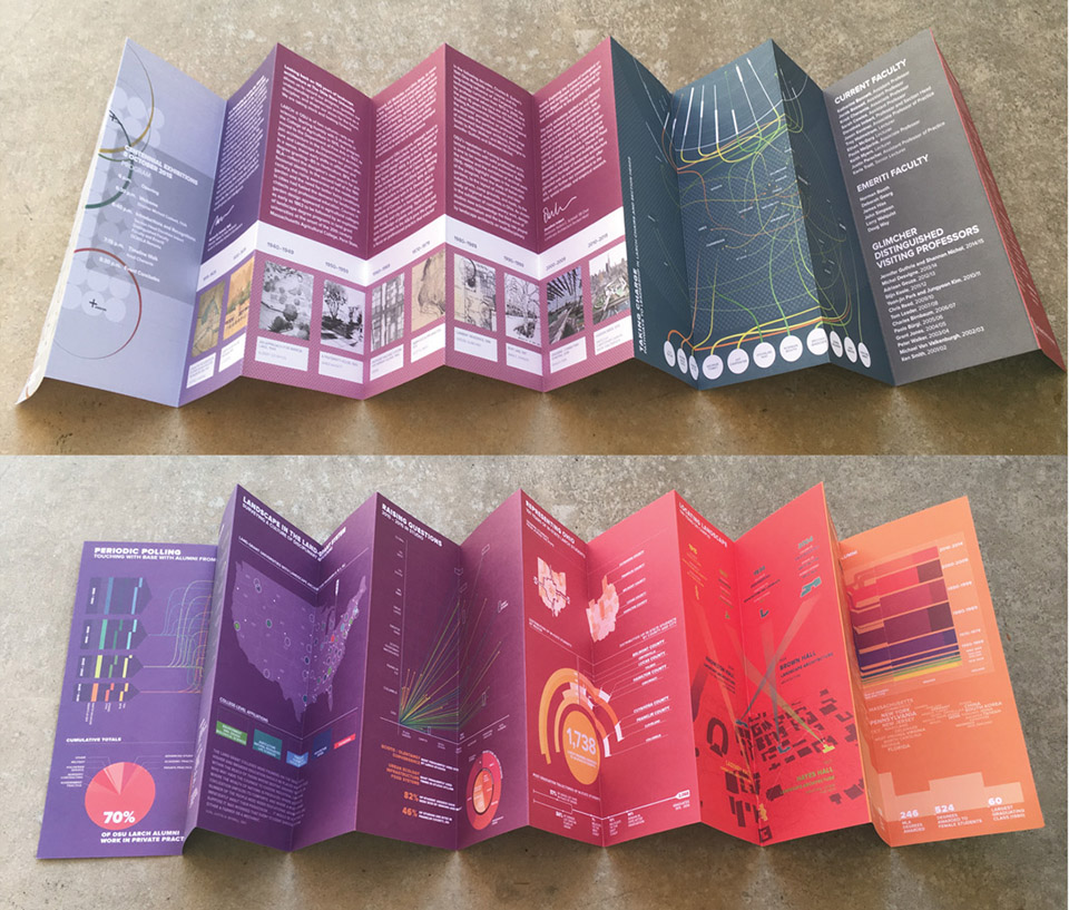
▲展示横幅被浓缩为一个供参观者和未来学生使用的小型手册,并在2015年召开的百年庆典活动上推出了1000份,The banners’ infographics were condensed into a handheld brochure that could be given to visitors and prospective students.
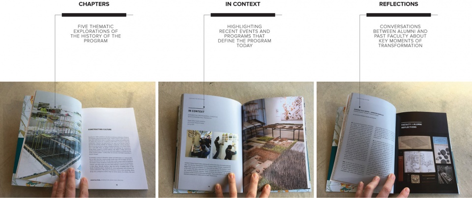
▲《试验场:俄亥俄州立大学景观设计学院100年》一书在记录学院发展历史的同时还介绍了学校在近期举办的活动和展览,同时摘录了一些对校友和教师的采访内容。The book includes explorations of the history of the program, recent events and programs that define the program today, and conversations between alumni and past faculty about key moments of transformation.
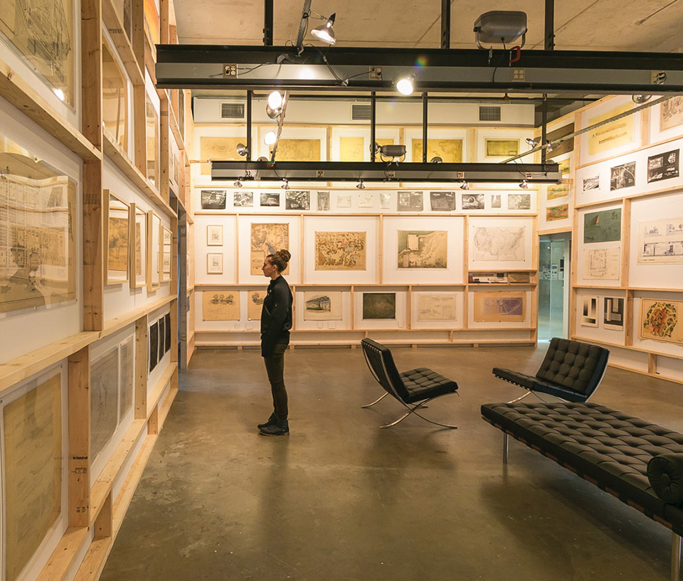
▲在学院画廊内举办的“手绘风景”展览,展出了学院前80年来的一百多张绘画作品。The exhibition Landscape By Hand presented more than one hundred drawings from the program’s first eighty years.
5.
纪录片《延斯·詹森:活着的绿色》 / Viva Lundin Productions + University of Michigan
“草原派”景观设计先驱的传奇人生
‘Jens Jensen The Living Green’ A feature documentary by Viva Lundin Productions and University of Michigan
Dramatizing the rise of Jens Jensen, the “Dean” of American landscape architecture
点击蓝色链接查看更多 Click the link for more details
纪录片《延斯·詹森:活着的绿色》(Jens Jensen The Living Green)戏剧化地讲述了延斯·詹森(Jens Jensen)的生平,他是一位来自异国的城市清道夫,也是美国最先维护生态公正性的人物之一。詹森的一生为城市发展的早期抗争指明了方向,并将“公园沙漠”、生态设计以及我们的原始需要与生活中自然的“活的绿色”联系在一起。他与Ossian Cole Simonds并称为“草原派”(Prairie Style)景观设计的先驱。他们把自然风光带入芝加哥的穷人以及工业领袖的家中。
今天,詹森仍然是绿色激进主义的典范。从他的故事中,我们将了解到他是如何身体力行地拯救了印第安纳州的沙丘(如今已成为州立及国家公园)和整个中西部的公园、如何为工业巨头们(福特、Armour和Rosenwald)设计景观,以及如何对奥尔多·利奥波德等众多环境保护主义先锋产生了积极的影响。
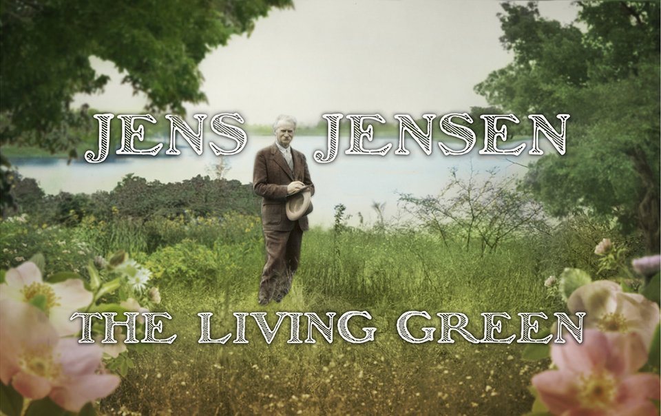
▲《延斯·詹森:活着的绿色》,Jens Jensen The Living Green
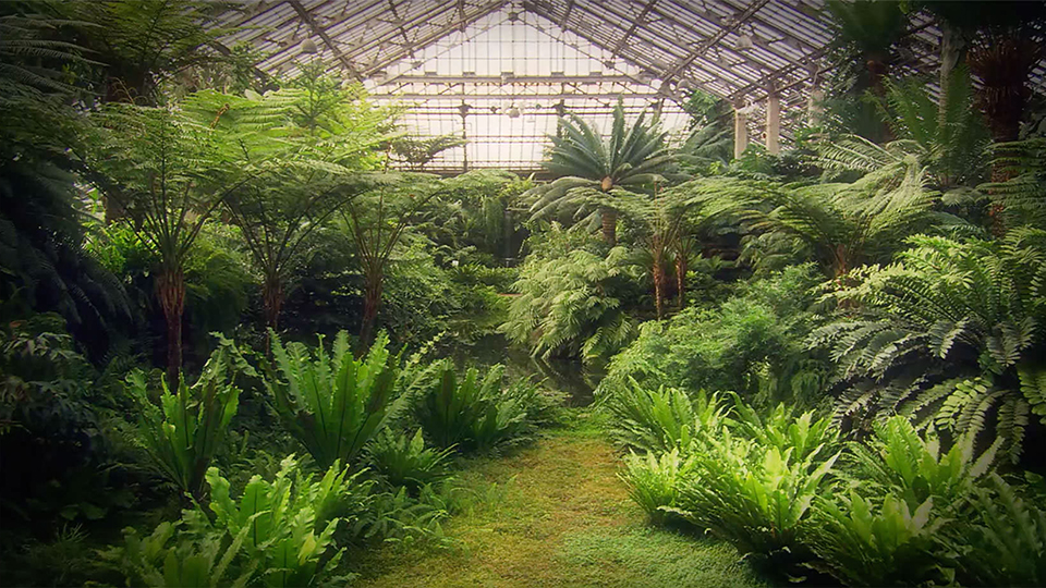
▲电影剧照,stage photo
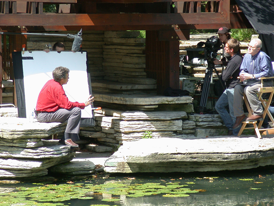
▲拍摄现场,filming site
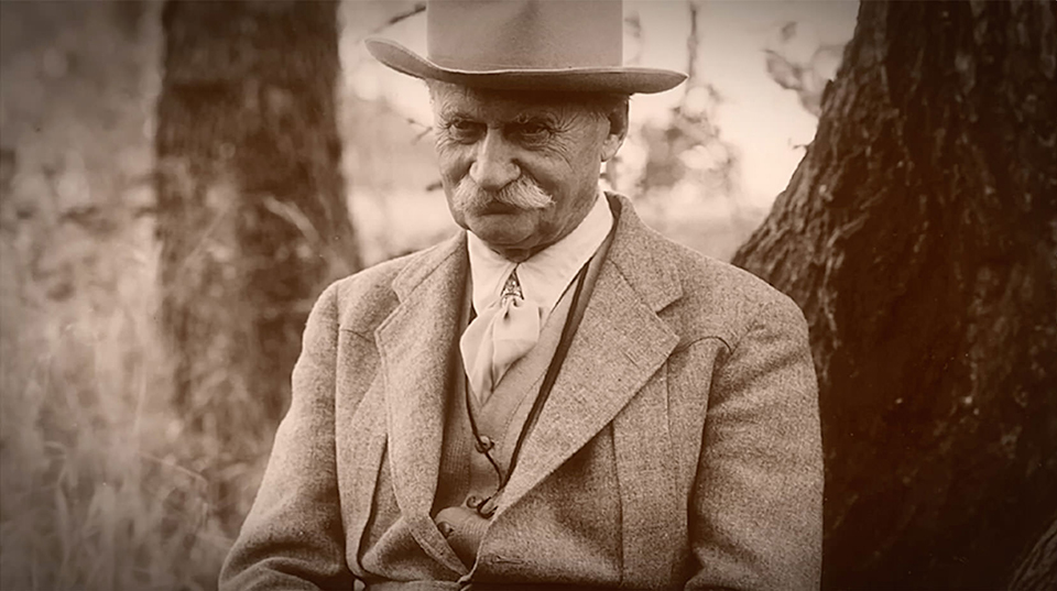
▲延斯·詹森,Jens Jensen
6.
非标准建筑材料的高效传达方法 / Design Workshop – Aspen
在业主、景观设计师和承包商之间建立起高效的沟通桥梁
Artful Technology Methods for Communicating Non-Standard Construction Materials / Design Workshop – Aspen
Using 3D scanning, modeling and printing to clarify understanding between the Owner-Landscape Architect-Contractor (OAC)
点击蓝色链接查看更多 Click the link for more details
景观设计师常常会使用非标准的材料进行设计,包括定制的水景小品、艺术装置和各种各样的树木和植被等。在向客户和承包商阐述和展示项目的预期效果和功能时,这些非标准的元素往往会带来诸多阻碍。该项目展示的创新方法能够借助3D扫描、建模和打印技术对非标准元素进行精确的实际效果展示,从而优化设计步骤,解决装配问题,以巧妙的方式在设计师的意图、业主的预期以及施工方的需求之间架起沟通的桥梁。
Landscape architects frequently design with non-standard materials, ranging from custom water features, to art installations, to the infinite variety of trees and vegetation, creating challenges in communicating unequivocally with clients and contractors about what a project would actually look like and how it would function. This innovative method uses 3D scanning, modeling, and printing to generate precise physical representations of non-standard elements that can enhance the design process, resolve installation issues, and artfully bridge the gap between the landscape architect’s vision, owner’s expectations, and the contractor’s needs.
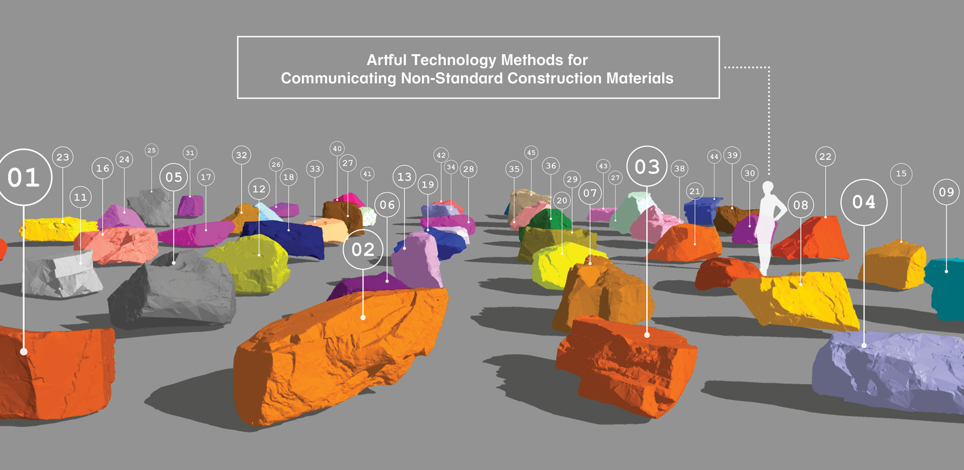
▲借助3D扫描、建模和打印技术,这种全新的传达过程能够降低施工风险,带来更加符合预期的设计成果。Using 3D scanning, modeling and printing, this new communication process reduces construction risks and leads to intentional design outcomes.
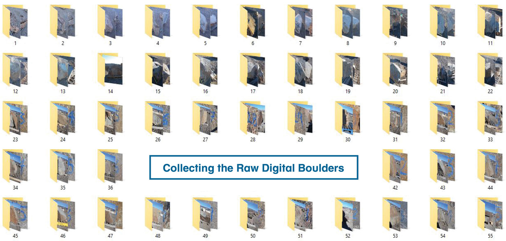
▲对原始巨石进行数字化整理:景观设计师会为每块巨石编上序号,以便通过数字工具进行追踪,为稍后的现场施工提供参考。The Landscape Architect tagged each boulder with an identification number to track them through the digitalization process and for onsite reference during construction.
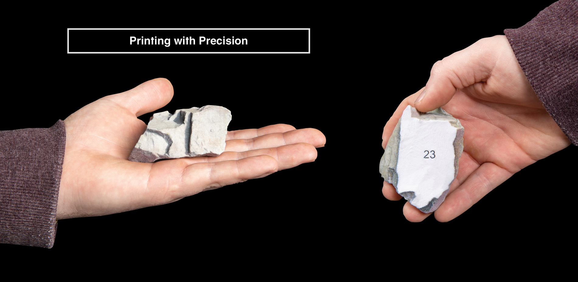
▲精确打印:巨石的图像会通过专门程序拼接在一起,生成一系列精确的、拥有各自独特形状、裂痕和颗粒状纹理的3D模型。A proprietary program stitched together the boulder images to generate 3D models printed with each boulder’s unique shape, natural clefts and granular texture.
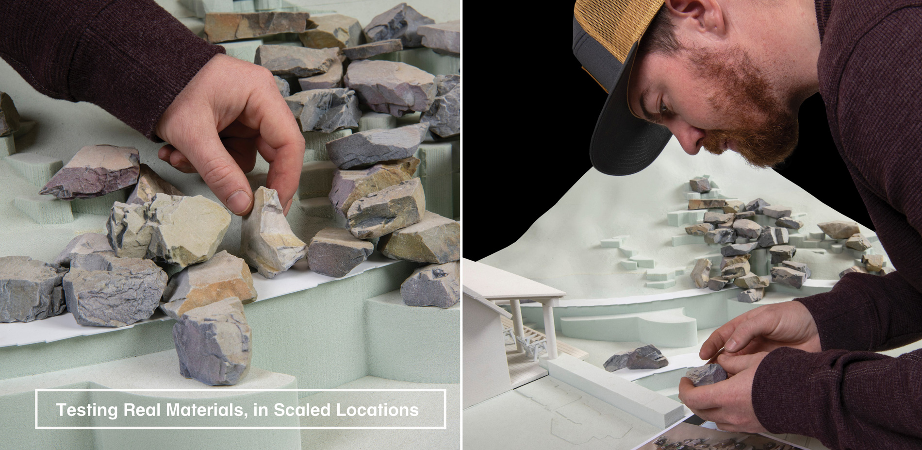
▲景观设计师建好的巨石模型精准地定位并放置在基础模型之上。这种方法能够在工作室内完成传统方法中的现场“试错”,从而大大降低了施工的成本和风险。The Landscape Architect placed the modeled boulders with intentional orientations on a base model. This method enabled the trial and error approach traditionally used in “the field” to be explored with the studio at significantly reduced cost and risk.
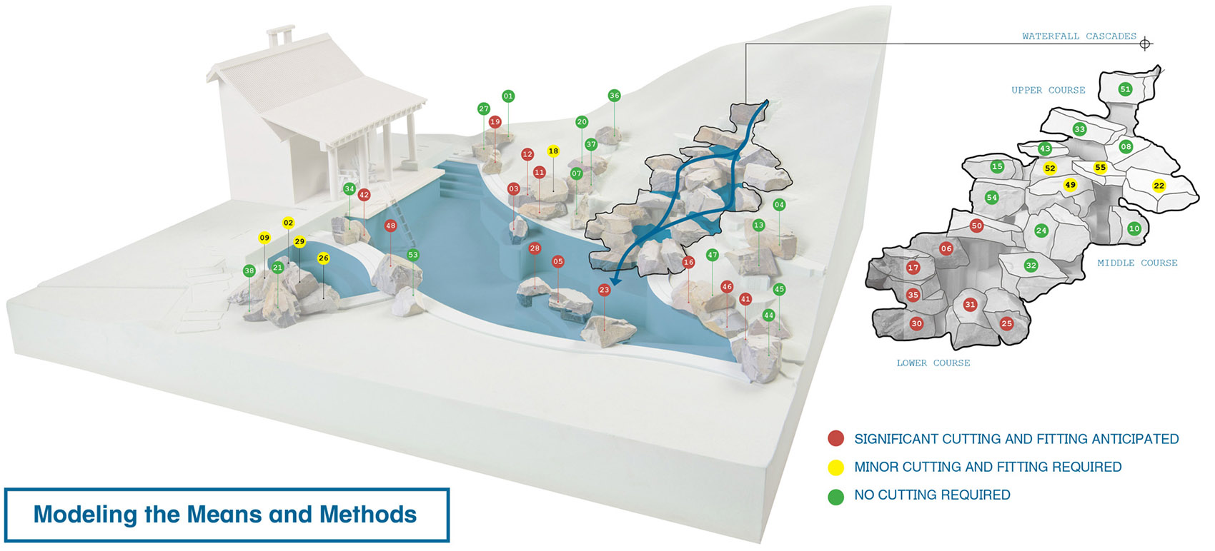
▲每块巨石都会得到测算和评估,以确保将它们固定在水池结构壁上所需花费的加工和施工量。Each boulder was evaluated for the level of intervention and fabrication needed to secure to the pool’s structural wall.
7.
种子银行:活体墙的新方法 / Miridae
构建生命墙的全新可能
The Seed Bank: A New Approach to the Living Wall / Miridae
To create a new kind of living wall
点击蓝色链接查看更多 Click the link for more details
“种子银行”展现了构建生命墙的全新可能,它能够鼓励互动和参与,并通过低技术手段实现植物的传播。相比于依靠风、重力或动物群来繁衍的植物,种子银行采取的是一种更加直接地面向栽培者的方式。通过“种子吧台”,来访者可以清晰地获取关于种子的图解和信息,并将它们带回各自的景观播种,使种子银行得以在这些景观中扩展,并起到恢复环境的作用。
The Seed Bank represents an effort to create a new kind of living wall that encourages interaction, engagement, and eventual plant dispersal through low-tech means. While many flora rely on wind, gravity, or fauna for propagation, this display distributes seeds in a more direct-to-cultivator manner. A seed bar provides visitors with clearly presented graphics as well as information and seeds that they can then take back to their respective landscapes to sow, allowing the Seed Bank to extend into and restore the landscape in which it resides.
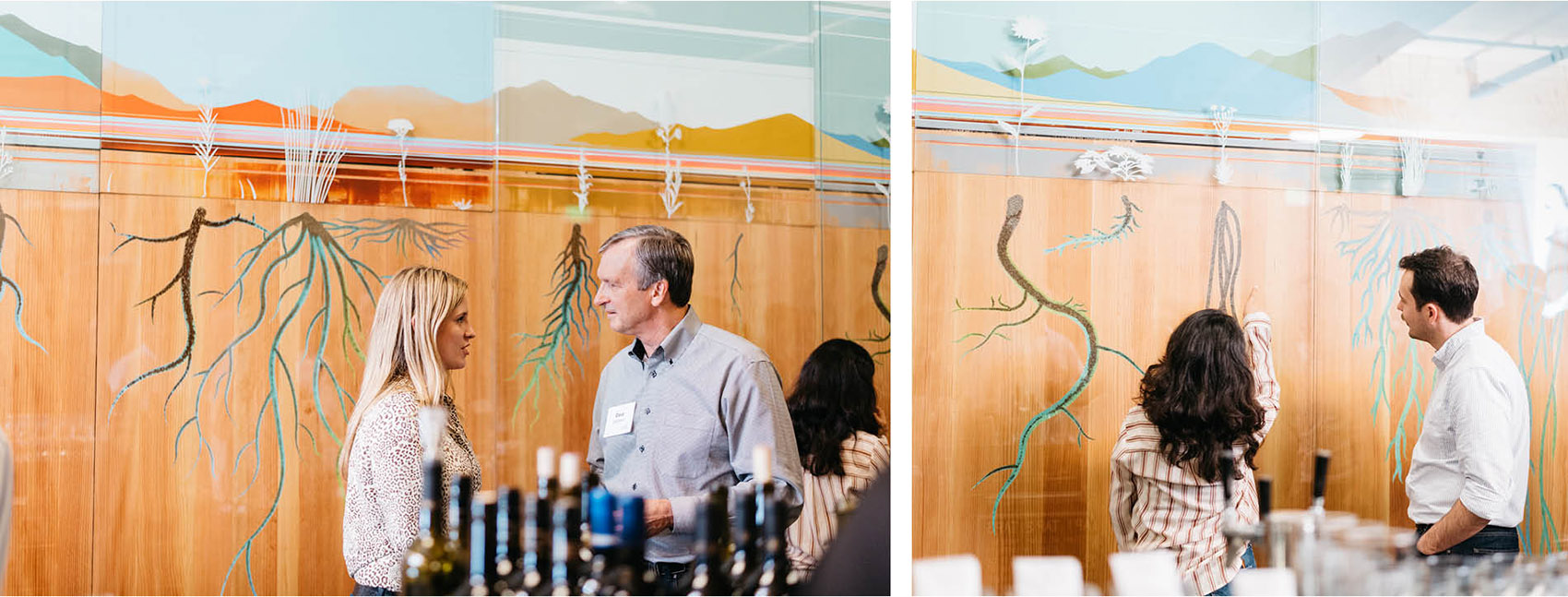
▲种子银行被设置在客户的公司总部、一栋创新性大型木构建筑的社交中心,它鼓励每一位访客参与其中,使他们了解到本地生境以及找到最佳生态实践方法的重要性。The Seed Bank is the physical and social centerpiece of the company’s state-of-the-art sustainable mass-timber-framed building. It encourages engagement amongst its visitors and educates about the importance of native habitats and best ecological practices.
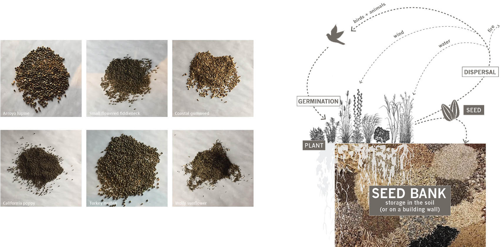
▲什么是种子银行?种子银行将种子储存起来并保护它们的遗传多样性,使其免于变得稀有乃至灭绝。种子银行中的种子处于睡眠状态,它们是帮助植物跨越时间的容器。What is a Seed Bank? A seed bank stores seeds and preserves their genetic diversity in case they become rare or extinct. The seeds in a seed bank are not dead, but rather vessels through which plants travel through time.
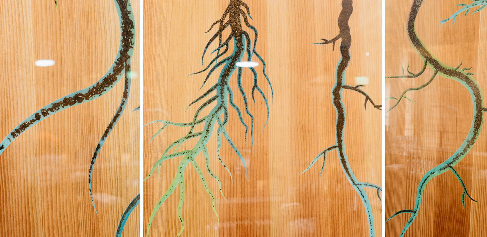
▲实际的种子被放置在植物根部横切面的图像上,每个根部结构都汇集了同一个物种。这些根部以抽象的方式展现了加州的原生草原物种,是根据已知的研究进行设计和解释。The actual seeds are located in the cross sectional roots, with one species per root structure. Each root is an abstract representation of a native California grassland plant species and was designed and interpreted based on known research.
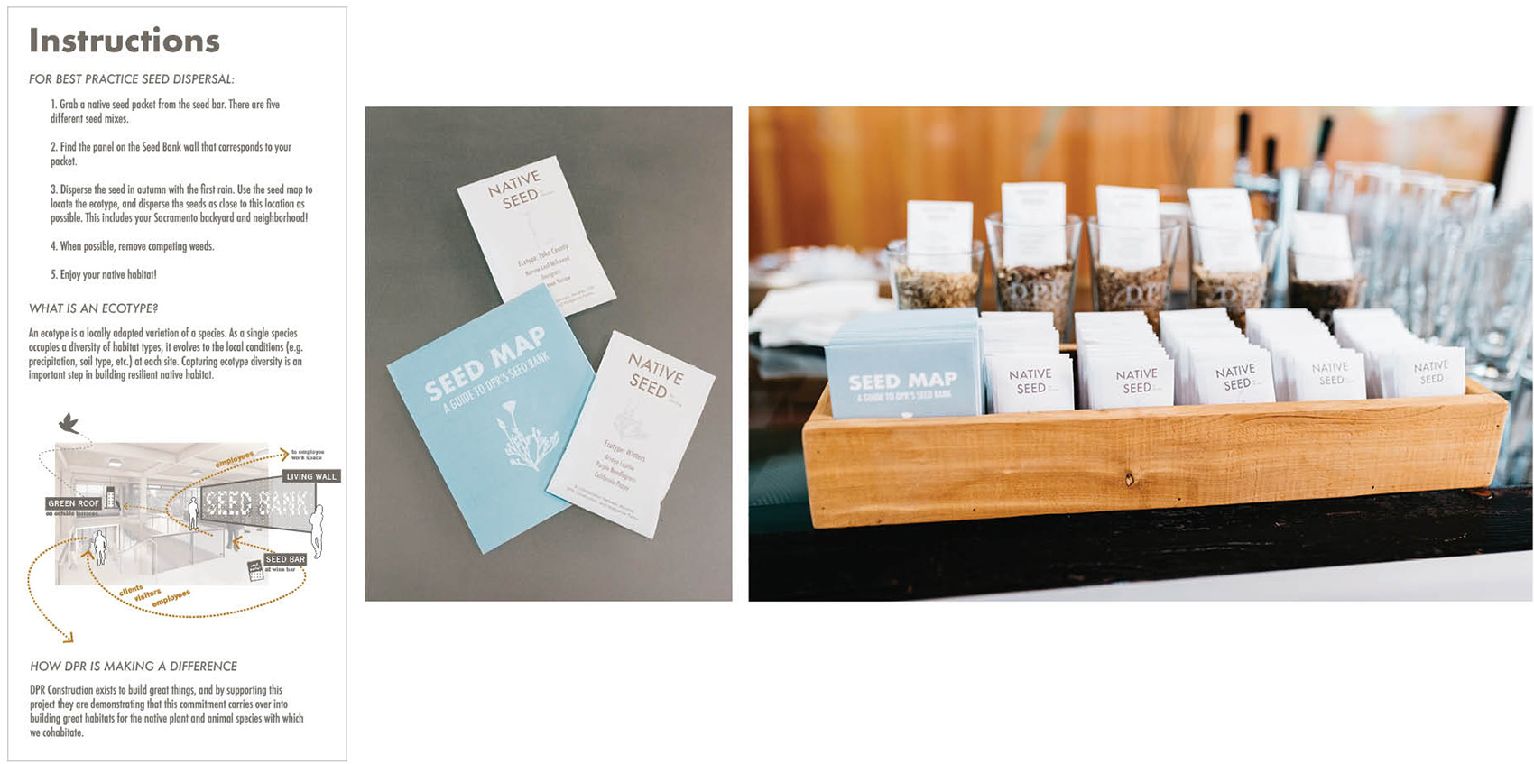
▲种子地图介绍了种子传播的最佳方式。种子吧台内还提供了可以随身带走的本地混合种子包。5个小包内的混合种子分别对应着装置中展示的5个生态型板块。The Seed Map communicates best practices for seed dispersal and is accompanied by a Seed Bar with take-away native seed packet mixes. Each of the five packaged seed mixes corresponds to each of the five ecotype panels of the installation.
8.
What’s Out There文化景观指南 / 美国文化景观基金会
展示美国五大城市景观遗产地的在线数据库
What’s Out There Cultural Landscapes Guides / The Cultural Landscape Foundation
An extraordinarily comprehensive and compelling online public resource that presents the landscape legacy of five of the nation’s great East Coast cities
点击蓝色链接查看更多 Click the link for more details
What’s Out There文化景观指南是文化景观基金会“What’s Out There数据库”的衍生品,它提供了全面且吸引人的在线公共资源。
设计精良的网站将带领观众游历美国五大城市的丰富景观遗产,并鼓励大众了解和探索身边值得注意的设计场所,同时提供其设计者和远见者的相关介绍。该系列指南通过丰富的图像和文字逆转了景观设计往往被大众所忽略的现状,同时强调了景观设计和景观设计师对于改善美国城市生活质量的重要影响。指南还可以与文化景观基金会(TCLF)网站中的海量内容无缝连接,或与GPS交互地图相结合。
Created by a partnership of the Cultural Landscape Foundation and the National Park Service, the What’s Out There Cultural Landscapes Guides are an extraordinarily comprehensive and compelling online public resource. The well-designed website leads the visitor through the broader legacy of five city landscapes, describes and directs people to significant designed places in the community, and introduces the designers and visionaries who created them. The guides counter the reality that landscape architecture has too often been undervalued in the public mind by demonstrating through a rich collection of images and text the impact of landscape architecture and landscape architects on the quality of American urban life.
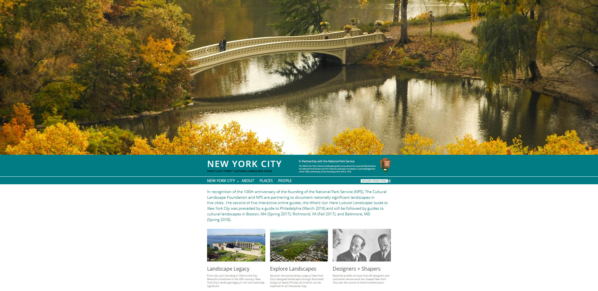
▲网站首页:What’s Out There文化景观指南(纽约)的主页采用大尺寸的滚动横幅,作为TCLF与NPS合作出品的五份在线指南的开篇。Welcome Home: With its large-format, scrolling banner images, the homepage of the What’s Out There Cultural Landscapes Guide to New York City announces one of five online guides produced by TCLF in partnership with the National Park Service.
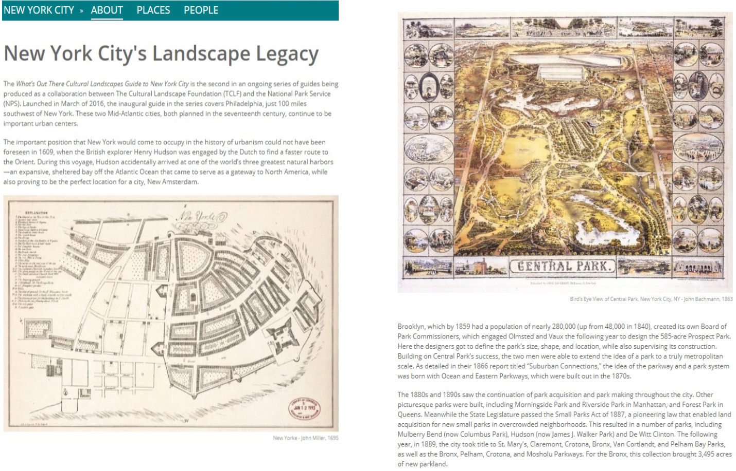
▲大尺寸照片:每份指南都包含一篇介绍该城市景观遗产的综述性文章,并配有地图、资料图片和当代照片。 这些文章提供了城市从起源到现状的历史框架,详述了其发展历程。The Bigger Picture: Each guide also includes an overarching essay on the city’s landscape legacy, illustrated with maps, archival images, and contemporary photographs. These introductory essays frame the city’s landscape history from its earliest beginnings, charting its growth to the present.
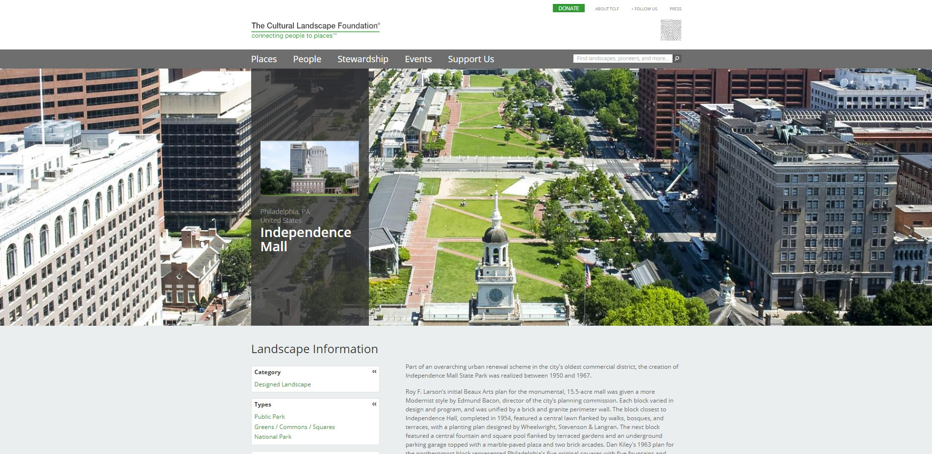
▲每篇文章都附带下拉菜单,提供与该景观的类型、风格和设计者相关的链接。菜单还与词汇列表相连,提供相关术语的释义和其他背景资料。The drop-down menus that accompany each landscape essay provide further links related to its type, style, and designer. The former connect, in turn, to a glossary with definitions and additional background information.
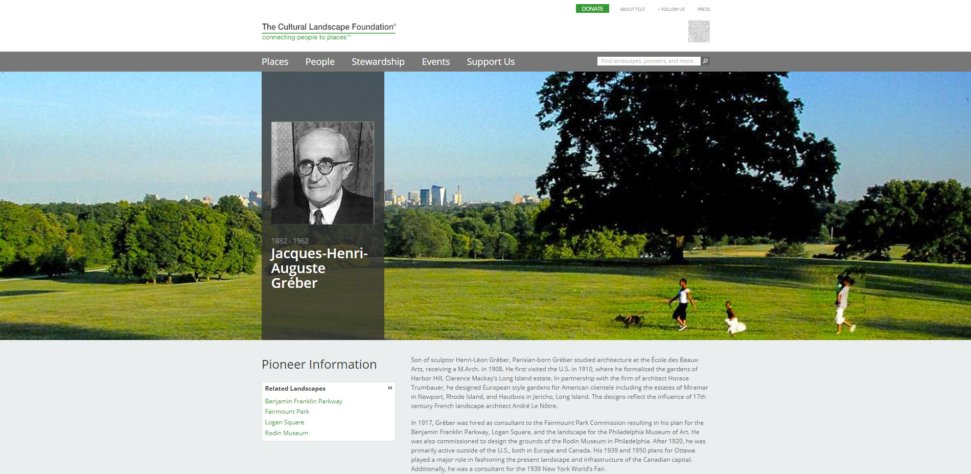
▲每位设计师的个人简介旁边都附有下拉菜单,可查看该设计师的所有相关作品。A drop-down menu beside each biographical profile presents (and links to) the designer’s “Related Landscapes” in the What’s Out There database.
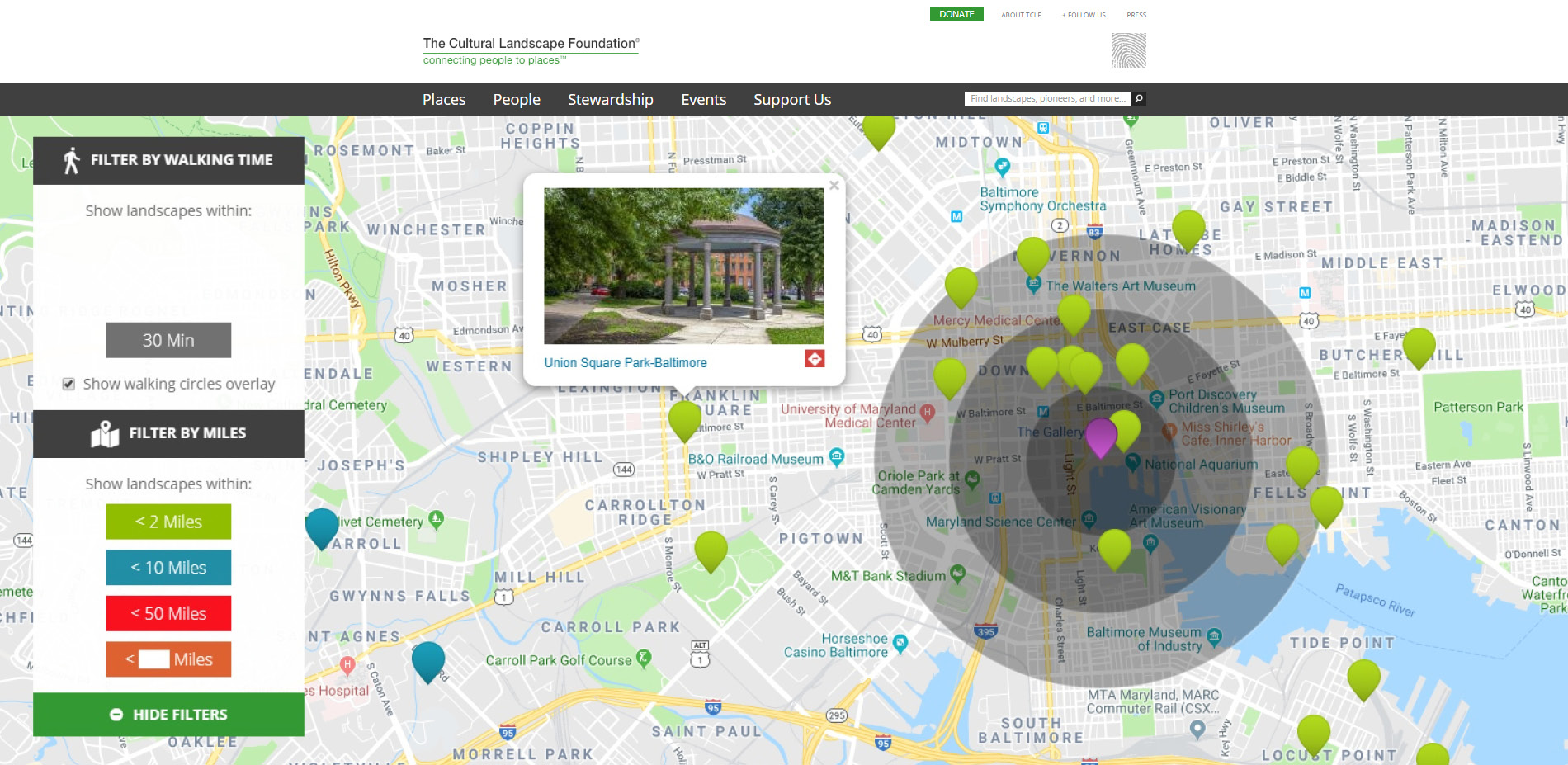
▲这些景观还可与基于GPS定位的“查看附近”功能相链接。使用者可以在自定义的距离范围内查看景观。地图中的同心圆代表了10分钟、20分钟或30分钟的步行距离。The landscapes are also linked to the GPS-enabled “What’s Nearby?” feature, which locates them within a customizable distance from each other or from the user’s current location. Using concentric circles, the maps also display walking distances of 10, 20, or 30 minutes.
9.
《河流的发明:亚历山大的目光与恒河降临》/ Dilip da Cunha (宾夕法尼亚大学)
从“填满河流的雨水”这一独特的角度来重新认知水系
The Invention of Rivers: Alexander’s Eye and Ganga’s Descent / Dilip da Cunha
reassess waterways in terms of the rainwater that fills them
点击蓝色链接查看更多 Click the link for more details
《河流的发明》引起了人们对“将土地与水分开”这一行为的关注——这是人们在理解和设计人居环境时最基本且最持久的行为之一。在本书中,河流被视为一种人类意志的产物而非自然的产物,从而为河流之外的世界留出了探讨的空间。
这是一本受众广泛的书籍。它整合了历史、艺术、文化研究、水文学和地理学,讲述了“河流”的概念是如何被建立起来,以及如何在人居环境的定义与日常实践中担任特殊的角色。本书以简单易懂的语言写成,并配以丰富的历史地图、照片与图解。终究,不论是从基础建造、自然、科学、景观、环境,还是从水流的隐喻等任何意义上说,河流都与我们每一个人有着密不可分的关联。
The Invention of Rivers draws attention to one of the most fundamental and enduring acts in the understanding and design of human habitation, namely, separating land and water. By presenting the river as a product of human intention rather than nature, the book makes room for worlds without it.
The book is written for a wide audience. It integrates history, art, cultural studies, hydrology, and geography to tell the story of how rivers have been constituted and granted a special role in defining human habitation and everyday practice. It is written in simple language and is richly illustrated with historic maps, photographs and diagrams. The river, after all, touches everyone whether through infrastructure, nature, science, landscape, environment, metaphors of flow, etc.
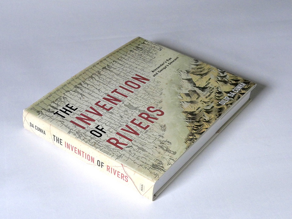
▲《河流的发明——亚历山大的目光与恒河降临》,封面和书脊,宾夕法尼亚大学出版社,2019。Invention of Rivers. Book cover and spine – Invention of Rivers: Alexander’s Eye and Ganga’s Descent (University of Pennsylvania Press), 2019)
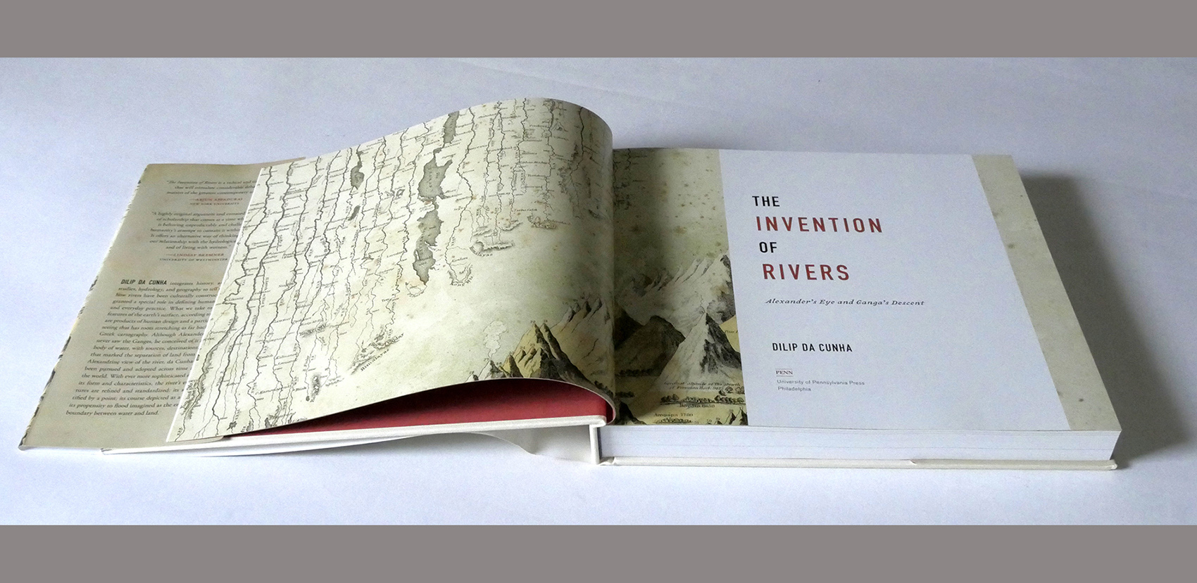
▲《河流的发明》扉页。 本书的封面和扉页描绘了G. W. Colton在1856年的《世界地图集》中对河流的比较研究。类似的研究在1800年代十分盛行,它们强调了线条在表达河流方面所发挥的作用。Invention of Rivers opening spread. The title page and book cover picture a comparative study of rivers by G. W. Colton in Atlas of the World, 1856. Such studies were popular in the 1800s. They highlight the role played by the line in articulating rivers.
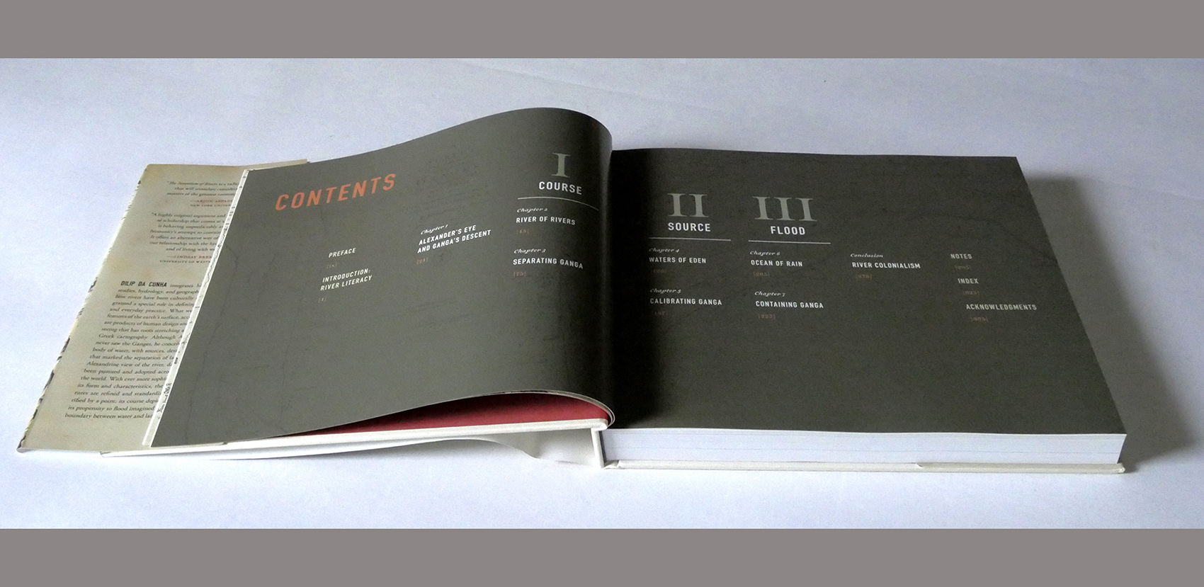
▲《河流的发明》内容目录。在“识读河流”的开篇介绍之后紧跟着“河道”、“源头”与“洪泛”三个章节。每个章节都讲述了艺术、科学和基础建造在使河流的本质要素变得具体化和常态化方面所发挥的作用。Invention of Rivers Table of contents. Following an introduction on River Literacy, the book is in three sections – Course, Source, and Flood each narrating the art, science and infrastructure that has gone into materializing, and naturalizing a particular essential of the river.
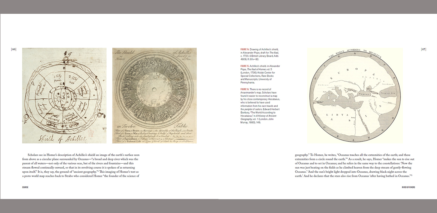
▲《河流的发明》第46-47页。“河道”章节通过历史图片和图解探寻了“世界地图”的起源,同时呈现了一些类似于描述水文循环的图例。Invention of Rivers pg 46-47. Illustrated with historic images and diagrams the section on Course probes the origin of the ‘world map’ as well as diagrams like the hydrological cycle.
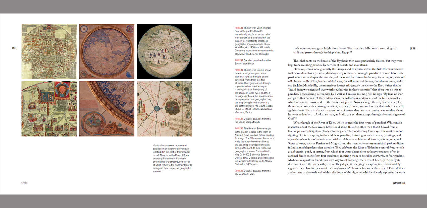
▲《河流的发明》第130-131页。中世纪的世界地图讲到了伊甸园之河的源头,并描述了水从海洋通过土地、云或者雨水回归山脉的过程。Invention of Rivers pg 130-131. Medieval mappa mundi speak of the source of rivers in the River of Eden, a reference to the return of waters from the sea to mountains either through the earth or via clouds and rain. © University of Pennsylvania Press
10.
Marnas花园游览网站 / Anne Whiston Spirn
游历和感受Marnas花园五十年间的时空变化
Marnas: A Journey through Space, Time, and Ideas
A journey through Marnas in space and time across five decades
点击蓝色链接查看更多 Click the link for more details
Marnas(www.marnasgarden.com)首次为公众提供了访问规划师和理论家安德松(Sven-Ingvar Andersson, 1927-2007)的花园实验室的途径。借助数千张照片,Andersson在这座花园中记录了他为期50年的研究实验。该项目将数字档案和交互式多媒体网站进行结合,提供了沉浸式的3D和4D体验,使访问者能够游历和感受花园在五十年间产生的时空变化。
Marnas (www.marnasgarden.com) provides the first public access to the garden laboratory of master designer/theorist, Sven-Ingvar Andersson (1927-2007), who recorded his experiments there, over the course of 50 years, in thousands of photographs. This extraordinary documentation made possible the digital archive and interactive multimedia website, designed as an immersive, three- and four-dimensional experience, which enables the visitor to journey through the garden in space and time across five decades.
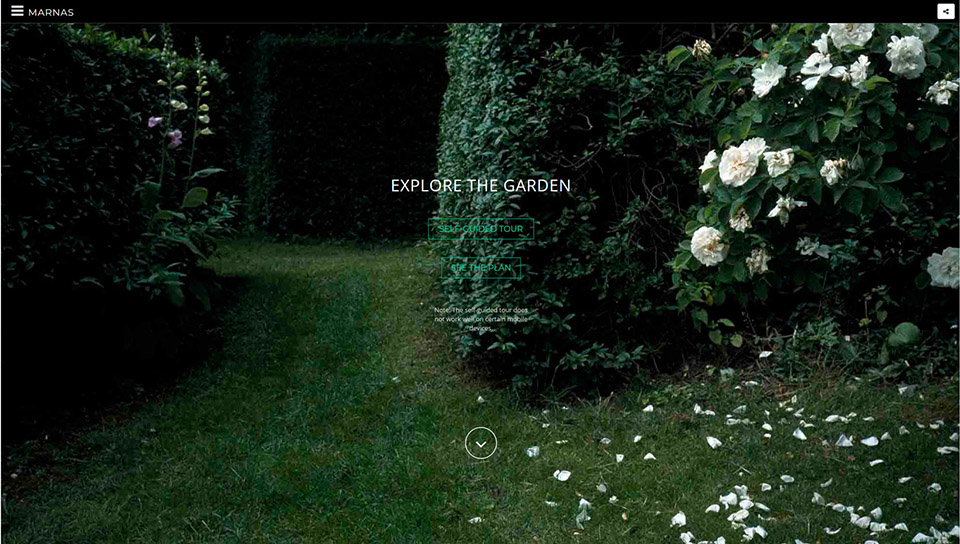
▲“Explore the Garden”邀请访问者在花园中自由漫步,并提供了数百种可能的路线。网站是基于一系列照片而构成的,它们共同将花园的各个部分连接起来。Explore the Garden is an invitation to wander around the garden on your own. There are hundreds of possible paths to choose from. This network was created by linking series of photographs, which connect all parts of the garden.
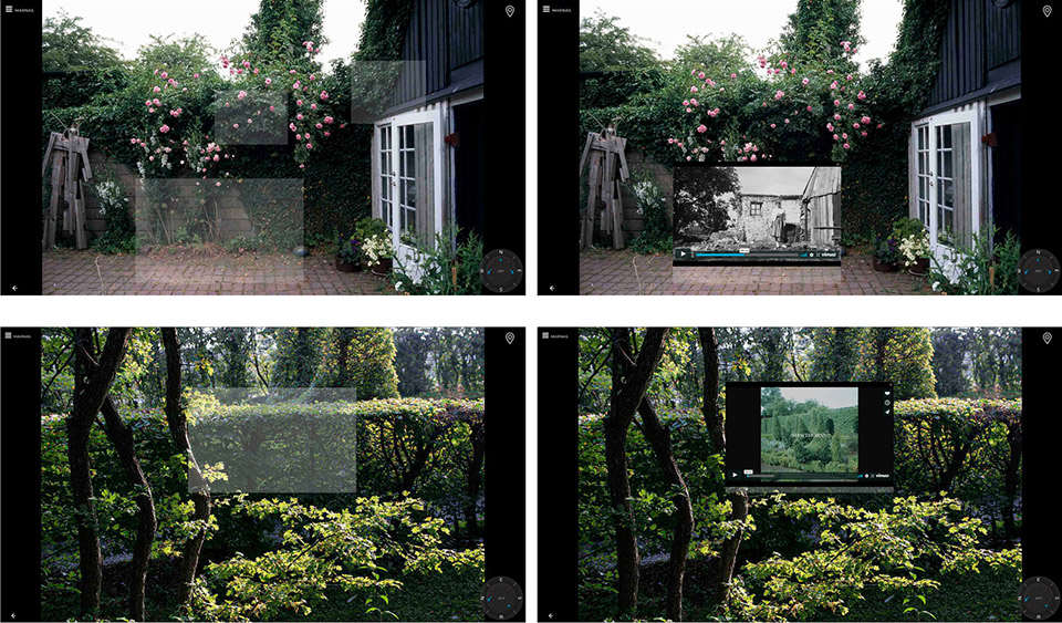
▲屏幕中有时会出现一个跳动的长方形。点击这个长方形即可观看一段介绍场所背后故事的短视频。图片顶部:露台如何从旧谷仓的废墟中产生。底部:遗传结构带来的适应性和限制。Occasionally, you encounter a pulsating rectangle. Click to watch a short video about ideas behind the place where you find yourself. Top: how the patio emerged from the ruins of an old barn. Bottom: on adaptation and the limits imposed by genetic structure.
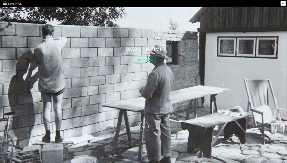
▲针对希望系统地研究花园发展过程的来访者,该章节按照时间顺序呈现了从1950年代至2000年代间的照片,并提供了麻省理工学院图书馆收藏的超过600张照片的链接。For those who want to study the garden’s development systematically, this section groups photographs chronologically from 1950s to 2000s. A link also takes you to the digital archive of more than 600 photographs in MIT Libraries, which I curated, selecting them from among thousands.
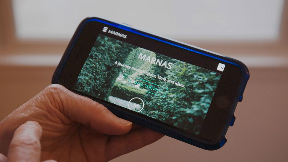
▲网站还能够很好地适应智能手机的浏览模式。除了自助旅行之外(不适用于小尺寸屏幕),所有的功能(包括视频和文字)都可以在手机平台上完整运行。When accessed on a smart phone, the website assumes a mobile-friendly format. All features (including videos and texts) are fully operational on mobile platforms except for the self-guided tour, which does not work well on mobile devices with a small screen.
11.
《走向城市生态学》,纽约 / SCAPE
一本为未来城市设计师制定的“指导手册”
Toward an Urban Ecology by SCAPE
A “manufestograph” for the next wave of urban designers
点击蓝色链接查看更多 Click the link for more details
点击蓝色链接查看更多 Click the link for more details
景观设计实践需要做出哪些改变,以应对气候变化的不确定性,同时满足培养社会凝聚力的需求?设计师如何才能创造社会性的事物,而不仅仅是简单地完成某个项目?《走向城市生态学》融合了设计、研究、艺术和环境知识等多个领域,将城市景观设计视为一种行动主义的形式,并针对下个世纪严峻的气候变化和社会分裂等问题提供了行动指南。
《走向城市生态学》是一部专题著作,也是一本手册、一则宣言。本书透过著名景观设计公司SCAPE的作品,借助项目介绍、合作者及特邀作者的文章阐述了一系列具有参与性的、立足于科学的实践策略。它揭示了设计如何融入自然的运行、循环以及塑造未来城市的系统,并重点关注了构成这些景观的人类和群体。
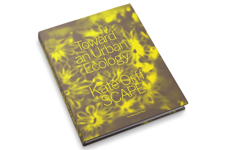
▲《走向城市生态学》封面。Toward an Urban Ecology, Book Cover
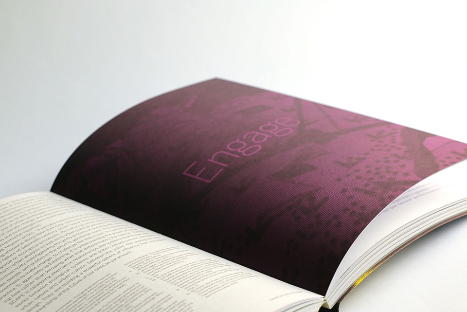
▲全书的内容框架建立在复兴、 共栖、融合与尺度四个主题之上。这些章节提供了前瞻性的思考和能够激发变革的设计挑衅,以系统的生态学思维和行为方式来武装读者。The themes of Revive, Cohabit, Engage, and Scale serve as the framework for the book. These chapters provide design provocations that can catalyze change and arm the reader with a way of thinking and acting ecologically across systems.
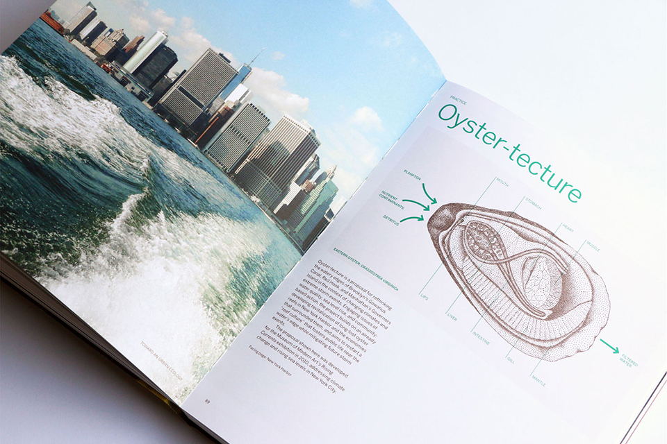
▲Oyster-tecture是为2010年MOMA举办的展览“Rising Currents”而设计的提案,旨在重建纽约人与港口的联系,促进清洁水的循环以及安全海岸的建设。Oyster-tecture was a proposal for MOMA’s Rising Currents exhibition in 2010, for re-establishing the relationship between New Yorkers and their harbor and setting into motion a regenerative cycle of cleaner water, engaged citizenry, and safer shores.
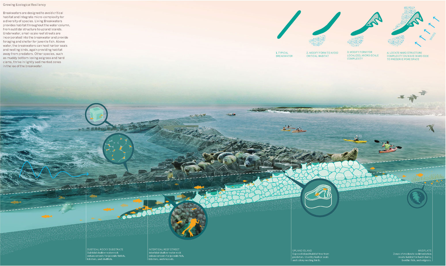
▲Living Breakwaters项目将复兴、 共栖、融合与尺度策略相结合,使水上基础设施与岸上教育及延伸相互连接,以促进斯塔顿岛的复兴,同时为该地区其他沿海社区提供潜在的可复制原型。Living Breakwaters combines the strategies Revive, Cohabit, Engage and Scale, linking in-water infrastructure with on-shore education and outreach to support a more resilient Tottenville, Staten Island, while serving as a potentially replicable prototype for other coastal communities in the region.
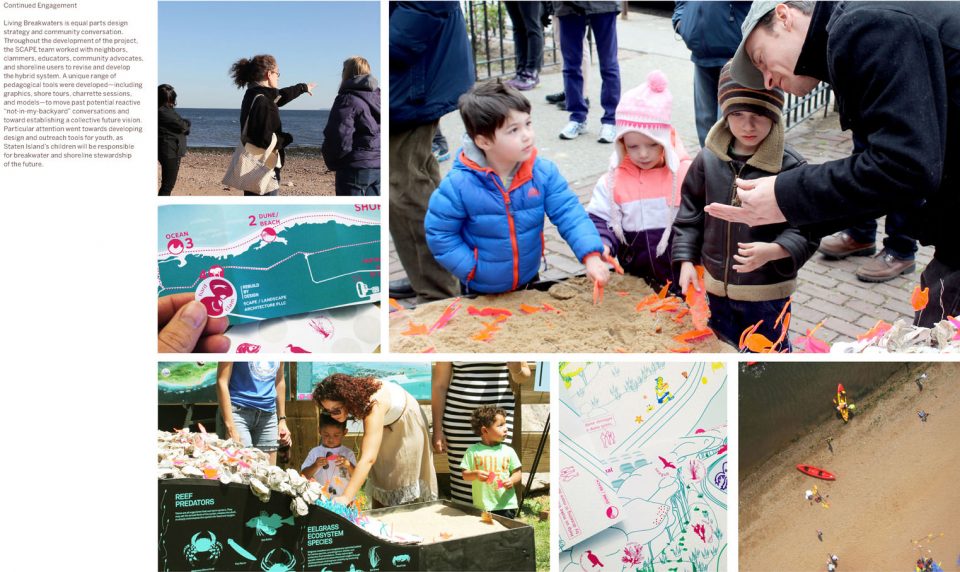
▲通过众多像Living Livingwaters这样与社区使用者合作完成的项目,长期的参与将成为“尺度”章节中所论述的、一种能够确保未来管理和弹性发展的战略。Through projects like Living Breakwaters which work with community users throughout the design process, continued engagement can be a form of Scale – a strategy to ensure stewardship and resiliency for the future.
12.
温哥华VanPlay公共娱乐品牌打造计划 / Design Workshop – Denver/Aspen
公园和娱乐部门在品牌和形象塑造方面的示范性转变
VanPlay: Plan to Play
A paradigm shift in how parks and recreation departments brand and identify themselves
点击蓝色链接查看更多 Click the link for more details
温哥华公园与娱乐管理委员会希望突破这种以“蓝与绿”为主题的传统公园模式,寻找设计团队来打造一个全新的品牌,并将公众的热情与好奇心引向这一为期超过25年的、全系统的总体规划当中。该项目试图利用这一潜能巨大的网络基础来构建一个充满活力的品牌形象,使其能够涵盖并代表城市中各类卓越而先进的设施和服务。
VanPlay作为全新升级的品牌,在项目实施后的六个月内便实现了超过一百万次数字展示,并将帮助温哥华市创建一个包容性的框架,以应对包括海平面上升、基础设施老化以及社会不平等加剧在内的各种各样的挑战。
Seeking a vision beyond the typical ‘blue and green’ parks motif, the Vancouver Board of Parks and Recreation challenged the design team to craft a brand to spark the public’s curiosity in the first systemwide master plan in over 25 years. The resulting brand draws from this energy to forge a vibrant identity agile enough to represent the breadth of exceptional and progressive services offered—from mahjong to warming stations for the homeless.
VanPlay, the reenvisioned brand, garnered over 1 million digital impressions in its first six months and is helping the city create a framework for inclusivity and welcome in the face of challenges that range from sea level rise, aging infrastructure and rising social inequality.
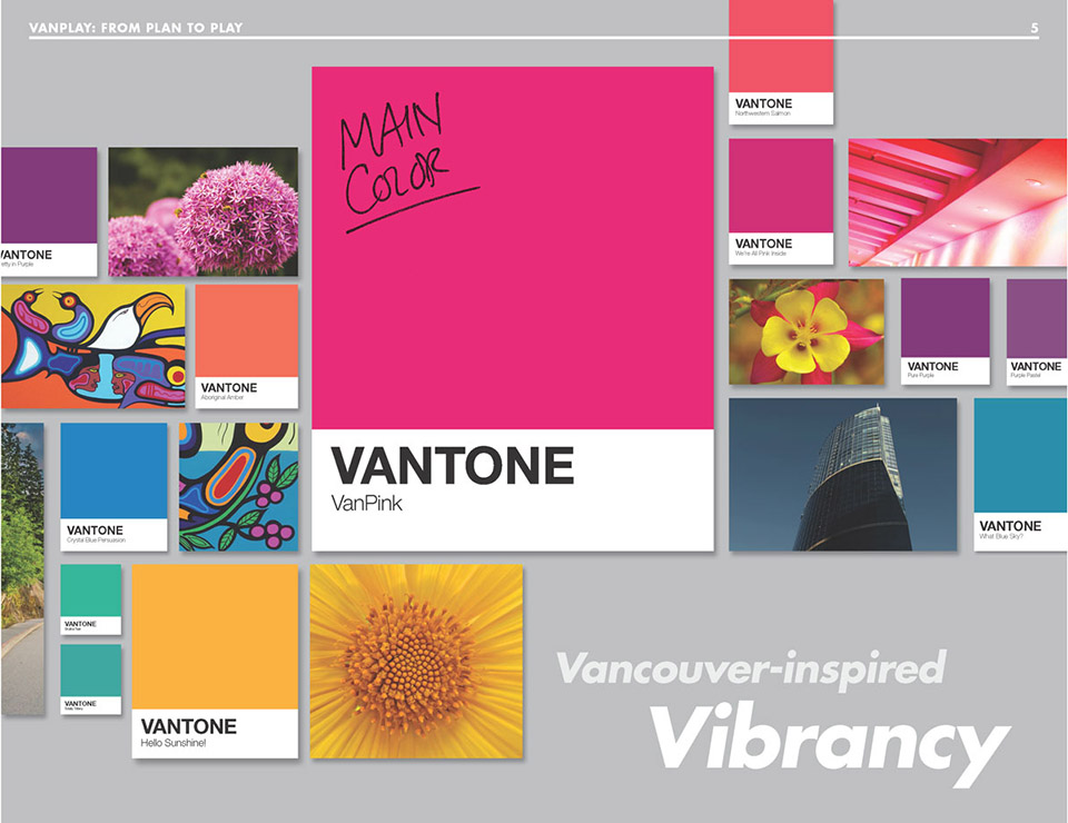
▲源于温哥华的活力:设计团队从温哥华生机勃勃的自然环境中找到灵感,精选了数百张能够反映色彩和文化特征的照片,并将其应用为品牌形象的主色调。Vancouver-Inspired Vibrancy:The team sought inspiration in the vibrant nature of Vancouver, visually and culturally. Hundreds of photographs representing color and culture were curated to become the brand’s color palette.
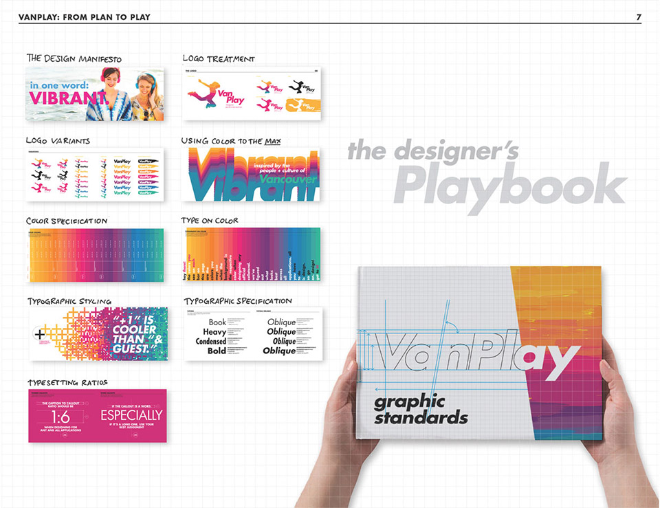
▲为了扩大品牌的影响力,设计团队开发了一套完整的设计标准手册,以确保VanPlay的品牌特征能够被每个参与规划的人使用,从而保持统一而富有凝聚力的视觉形象。To expand the reach of the brand, the team developed a complete design standards manual to enable anyone and everyone involved in the planning process to design assets for public release, which maintained a cohesive and unified visual identity.
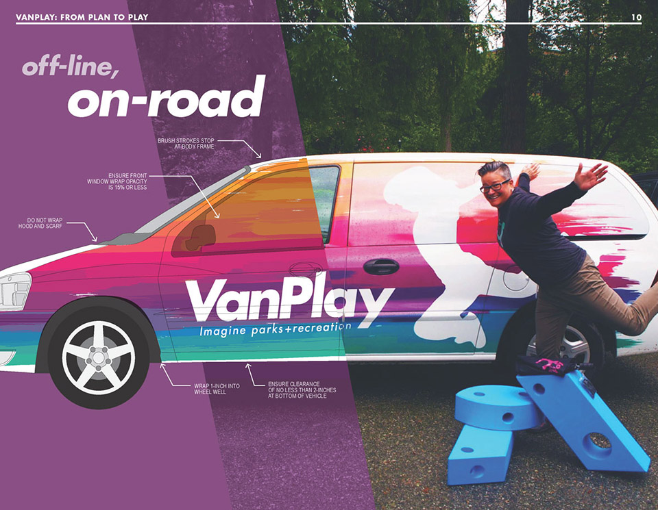
▲项目团队为VanTour巡回活动开发了一款旅行房车,并在其中置入一个“想象力游乐场”。旅行房车就如同移动的广告牌一般,大量地吸引了人们的注意。The team developed a tour van for the VanTour. The Van hauls the Imagination Playground and functions as a moving billboard to generate and maintain top-of-mind attention on the campaign.
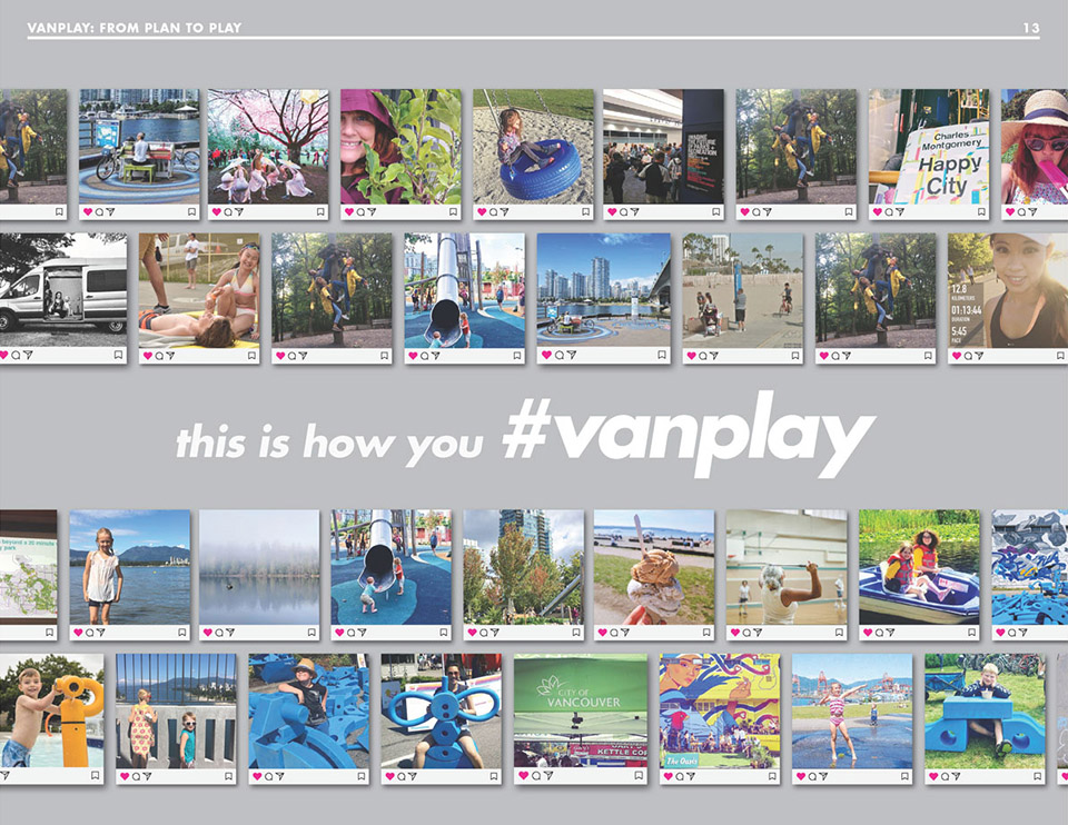
▲借助社交媒体,社区成员得以表达和分享自身的创意、照片和视频,全面地展示出每个温哥华人独有的#VanPlay方式。Through social media, the community furthered the campaign’s reach by posting thousands of their own thoughts, photos and videos to share how Vancouverites #vanplay.

▲线上VanPlay:待在家里的人们可以观看由VanPlay出品的优质电影。它记录了温哥华日常生活的情景,加深并拓宽了人们对于公园和娱乐系统的认知。If You’re VanPlaying Online…For those playing along at home, VanPlay debuted a highly-produced film of life in Vancouver, bringing the “day in the life” VanScene to life. The film reinforces the breadth scope of the parks and recreation system.
13.
《新景观宣言》:二十一世纪的行动号召 / Landscape Architecture Foundation
景观设计将在当今世界的塑造中发挥核心作用
The New Landscape Declaration: A Call to Action for the Twenty-First Century
Landscape architecture will play a central role in shaping today’s world
点击蓝色链接查看更多 Click the link for more details
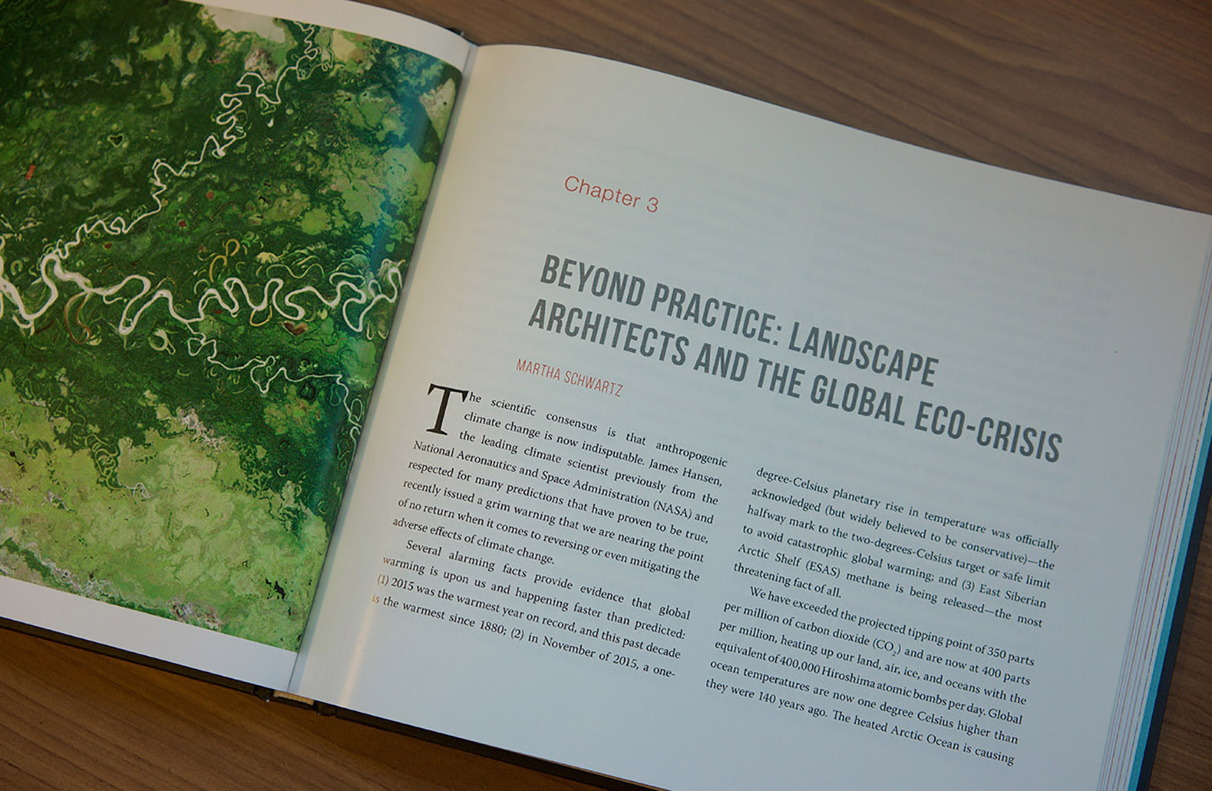
《新景观宣言》(The New Landscape Declaration)一书对景观设计及其潜力进行了批判性、刺激性和启发性的探索,收录了来自知名和新兴景观设计师的32篇论文。书中的想法跨越了学科界限,挑战了当前的思想和实践困境,强调了倡导多元化、创造力、领导力和执行力的必要性。
The New Landscape Declaration book is a critical, provocative, and inspirational examination of landscape architecture and its potential. The ideas cross disciplinary boundaries and challenge current silos of thought and practice, underscoring the need to diversify, innovate, and create a bold culture of leadership, advocacy, and activism.
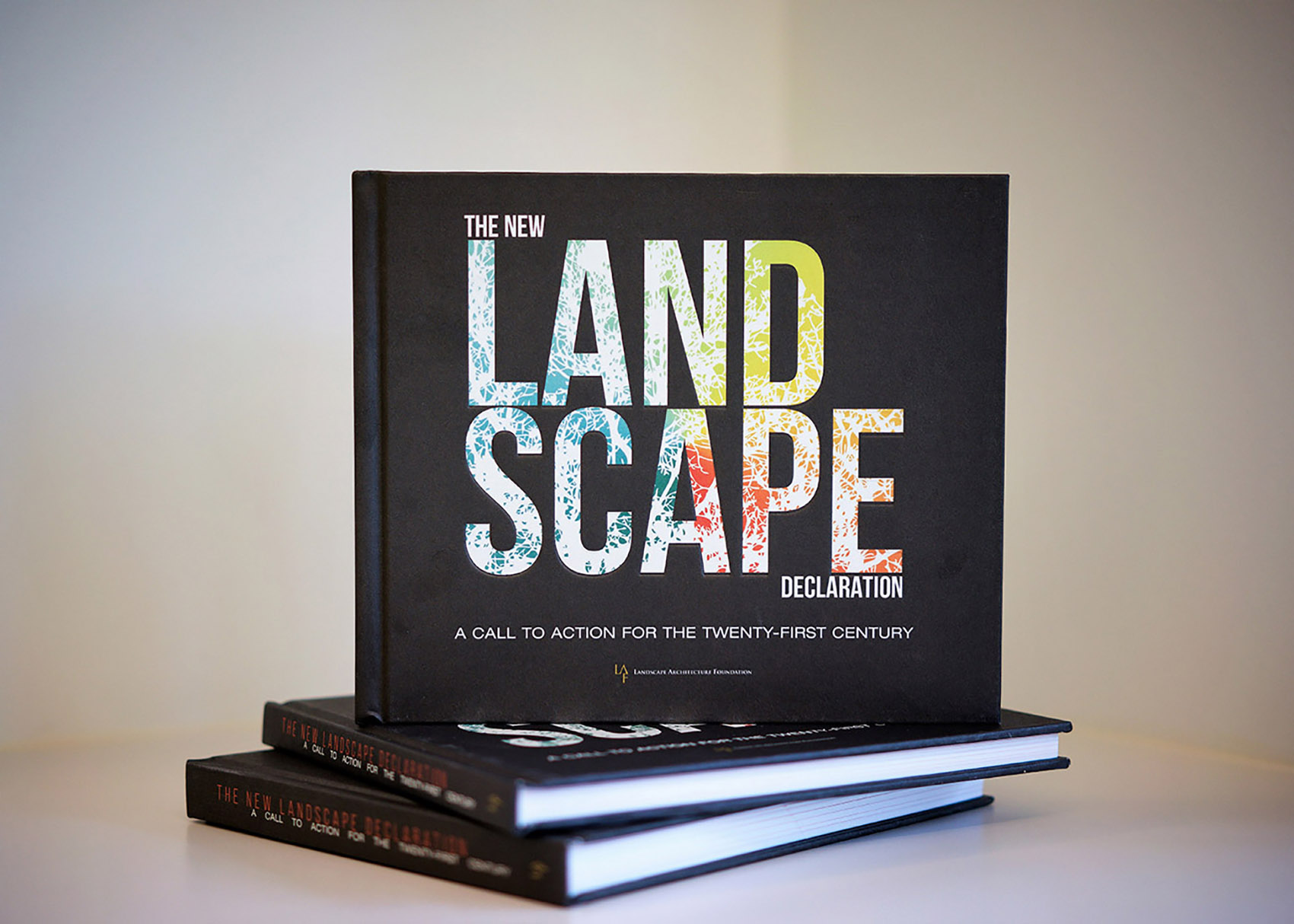
▲《新景观宣言》的封面与书脊。Book cover and spine.
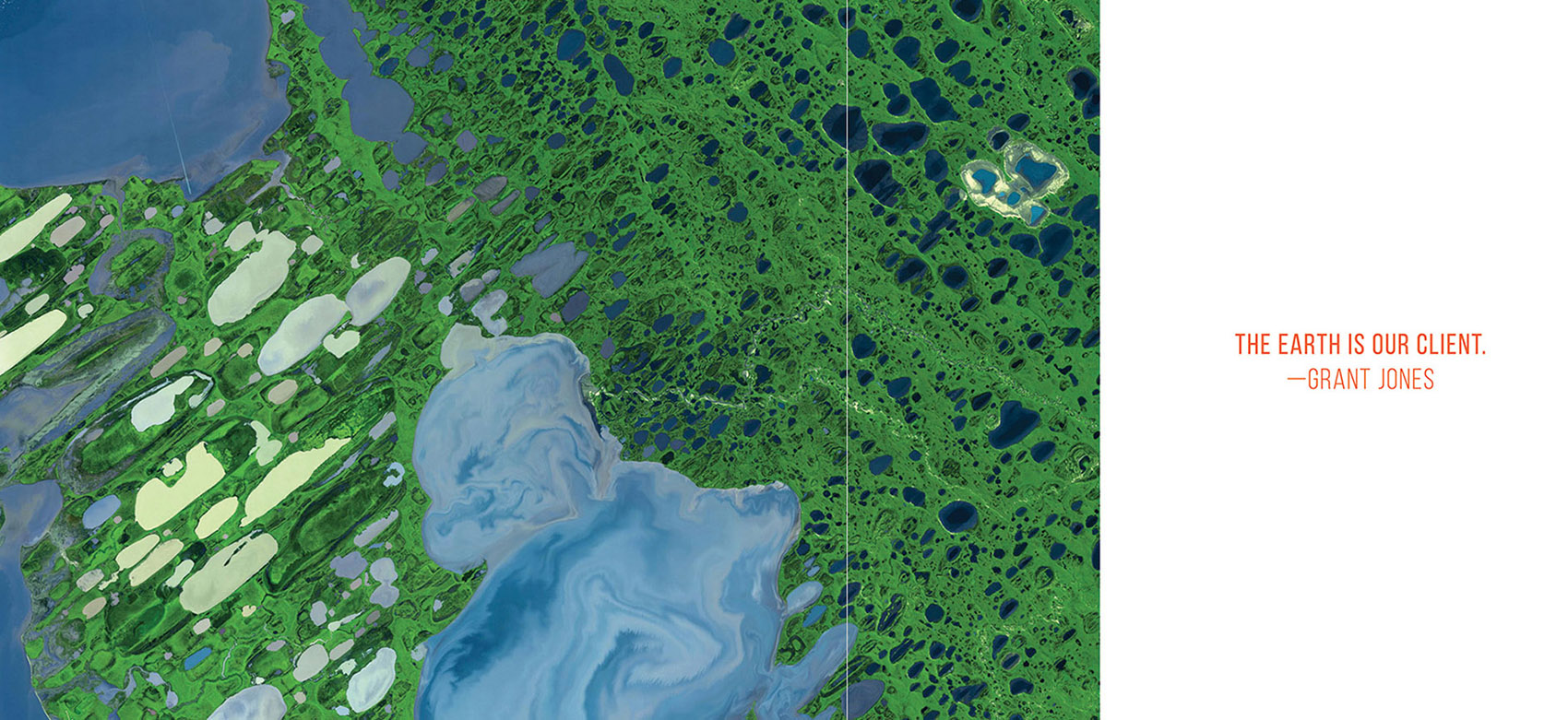
▲这本书以格兰特·琼斯的题词开篇。这一优雅的设计结合了来自NASA提供的、显示了巨大景观变化的图像:比如这张格陵兰冰原上的早期融水图。The book opens with an epigraph from Grant Jones, FASLA. The elegant design incorporates images from the NASA Earth Observatory that show vast landscape changes, such as this image of early meltwater on the Greenland Ice Sheet.
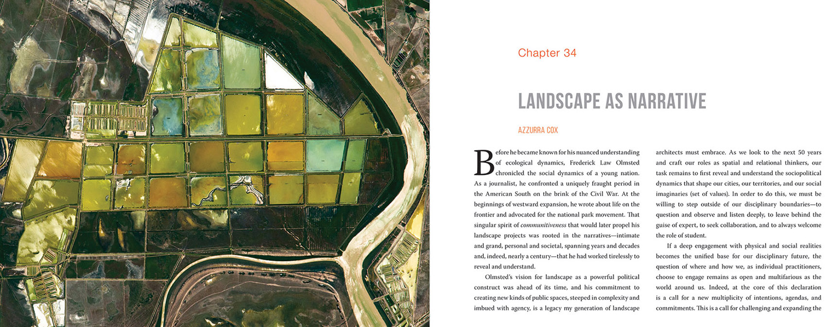
▲除了知名的设计师之外,这本书还包括六位新锐设计师主笔的“未来之声”部分。In addition to established leaders, the book includes a “Voices of the Future” section with essays from six rising landscape architects.
▲《新景观宣言》一书的独特之处在于,它不需要作者写自己的工作,而是写景观园林学的愿景。The New Landscape Declaration book is unique in that the authors were specifically asked not to write about their work but rather their vision for the landscape architecture discipline.
14.
为防灾做出改变:传播有效的森林防火规划策略 / Design Workshop, Inc.
一个提供火灾防控策略和方法的视觉工具箱
Affecting Change to Avoid Disaster: Communicating Effective Wildfire Planning Strategies / Design Workshop, Inc.
A visual toolbox of strategic risk-reduction methods
点击蓝色链接查看更多 Click the link for more details
森林大火在美国西部各州频频发生,面临着失去家园的风险的社区有必要做好更充分的准备,同时,作为社区的设计者,景观从业人员也需要有更好的防控和减灾策略。一份直观易懂的教学资料能够帮助景观设计师在社区开发的早期阶段向公众介绍火灾防控的方法,继而让公职官员能够了解到土地使用的潜在影响并准备更全面的应对措施。凭借着这个提供防控策略和方法的视觉工具箱,景观设计师得以更顺利地将原先的脆弱环境变得稳定而强健。
With a rise in wildfires in the western American states comes the necessity for better preparedness for communities at risk of losing their homes, and better suppression and mitigation strategies for the landscape architects who design them. A compendium of easy-to-navigate educational graphics enables landscape architects to introduce these wildfire mitigation approaches during early stages of community development so that public officials may understand potential land use impacts and prepare more holistic responses. Armed with this visual toolbox of strategic risk-reduction methods, landscape architects are empowered to initiate conversations that would trade vulnerability for resilience.
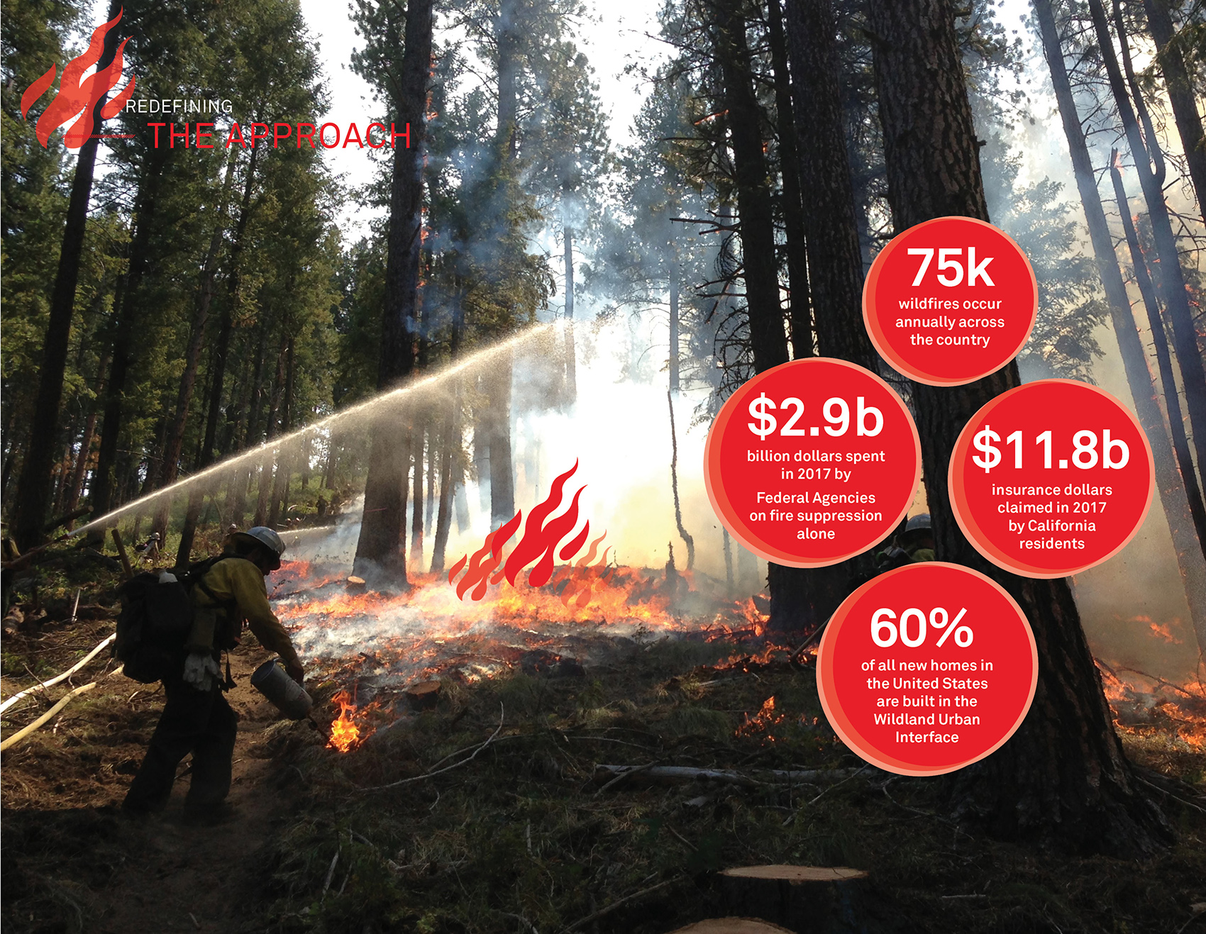
▲2018年,美国各地有850万英亩土地被烧毁,其中风险地区的发展面临着严重威胁。这一数字迫使景观设计师采取行动,通过与社区合作来改善土地使用的规划,从而减少火灾的风险和影响。In 2018, over 8.5 million acres burned across the United States, threatening development in at-risk areas. This statistic demands a call to action for landscape architects to collaborate with communities and improve land use planning that reduce risk and impact.
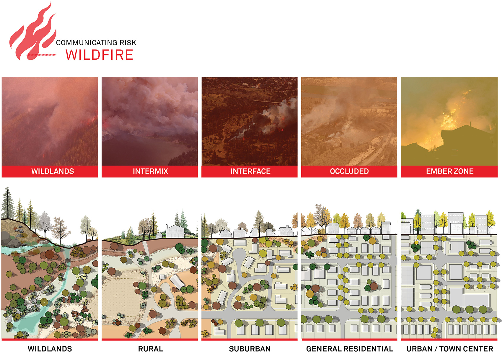
▲CPAW聘请景观设计师传达有效的防火规划和设计概念、减灾政策以及法规。首先,“从林野到城市密度的连续体”列举了从乡村到城市的建筑环境条件。CPAW engaged the landscape architect to create a new visual series to educate citizens of effective policies and regulations. To begin, a ‘Continuum of Wildland to Urban Densities,’ places conditions of the built environment from rural to urban.
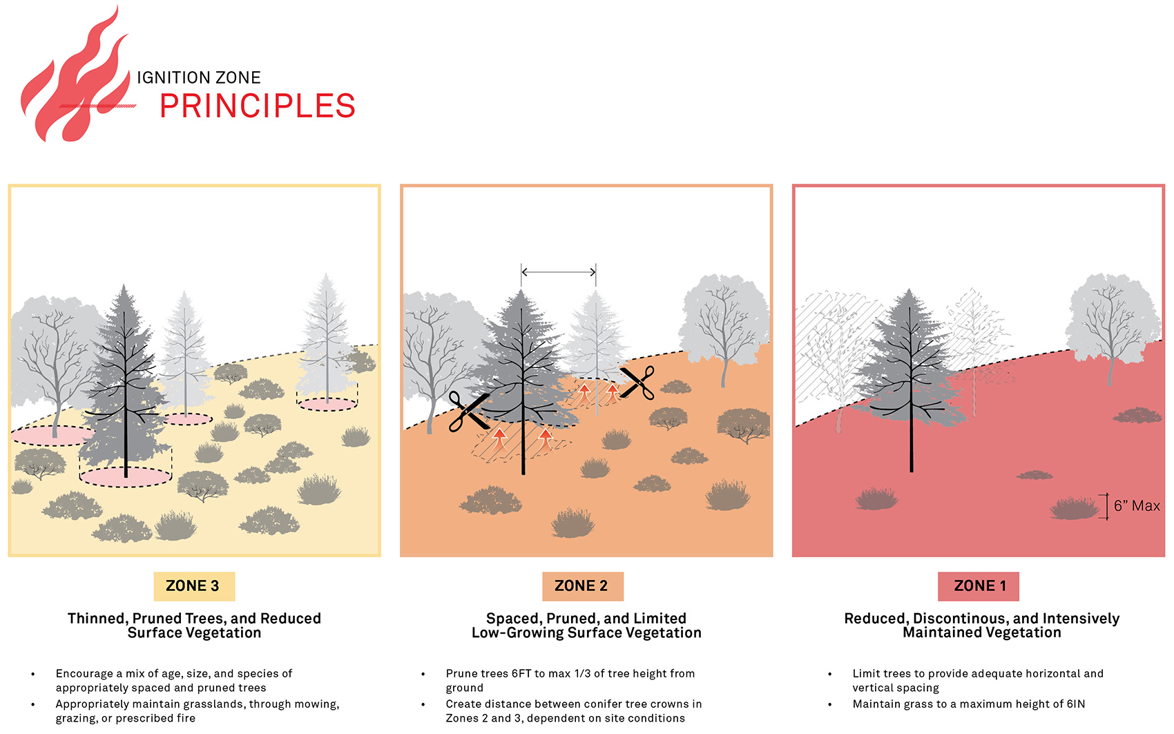
▲基础资料库将与森林野火、脆弱性和火灾防控相关的技术概念转化为直观且具有叙述性的资源,图文并茂且易于理解。The foundational library of assets translates technical concepts related to wildfire, vulnerability, and mitigation into visual and narrative resources, easily understandable and graphically rich.
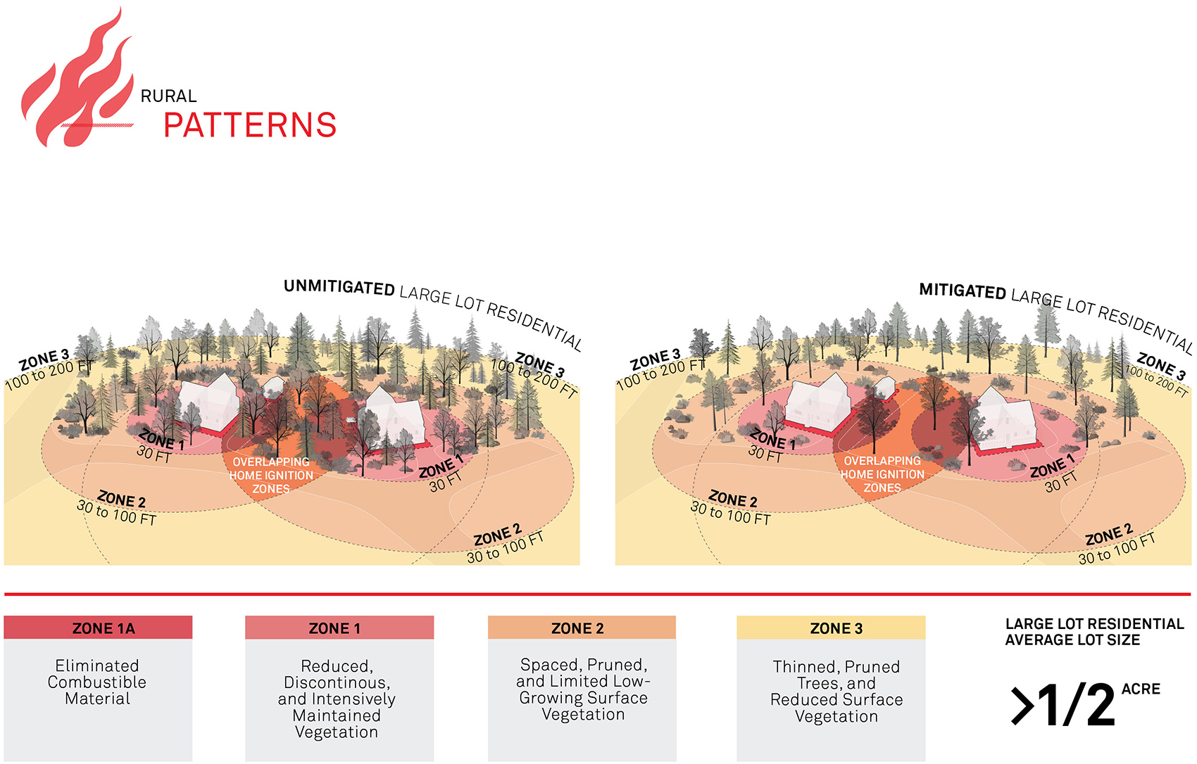
▲新的图文资料对防卫空间图例进行了更详实的补充。The visuals expanded on typical defensible space diagrams, which are overly general and ignore specific development challenges.
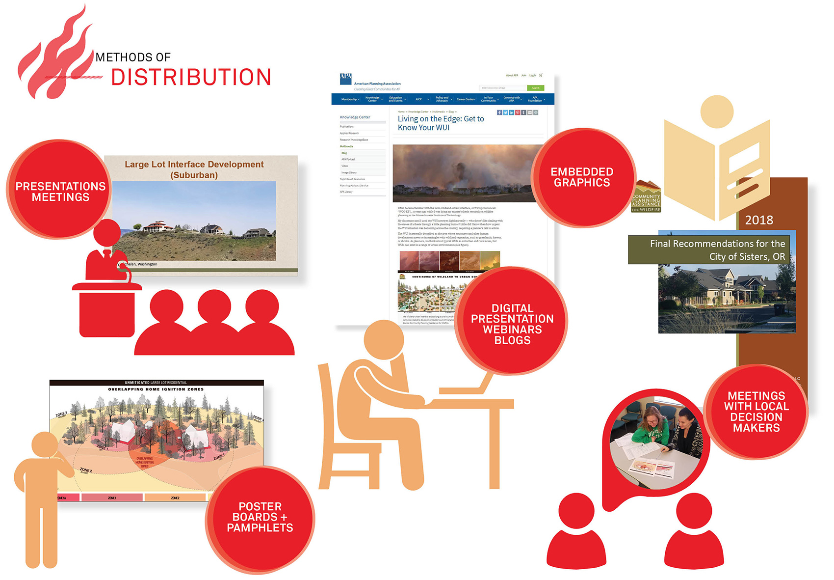
▲视觉资料被编辑为各种形式,可通过演示文稿、小册子或嵌入指导性文件(如综合计划)来进行传播。技术上的准确性得到调整与平衡,以保证贴合不同社区的具体环境。Visuals were adapted for multiple formats to enable communication in a presentation format, a pamphlet, or embedded in a guiding document such as a comprehensive plan. Technical accuracy was balanced to remain relevant to communities in a variety of environments.
15.
《家园指南》:飓风马修之后,六个社区的重建 / 北卡罗莱纳州立大学海岸动力学设计实验室
帮助受灾居民重建家园,促进社区的健康发展
Homeplace: Conversation Guides for Six Communities, Rebuilding After Hurricane Matthew
A menu of high-quality, community-specific designs and strategies at multiple scales, resulting in a coordinated post-disaster rebuilding effort that strengthens communities in the long run
点击蓝色链接查看更多 Click the link for more details
《家园指南》旨在帮助洪灾的幸存者们解读有关恢复和重建工作的复杂信息。它通过一系列传播工具来为灾区提供易于理解的技术援助,以解决典型的灾后问题。在这种大型的、以州政府主导的计划框架内实施重建,有助于促进居民、社区官员以及多方之间的对话。项目不仅充当了与受灾社区进行批判性对话的实体档案,还提供了方便传阅和分享的电子版本,以回应乡村社区资源匮乏的现状。在重建计划的未来阶段,“家园”项目还将提供可通过多平台进行修改、更新和分享的通信基础设施。
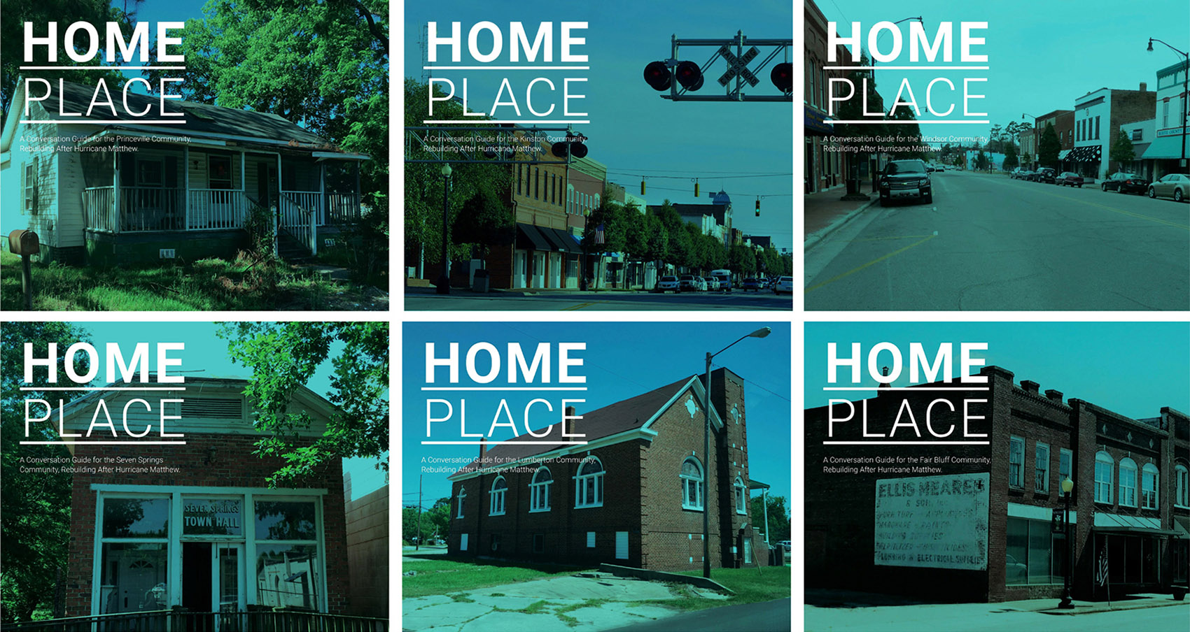
▲指南有助于帮助城市决策者、区域规划者和居民在飓风马修过后对社区重建的选择进行深入理解。These guides were used by city leaders, regional planners, and residents to better understand options for the communities rebuilding after Hurricane Matthew.
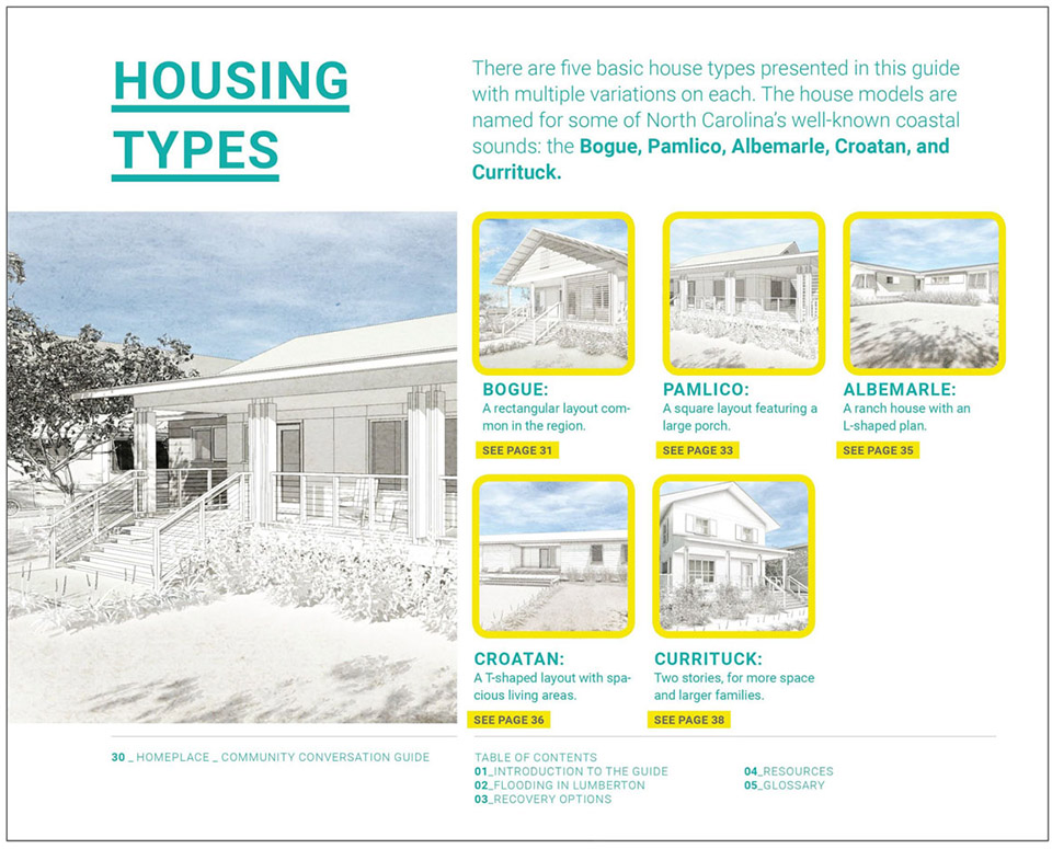
▲图中的5个核心住房类型均来自于该地区的本土建筑,并以该州著名的海岸地带命名。The 5 core housing schemes were derived from the region’s vernacular architecture and named for the state’s famed coastal sounds.
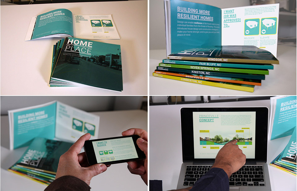
▲《家园指南》能够以数字和印刷方式在各类平台上访问,随时满足人们对于“现场”工具的需求。The guides were designed to be accessed both digitally and in print, and on various platforms, anticipating the need for the tools “in the field.”
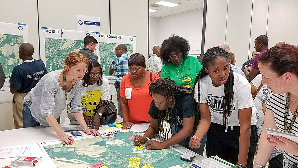
▲地图和指南在公共场合中被大量使用,鼓励大众积极进行对话。The maps and guides are used in public settings as tools to activate conversation.
更多ASLA获奖案例请点击
All ASLA Awarded Projects Click Below
ASLA Awarded Projects
欢迎在评论区分享你对景观学传播与交流方式的看法!
Welcome to add more examples in the comments!







又见密斯凡德罗椅