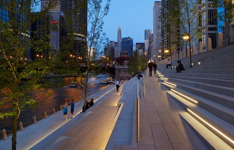
来自 Sasaki 对gooood的分享。更多关于他们: Sasaki on gooood
Appreciation towards Sasaki for providing the following description:
拾芝加哥河的城市生态与休闲效益
芝加哥河主干有着悠久且丰富的历史,它在很多方面呈现了芝加哥城市本身的发展。芝加哥河以前是一条蜿蜒的沼泽,后来被硬化改造为工程河道以支持城市向工业型转换。为了改善卫生情况,城市将河流主干与南边分支水流方向倒转,在此之后,建筑师与城市设计师丹尼尔·伯纳姆提出了滨河步道与瓦克道高架桥的新愿景。近十年来,河流所扮演的角色随着芝加哥滨河项目再次转换——重拾芝加哥河的城市生态与休闲效益。
The Main Branch of the Chicago River has a long and storied history that in many ways mirrors the development of Chicago itself. Once a meandering marshy stream, the river first became an engineered channel to support the industrial transformation of the city. Following the famed reversal of the river, in which the city reversed the flow of the Main Branch and South Branch to improve sanitation, architect and urban planner Daniel Burnham introduced a new civic vision of riverside promenades with the addition of the Wacker Drive viaduct. Over the last decade, the role of the river has been evolving with the Chicago Riverwalk project—an initiative to reclaim the Chicago River for the ecological, recreational and economic benefit of the city.
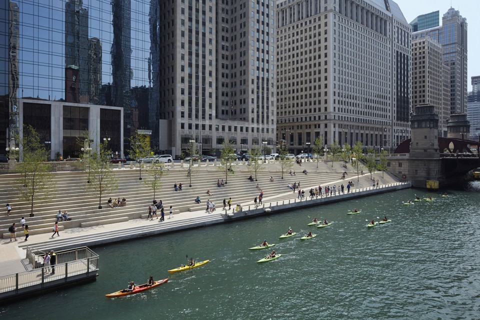
▼林立高楼中的芝加哥河,Chicago River in the city
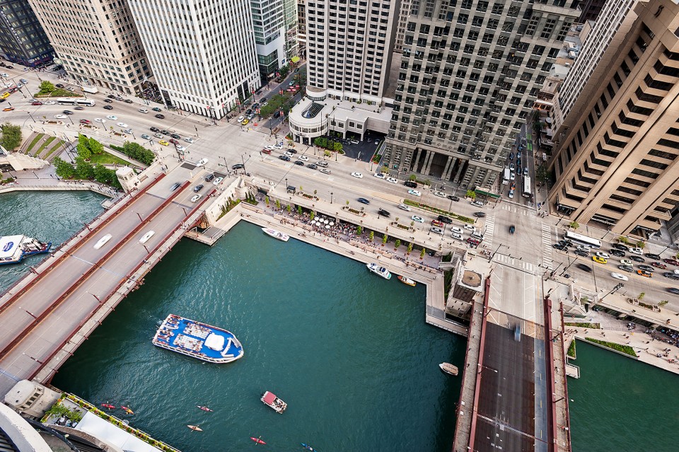
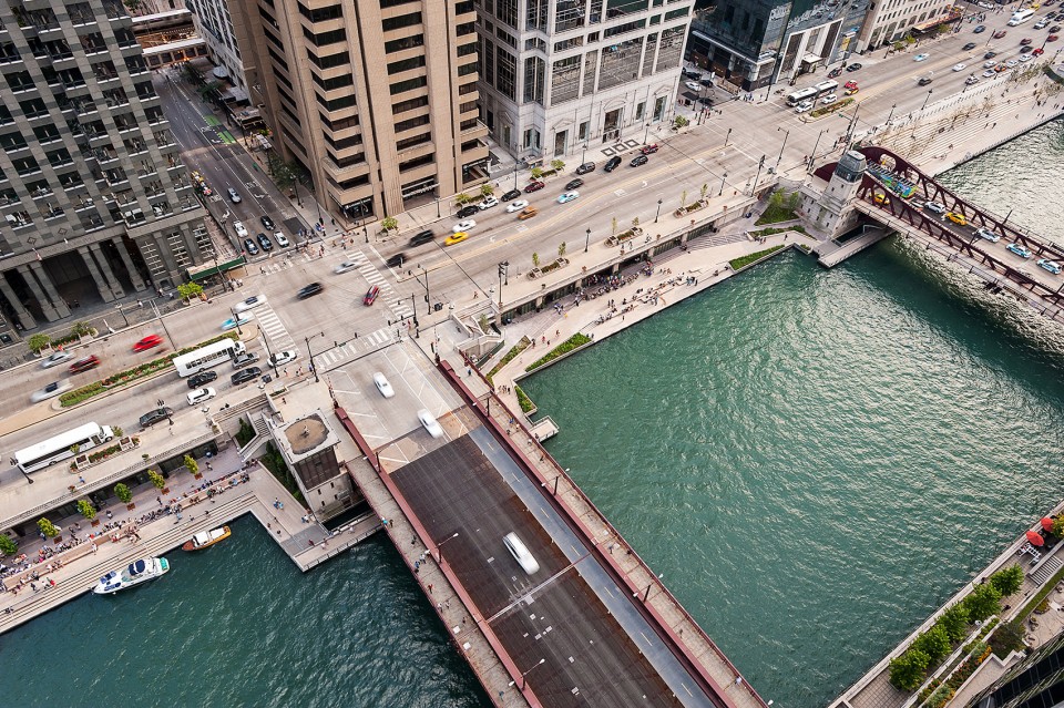
几年前,由于河流的重度污染,滨河休闲是遥不可及的目标。但今天这个愿景成为现实。在水质方面的最新进展以及沿河公共休闲使用强度的提升都体现了滨河生活的增加,呼唤通向水岸的新的连接。响应这些号召,芝加哥交通部开始实施滨河步道项目,用新空间充实系统的各个部分,其中包括非常成功的退伍军人纪念广场与沃巴什广场。
The goal of embracing the river as a recreational amenity seemed impossible years ago given the river’s high levels of pollution. But today that vision is becoming a reality. Recent improvements in river water quality and the increased intensity of public recreational use signal growing life along the river, demanding new connections to the water’s edge. Accordingly, the Chicago Department of Transportation and Ross Barney Architects led Phase One of the Riverwalk, an initial segment that includes Veteran’s Memorial Plaza and the Bridgehouse Museum Plaza.
▼干净的水质保证了滨河空间的利用率,the improved water quality vitalized the riverside
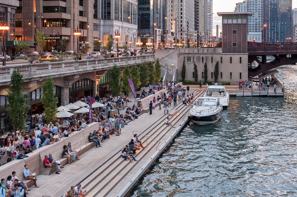
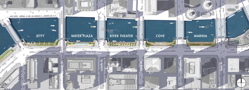
2012年,Sasaki、罗斯巴尼建筑事务所、阿尔弗雷德本纳什工程公司以及广泛的技术顾问团队合作,任务是为州街与湖街之间的六个街区创造愿景。在先前河流研究的基础上,此团队提出的芝加哥滨河概念规划在湖泊与城市步行系统,以及河流在城市中的支流之间提供了最后的关键连接。
In 2012, the team of Sasaki, Ross Barney Architects, Alfred Benesch Engineers, and Jacobs/Ryan Associates, supported by technical consultants, was tasked with completing the vision for Phases Two and Three: six blocks between State Street and Lake Street. Building off the previous studies of the river, the team’s plans provide a pedestrian connection along the river between the lake and the river’s confluence.
▼六个街区,六个愿景,six blocks with six visions
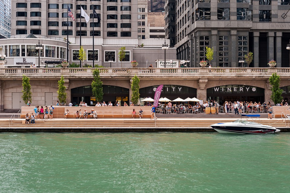
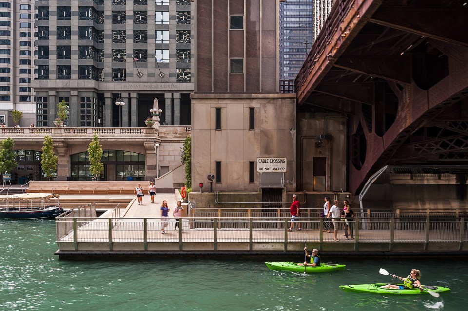
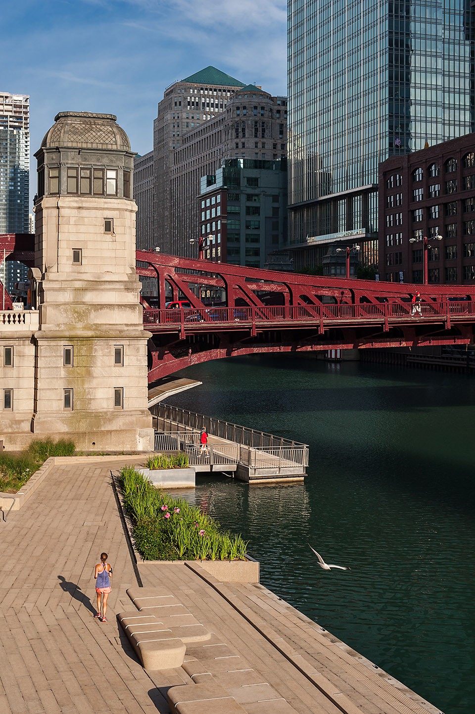
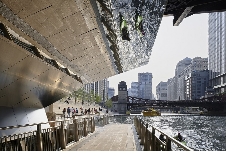
但此任务在技术上面临极大挑战。设计团队需要在局限的7.6米宽的建成区扩展步行项目空间并与街区间一系列穿过桥下的区域协调。除此之外,设计还需要适应河流每年的洪水涨落,竖向高度差近两米。
The task at hand was technically challenging. The design team, for instance, needed to work within a tight permit-mandated 25-foot-wide build-out area to expand the pedestrian program spaces and negotiate a series of under-bridge connections between blocks. Further, the design had to account for the river’s annual flood dynamics of nearly seven vertical feet.
▼狭窄的线性滨水公园,linear waterfront park
▼近两米的高差,seven vertical feet height difference
▼大量的桥下空间,under-bridge connections
相对独立,与河相连的全新功能系统
将这些挑战变成机遇,团队为此线性公园提出了新的思路。取代以建筑为导向的充满直角拐弯的步道,将步道视为一个相对独立的系统——通过自身形态的变化,促进形成一系列与河相连的全新功能联系。
Turning these challenges into opportunities, the team imagined new ways of thinking about this linear park. Rather than a path composed of 90-degree turns, the team reconceived of the path as a more independent system—one that, through changes in its shape and form, would drive a series of new programmatic connections to the river.
▼独立的滨河步道系统, an independent path system
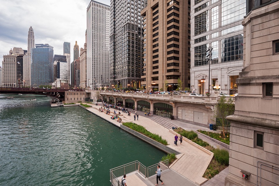
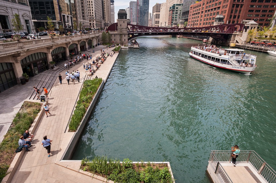
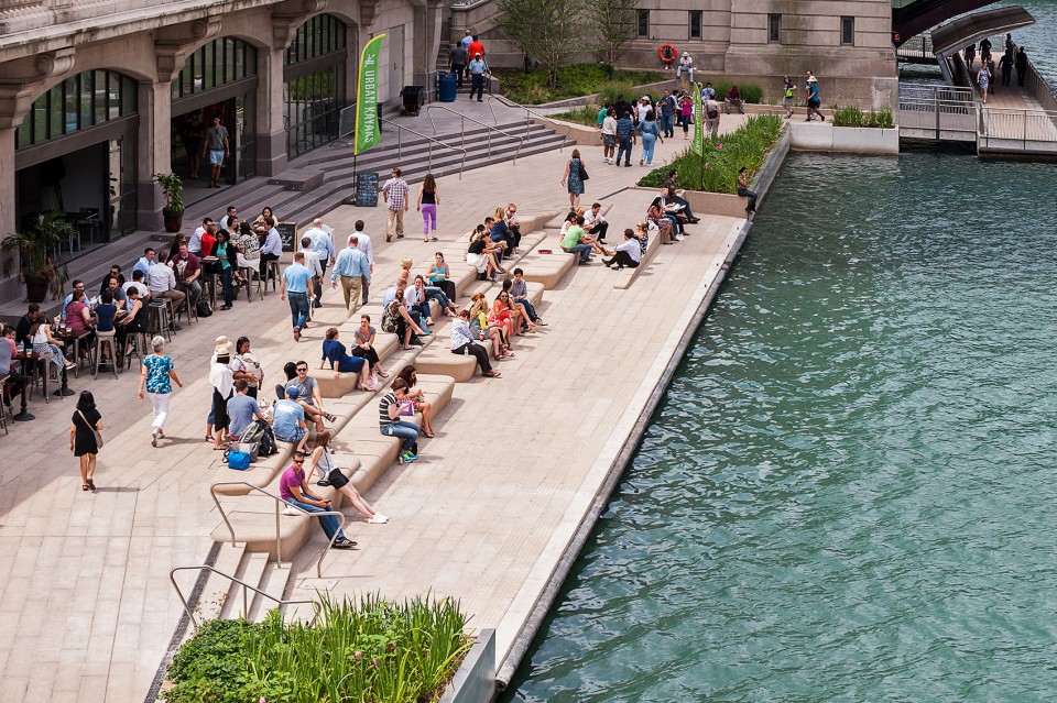
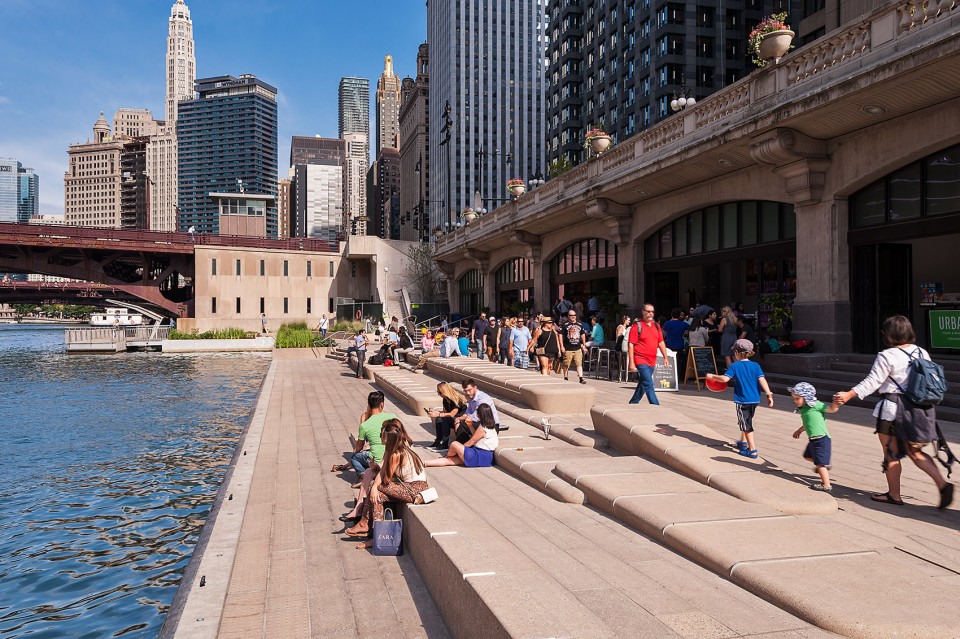
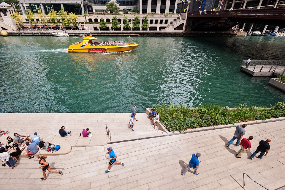
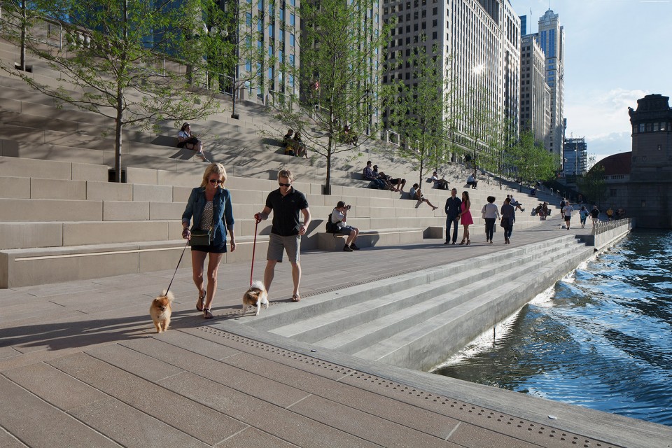
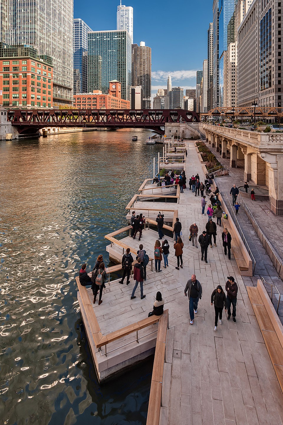
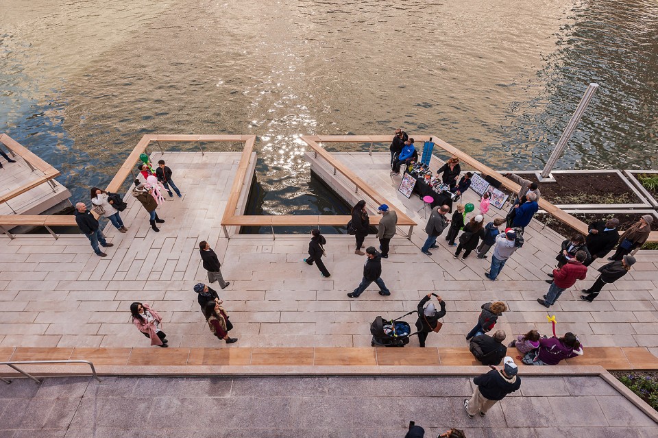
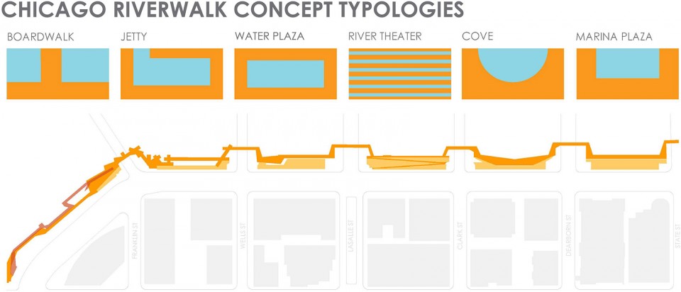
多种街区形态
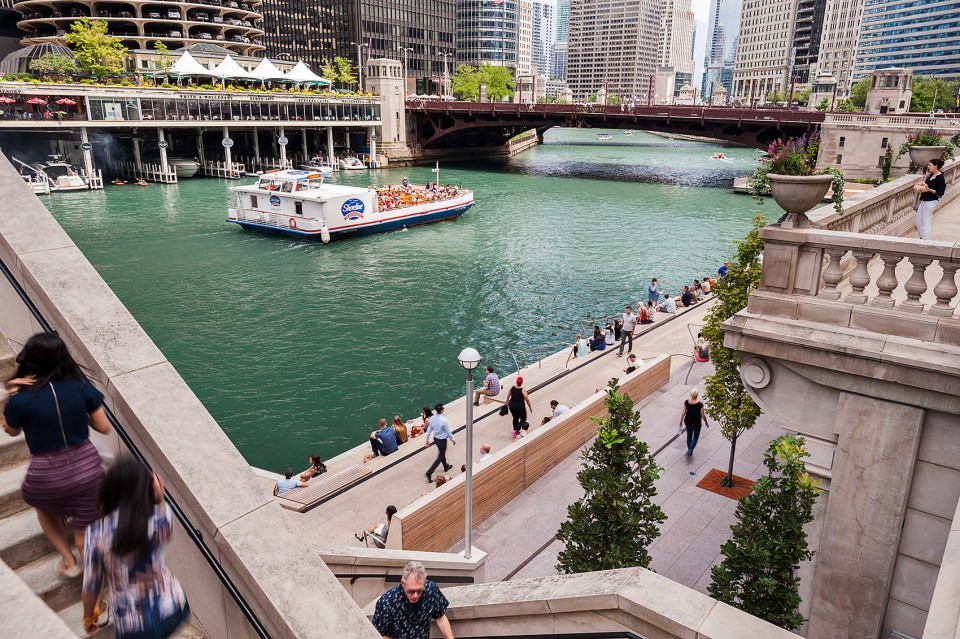
新的连接使得滨河生活更加丰富多彩,每个街区都呈现出不同形态,代表以河流为基础的一种功能。这些空间包括:
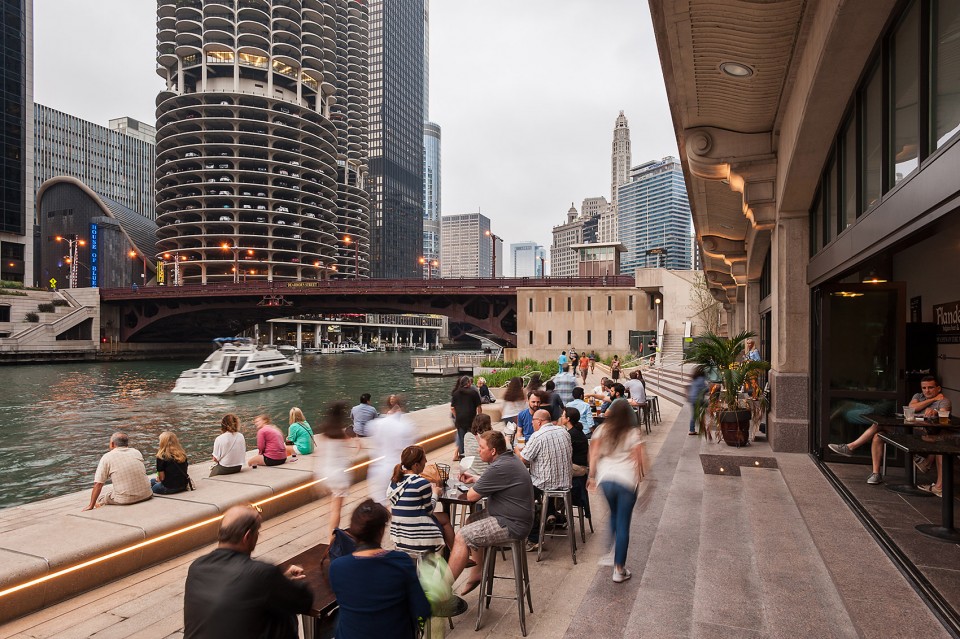
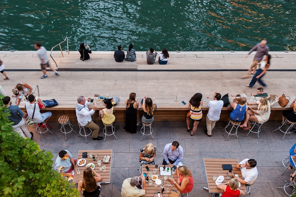
码头广场:餐厅与露天座椅使人们可以观赏河流上动态场景,包括驳船航行、消防部门巡逻、水上的士和观光船。
With new connections that enrich and diversify life along the river, each block takes on the form and program of a different river-based typology. These spaces include:
The Marina Plaza: Restaurants and outdoor seating provide views of vibrant life on the water, including passing barges, patrols, water taxis, and sightseeing boats.
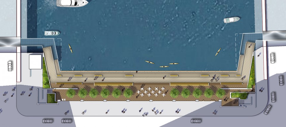
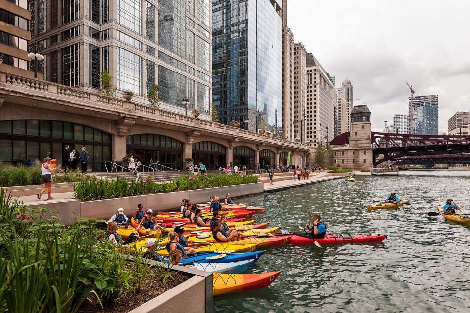
小河湾:租赁与存放皮划艇与独木舟, 通过休闲活动将人与水真切地联系起来。
The Cove: Kayak rentals and docking for human-powered crafts provide physical connections to the water through recreation.
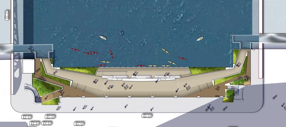
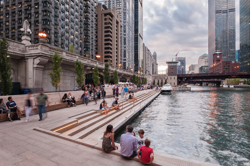
河滨剧院:连接上瓦克和河滨的雕塑般的阶梯为人们到达河滨提供了步行联系,周边的树木提供绿色与遮荫。
The River Theater: A sculptural staircase linking Upper Wacker and the Riverwalk offers pedestrian connectivity to the water’s edge and seating, while trees provide greenery and shade.
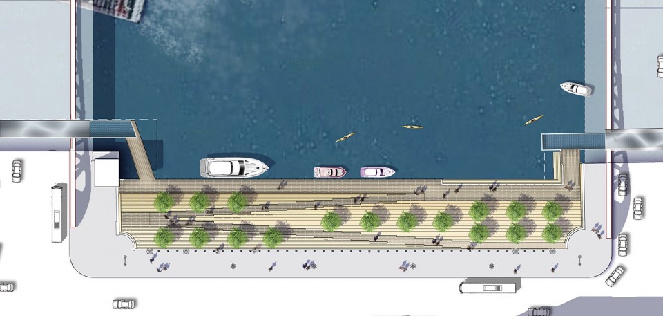
水广场:水景设施为孩子与家庭提供了一个在河边与水互动的机会。
The Water Plaza: A water feature offers an opportunity for children and families to engage with water at the river’s edge.
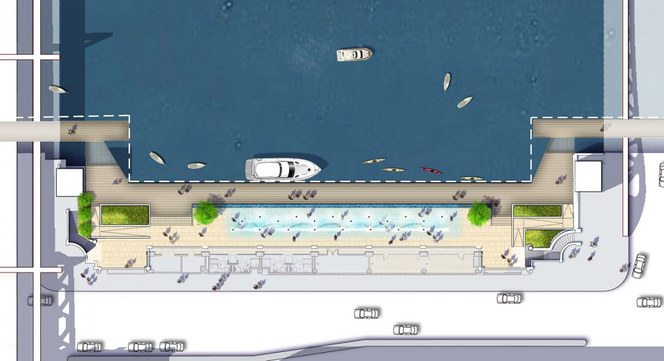
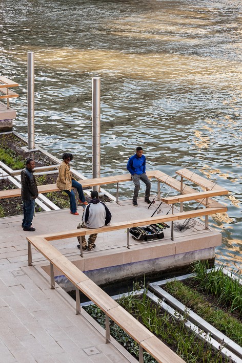
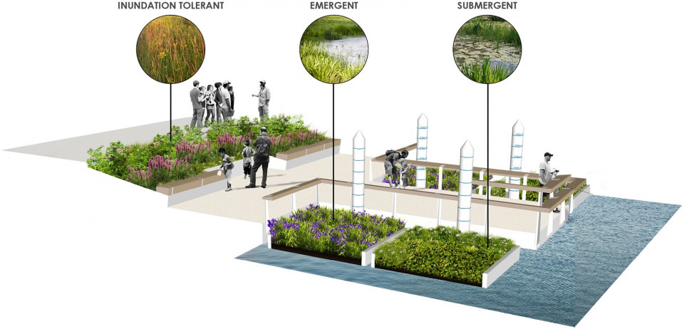
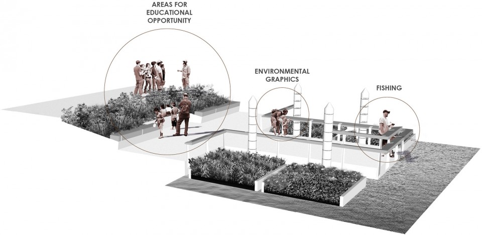
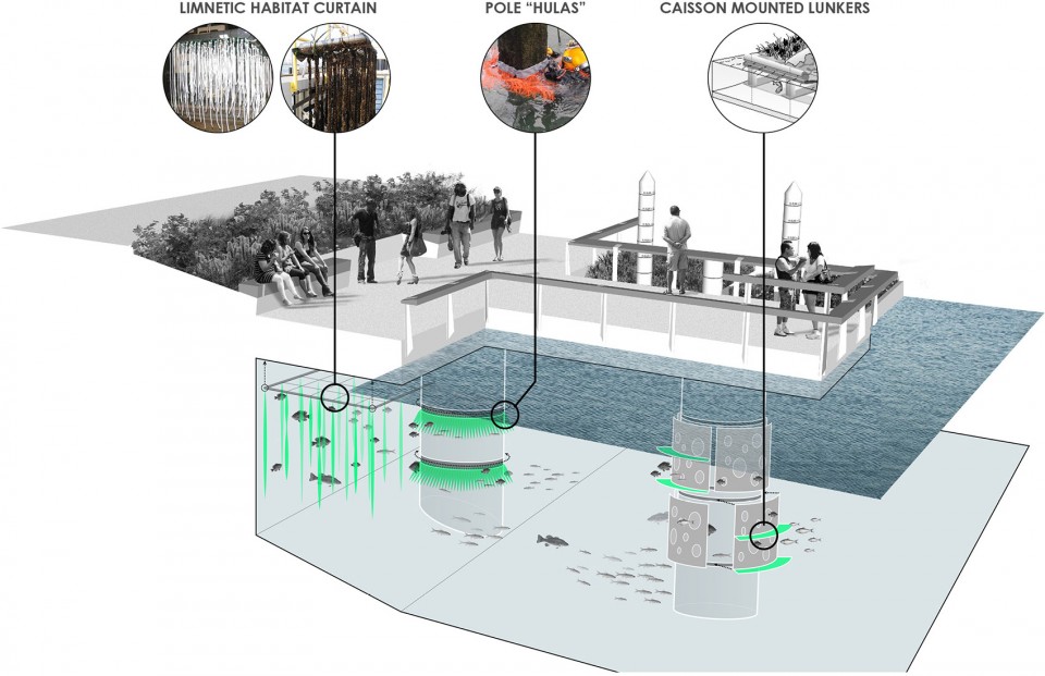
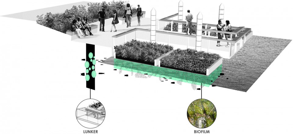
码头:一系列码头与浮岛湿地花园为人们了解河流生态提供了互动的学习环境,包括钓鱼与认识本土植物的机会。
The Jetty: A series of piers and floating wetland gardens offers an interactive learning environment about the ecology of the river, including opportunities for fishing and identifying native plants.
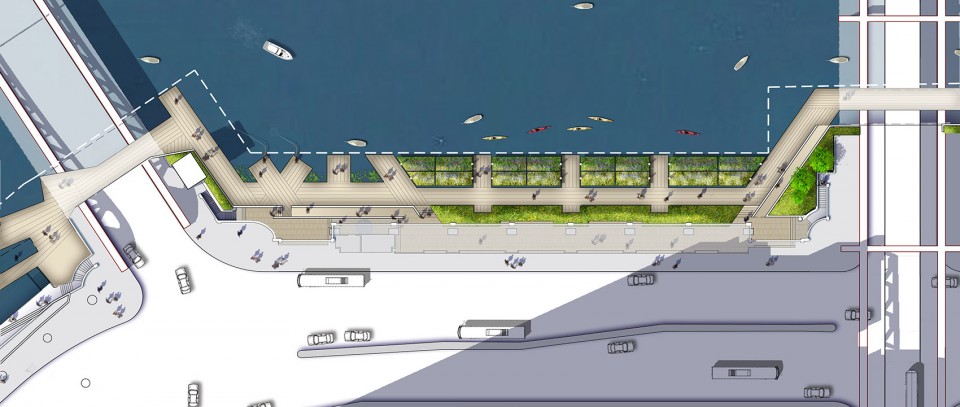
散步道:无障碍步道与全新的滨水边缘创造出通向湖街的连续体验,并在关键的交叉路口为未来开发建立背景。
The Boardwalk: An accessible walkway and new marine edge creates continuous access to Lake Street and sets the scene for future development in this critical space at the confluence.
全新步道系统
New connected path system
作为一个全新的联系步道系统,概念性规划框架为公园游客提供不间断步行体验。每个类型空间不同的功能与形态使它们可以提供滨河的多样体验,从餐饮、大规模公众活动,到全新划艇项目设施。同时,设计材料与细节沿整个项目长度提供视觉上的统一。例如,铺面体现背景现状的对比:精致的切石沿典雅的学院风格瓦克高架道路与桥屋建筑铺展开,而低层竖向与钢筋出露的桥梁下方由坚实的预制板环绕。
As a new connected path system, the Chicago Riverwalk design provides both continuity and variety for a park visitor. The distinct programs and forms of each typological space allow for diverse experiences on the river ranging from dining opportunities to expansive public event programming to new amenities for human-powered craft. At the same time, design materials, details, and repeated forms provide visual cohesion along the entire length of the project. Paving, for instance, mirrors the contrasts of the existing context: A refined cut stone follows the elegant Beaux-Arts Wacker viaduct and bridgehouse architecture, while a more rugged precast plank flanks the lower elevations and underside of the exposed steel bridges.
The first three blocks, from State Street to LaSalle Street, were completed and opened to the public in May, 2015. The construction of the next three blocks began in summer 2015 and will be completed in 2016.
▼餐饮,dining opportunities
▼全新划艇项目,new amenities for human-powered craft
▼垂钓,fishing
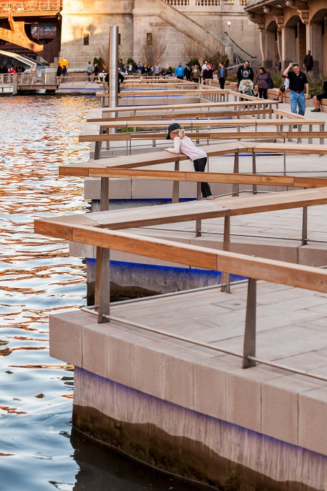
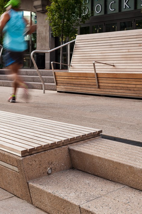
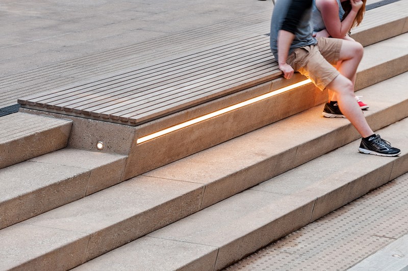
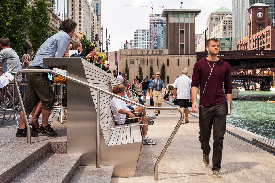
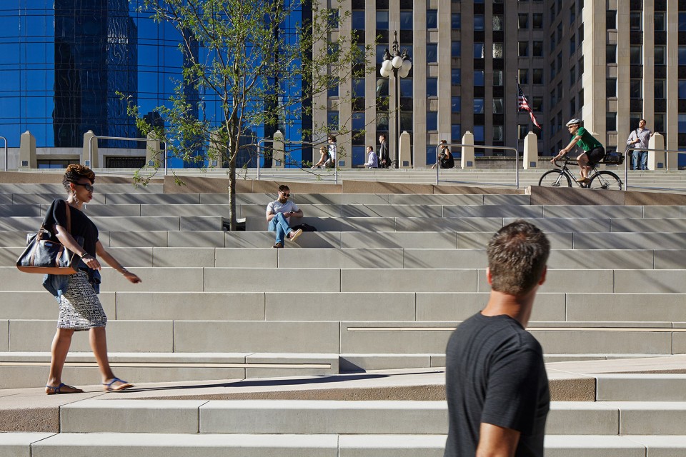
统一的设计材料与细节
Design materials, details, and repeated forms provide visual cohesion
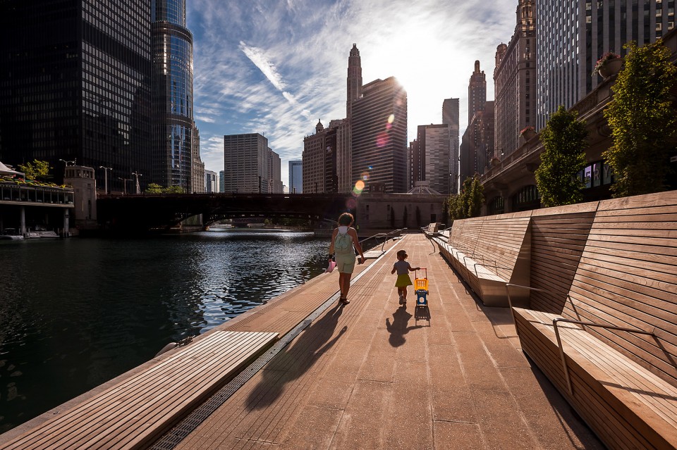
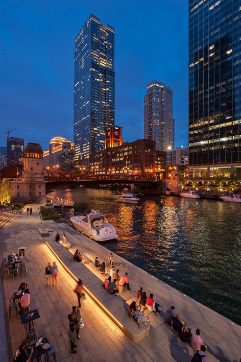
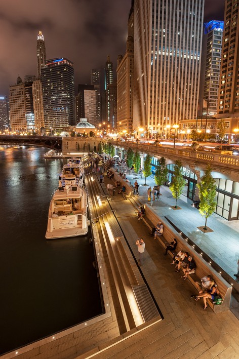
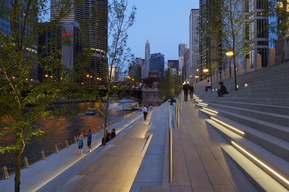
活力十足的滨河夜景
Evening view
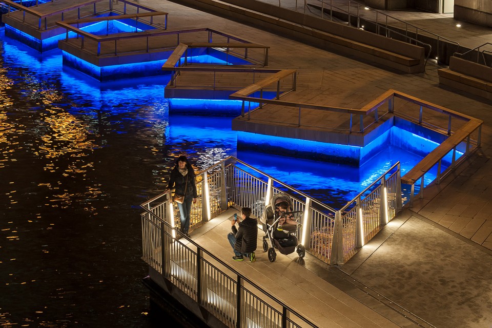
结合休闲功能的生态恢复策略
Ecological restoration
Project name: Chicago Riverwalk Expansion
Project location: Chicago, IL
Client name: Chicago Department of Transportation
Completion date: in progress
Size: Phase Two, 1.5 acres/three blocks (opened May 2015)/Phase Three, 2.0 acres/three blocks (opening 2016)
Services: Planning/Urban Design/ Architecture/Landscape Architecture/Civil Engineering/ Graphic Design
MORE: Sasaki ,更多关于他们: Sasaki on gooood
我比较关注得是 2020年10月为什么搜索滨水标签打头得还是2016年得项目呢~~谷德大大给点力啊
这样的生活状态好舒服
这个很有想法
感谢分享 文字和图片都特别的多 多个角度阐述了功能和形式,学习ing
赶紧照搬过来
那个上面餐厅吃饭用的桌子和下面座椅的后背结合起来的,下面的人不会感到别扭吗?
那个高度处理得可以,应该问题不大
这个两米水位差的具体解决方法是??车行道下是商铺?不会被淹?
这是个能学一辈子的项目
惊艳。
gooood
芝加哥不是被变形金刚炸了么,这么快就修好啦?
SWA的项目,就像一个沉稳的中年大叔(原谅大叔控),因为足够成熟与从容,所以不会刻意去标新立异,也不过分追逐华丽的外在,但举手投足却都是满满的精致与细节。
原谅我也哇哇 的笑出来
大叔控没毛病,但这是Sasaki的项目,和SWA一点儿关系都没有。
原谅我 哇的一声笑
666
芝加哥滨河步道的设计在原有城市设计的基础上进行改造,才可以建立滨河与道路下层商业之间的互动,所以可以看出设计是一个逐步完善的过程。对于大家所说的护栏,其实主要跟空间使用的方式有关系,例如剧院和垂钓区就设置了护栏,而与餐饮结合的休闲区、码头、皮划艇区域则通过亲水台阶和夜间灯光进行提示,当然在视线不佳或者空间转换的区域也是增加了护栏。
的确 漂亮。。。不过如果在中国估计沿河都是栏杆。。。
那个栏杆做的好带感
我觉得国内和国外滨河的区别就是:几乎国内的滨河区域为了安全考虑都有防护栏,但防护栏又不一定做得好,所以反而破坏了滨河景观的美感,私以为有时候设计师们应该大胆点,人不是傻子,没有防护栏警惕性会更高,反而出事故的几率要小的多。
就国内的情况来说,要是不做护栏,验收可能过不了是其一,群众也有可能不接受是其二哇
说的极是~
设计师是愿意大胆,但是方案是通不过相关部门对于安全要求的
我在外国生活,大部分都是没栏杆的
赞
大神中的大神,膜拜
膜拜
超级喜欢!
空间层次和步行体验简直丰富到爆炸
人工下見自然
国内缺乏这种亲水的滨河设计
能达到III类水的城市河道中国屈指可数
三类水人可直接饮用了 四类都很少见 环保任重道远
高大上
分析的特别全面,不过没有水广场和码头的鸟瞰图啊
和城市的气质相当合拍!
好美 环境好 干净
gooood