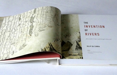
“从地图上看,河流往往只表现为穿插在景观中的蓝色线条。建筑师和城市规划师Dilip da Cunha为归纳这些水体提出了一种更加神秘的构想:将它们看作是旅行的“雨景”。陆地与水不再以传统的方式被区分,而是成为一种能够被广泛感知的湿润。Da Cunha追溯了恒河从亚历山大时代到今天的演变历史,邀请读者们从“填满河流的雨水”这一独特的角度来重新认知水系。借助丰富的图解,作者为我们提供了关于水文学研究的全新视角,这对于理解和应对降水不断增多的气候变化而言很可能有着至关重要的意义。”
– 2020年评审委员会“On maps, rivers often appear simply as blue strokes through a landscape: a source and a course. But Dilip da Cunha imagines a far more mystical approach to these bodies of water: that they are traveling “rainscapes,” eschewing traditional distinctions of land versus water for a more widespread sense of wetness. Da Cunha traces the Ganges’ history from the time of Alexander to the present, inviting readers to reassess waterways in terms of the rainwater that fills them. This thinking, accompanied by plentiful illustrations, offers a fresh outlook on hydrology that may prove crucial in understanding and addressing a changing climate with more rain in the forecast.”
– 2020 Awards Jury
来自 ASLA 对gooood的分享。
The Invention of Rivers: Alexander’s Eye and Ganga’s Descent | Dilip da Cunha (University of Pennsylvania)
项目陈述
PROJECT STATEMENT
《河流的发明》将人们的注意力引向一个事实:我们所认识到的河流,往往是由水文循环中出现在特定时间点的独特路线所形成的设计产物。这样的路线被绘制在地图中,被映刻在我们的想象中,并通过一系列法令和建造行为被强行地实行,逐渐成为一种理所当然的存在。然而在今天,随着不理智的发展和气候变化问题,洪水发生的频率越来越高,人们随即提出修建防洪堤、自然防御系统、水泵、休耕和撤退等各种各样的方案措施,使河流的界线成为了被关注的焦点。这些措施提出了“在何处画线”的问题,同时也提出了随之产生的“分界问题”:是分界存在于自然当中,亦或是这种分界规训了自然?
本书在以宏观角度审视河流的同时,以更加细致的眼光观察了恒河,并追溯了几千年来它被描述、绘制、探索和创造的方式。同时,该书也记录了雨水对成为河流的“抵抗”,这种抵抗所指示的是一种以水文循环中的短暂瞬间为基础的人为设计方式。
The Invention of Rivers draws attention to the river as a product of design facilitated by a uniquely endowed line in a chosen moment of time in the hydrologic cycle. This line, imaged on maps, etched in the imagination, and enforced on the ground with regulations and constructions, has become a naturalized presence. Today, however, with the increasing frequency of flood associated with climate change alongside unwise development, the line of the river has come into sharp focus with proposals for levees, natural defenses, pumps, and retreat. These responses raise questions on where the line is drawn, but also on the separation that it facilitates. Is this separation found in nature or does nature follow from its assertion?
While the book interrogates the river in general, it takes a closer look at the Ganges, tracing the ways in which it has been pictured, mapped, explored, and created over millennia. But it also documents rain’s resistance to being made into a river, a resistance that points to design grounded in another moment of the hydrologic cycle.
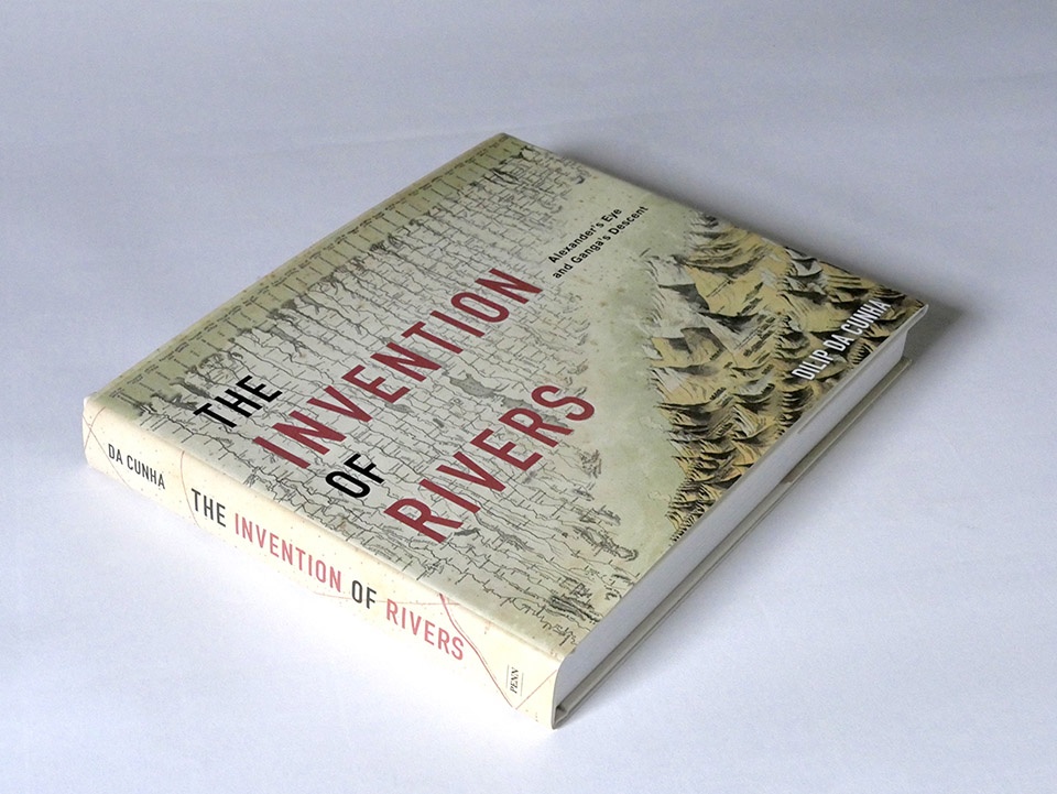
▲《河流的发明——亚历山大的目光与恒河降临》,封面和书脊,宾夕法尼亚大学出版社,2019。Invention of Rivers. Book cover and spine – Invention of Rivers: Alexander’s Eye and Ganga’s Descent (University of Pennsylvania Press), 2019) © Dilip da Cunha
项目说明
PROJECT NARRATIVE
《河流的发明》引起了人们对“将土地与水分开”这一行为的关注——这是人们在理解和设计人居环境时最基本且最持久的行为之一。用于表示分界的线条被绘制在地图中,被映刻在我们的想象中,并通过一系列法令和建造行为被强制地实行,在经受几个世纪的风雨的洗礼后,逐渐成为一种理所当然的存在;海岸线、河岸与水边也同样如此。它们往往受到艺术表达、科学探究、基础设施工程和景观设计的影响,却很少有人注意到真正导致这些现象的“分离”行为。然而在今天,随着洪水频率的增加,以及(可能)由气候变化导致的海平面上升,使得分隔陆地与水的“界线”成为了一个尖锐的问题。人们提出修建围墙、防洪堤、自然防御系统、水泵、休耕和撤退等一系列措施,提出了“在何处画线”的问题,同时也提出了随之产生的“分界问题”:是分界存在于自然当中,亦或是这种分界规训了自然?
本书传达的观点是,将土地与水分离开是一种设计行为,它是由水文循环中出现在特定时间点的独特路线所促成的。尽管我们可以从各种各样的书籍中了解到这条路线,但这本书所关注的是另外一种“布线方式”,它使我们能够看见并体验河流,认识这个被全人类视为文明脊柱、生态奇迹和生命之线的存在,以及最重要的,它作为自然事物的存在。而在本书中,河流被视为一种人类意志的产物而非自然的产物,从而为河流之外的世界留出了探讨的空间。尤其是,它为雨水留出了空间,因为河流的存在从很大程度上令雨水变得不善和边缘化。然而,正是在一个充满雨的世界里,“河流的设计”才随着分界线的发明而展露雏形。
《河流的发明》以“识读河流”(river literacy)为开篇,随后是“河道”、“源头”与“洪泛”三个章节。每个章节都涵盖了河流的一个基础要素,以及用于定义河流的突出特征。要观察并理解这些基础要素,识读图上线条的能力必不可少——笔触的延伸,起始的点,以及它的擦除和修改。这种识读能力直接促成了河流作为一个设计项目的成功,并使其可以传播到世界各地,或者说创造了一个欢迎这种传播的世界。的确,将线条与实地联系起来、按照地图上的比例复制,以及在脑海中刻画其形象的能力,对于可视化、理解和设计居住环境而言是不可或缺的。它涉及到各种各样的学术领域,这些领域凭借其自身特有的方式共同让河流成为了一种有形事物,使其可以被描述、探索、绘制、奴役、设计和受到敬仰,在今天更被赋予了作为生命体的权利。
本书的最后一个章节是“河流殖民主义”。该章节展示了一条“以线绘成”的河流是如何不遗余力地为土地提供服务,如何帮助其供水、排水,以及如何在最近越来越多地为房地产和建筑行业提供河岸环境。该章节进一步地为当今仍在不断分裂世界的“文化冲突”提供了新的解释:河流是为征服者、发现者、探险家、传教士和殖民者服务的,它不仅使世界领土化,还使那些本可将自身的存在锚固于水循环另一时刻的人们沦为殖民。通过对河流作为殖民武器的身份的质疑,本书为承载居住与想象的另一处乐园——雨水——留出了讨论的空间。
本书在以宏观角度审视河流的同时,以更加细致的眼光观察了恒河(Ganges)。二者在数千年间一直以相辅相成的方式发生着演变。通常而言,河流是通过世界舞台上强有力的概念,例如“水文循环”、“福地”、“洪水”“洪水”“城市”和“文明”等,来建立并巩固某一处的独特水体;恒河更是通过我们如今熟悉的印度次大陆的三个被选中的地理区域(山区、平原和三角洲)而制定了自身的航向。尽管学者们通常会将“Ganges”与“Ganga”两个词语(均指恒河)交替使用,但本书认为“Ganges”和“Ganga”所指向的是不同的事实,它们分别代表着水文循环中独一无二的时刻,比如“Ganges”指的是河流,而“Ganga”则指代雨水。后者作为无处不在的“女神”化身而备受崇敬,前者则将我们引向亚历山大大帝的历史。这位学识广博的君主在公元前4世纪跨越了兴都库什山脉,在引入军队的同时,也带来了用划分水陆的方法来阐述地方环境的地理学科。这样的表述方式使地方可以在地图中得以表现;可它同时也使这些地方成为领土、使这些地方的人民成为被殖民者。虽然亚历山大大帝未曾到达我们如今所知道的恒河,却成功引入了地理学的目光。从那时起,人们便一直试图将雨水限制在某一点源头或渠道之中,其后果是巨大的财富和发展与洪水灾害并存。恒河(Ganga)拒绝屈从于亚历山大的目光和他想象中的路线。她每年都会掀起毁灭性的洪水,任由自己被污染,哪怕人们不再对她抱以信任。她所拥有的“地方”并不是一个可划分为水和陆地的地理学表面,而是一种遍布云层与水底的、无处不在的湿润。她与“Ganges”的不同之处在于,Ganga不会从陆地中流走,她在不同的时间容纳着所有的一切——土地、空气、水、植物和动物。印度人民会在每年雨季到来之际庆祝她的到来,也就是我们所知道的恒河降临(Ganga’s Descent)的故事。
总结来说,《河流的发明》一书探索了艺术、科学与基础建造这些使河流的概念变得物质化和常态化的领域,以及河流反过来对于“被殖民”的雨水领地的持续影响。
这是一本受众广泛的书籍。它整合了历史、艺术、文化研究、水文学和地理学,讲述了“河流”的概念是如何被建立起来,以及如何在人居环境的定义与日常实践中担任特殊的角色。本书以简单易懂的语言写成,并配以丰富的历史地图、照片与图解。终究,不论是从基础建造、自然、科学、景观、环境,还是从水流的隐喻等任何意义上说,河流都与我们每一个人有着密不可分的关联。
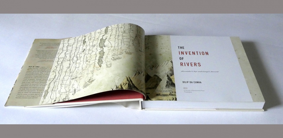
▲《河流的发明》扉页。 本书的封面和扉页描绘了G. W. Colton在1856年的《世界地图集》中对河流的比较研究。类似的研究在1800年代十分盛行,它们强调了线条在表达河流方面所发挥的作用。Invention of Rivers opening spread. The title page and book cover picture a comparative study of rivers by G. W. Colton in Atlas of the World, 1856. Such studies were popular in the 1800s. They highlight the role played by the line in articulating rivers. © Dilip da Cunha
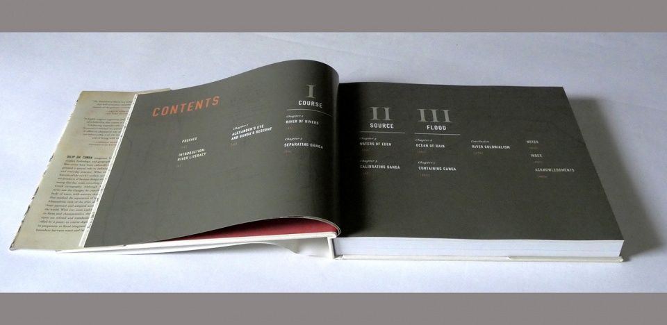
▲《河流的发明》内容目录。在“识读河流”的开篇介绍之后紧跟着“河道”、“源头”与“洪泛”三个章节。每个章节都讲述了艺术、科学和基础建造在使河流的本质要素变得具体化和常态化方面所发挥的作用。Invention of Rivers Table of contents. Following an introduction on River Literacy, the book is in three sections – Course, Source, and Flood each narrating the art, science and infrastructure that has gone into materializing, and naturalizing a particular essential of the river. © Dilip da Cunha
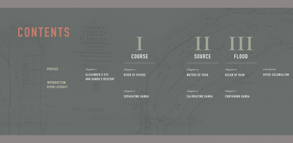
▲《河流的发明》内容目录。本书在以宏观角度审视河流的同时,以更加细致的眼光观察了恒河(Ganges)。二者在数千年间一直以相辅相成的方式发生着演变。Invention of Rivers Table of Contents. While the book interrogates the river in general, it takes a closer look at the Ganges in particular. The two having evolved in mutually supportive ways over millennia. © University of Pennsylvania Press
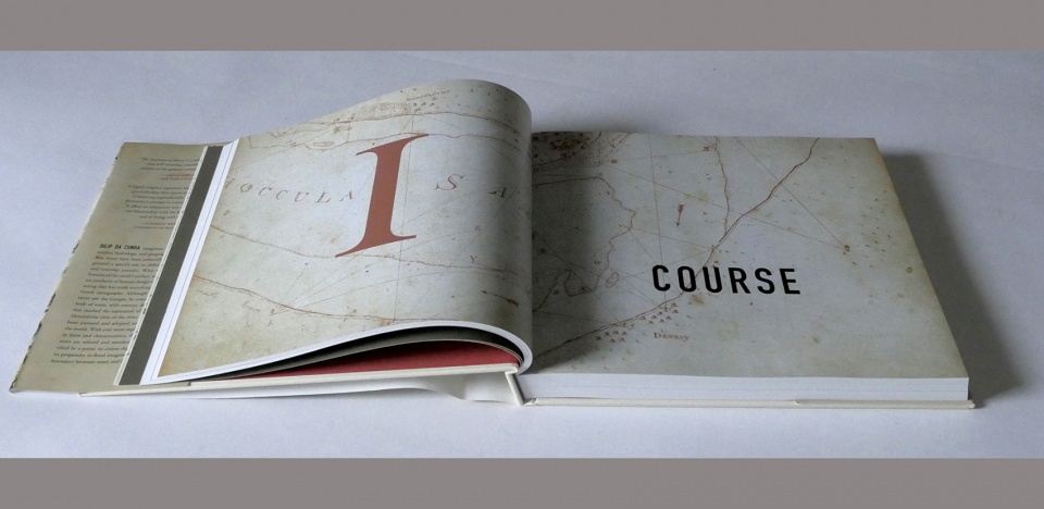
▲《河流的发明》“河道” 章节。该章节追溯了水流概念的形成、与相邻土地的分离以及与时间的对应关系。Invention of Rivers Course section. The section on Course tracks the idea of a flow of water, its separation from adjoining land and its calibration with time. © Dilip da Cunha
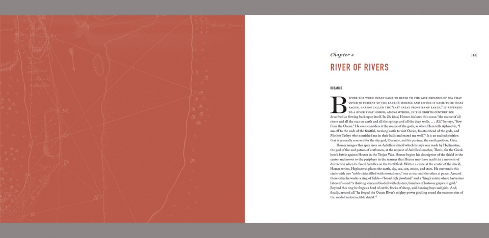
▲《河流的发明》第44-45页。“河道”章节开始于海洋之神Oceanus的故事。在荷马的描述中,Oceanus是“地球上一切河流、海洋、温泉与深井的源头。”Invention of Rivers pg 44-45. Course begins with Oceanus, described by Homer as “the source of all rivers and all the seas on earth and all springs and all deep wells.” © University of Pennsylvania Press
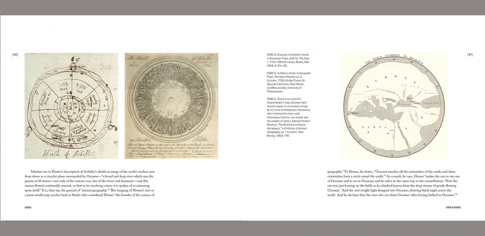
▲《河流的发明》第46-47页。“河道”章节通过历史图片和图解探寻了“世界地图”的起源,同时呈现了一些类似于描述水文循环的图例。Invention of Rivers pg 46-47. Illustrated with historic images and diagrams the section on Course probes the origin of the ‘world map’ as well as diagrams like the hydrological cycle. © University of Pennsylvania Press
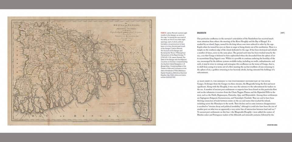
▲《河流的发明》第106-107页。“河道”章节细致研究了以孙德尔本斯和孟加拉三角洲的混乱地带为背景的恒河图纸。Invention of Rivers pg 106-107. The section on Course explores the drawing of the Ganges out of the dynamic muddiness of the Sundarbans alongside the articulation of the ‘Bengal Delta’. © University of Pennsylvania Press
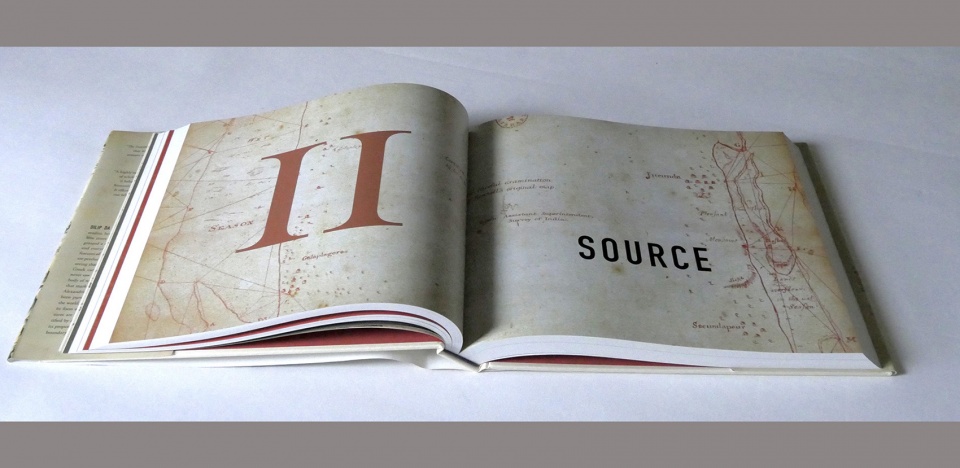
▲《河流的发明》“源头” 章节。河流之源往往被表达为一条画线的端点。本章节以寓言“天堂的四条河”为启发,追溯了这一“端点”的起源。Invention of Rivers source section. Source of a river is a point of at the start of a drawn line. This section traces the search for this point, driven by the idea of paradise being the source of four rivers. © Dilip da Cunha
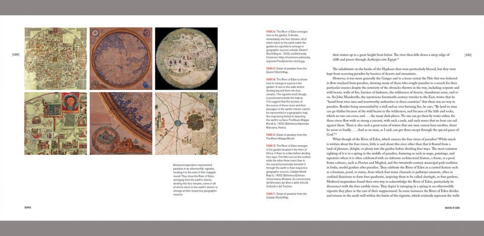
▲《河流的发明》第130-131页。中世纪的世界地图讲到了伊甸园之河的源头,并描述了水从海洋通过土地、云或者雨水回归山脉的过程。Invention of Rivers pg 130-131. Medieval mappa mundi speak of the source of rivers in the River of Eden, a reference to the return of waters from the sea to mountains either through the earth or via clouds and rain. © University of Pennsylvania Press
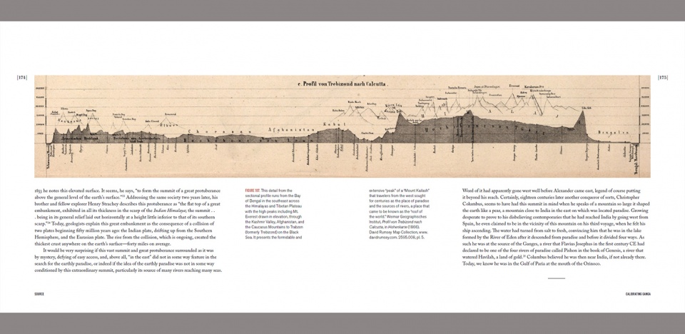
▲《河流的发明》第174-175页。神话中说恒河发源于云端,河水从群山之颠降临(即冈仁波齐峰)。而在欧洲人的眼中,它只是一条线的起点。Invention of Rivers pg 174-175. Myths point to the source of the Ganges in clouds that descended on a mountain of mountains, Mount Kailash; but European surveyors determined it to be a point at the start of a line. © University of Pennsylvania Press
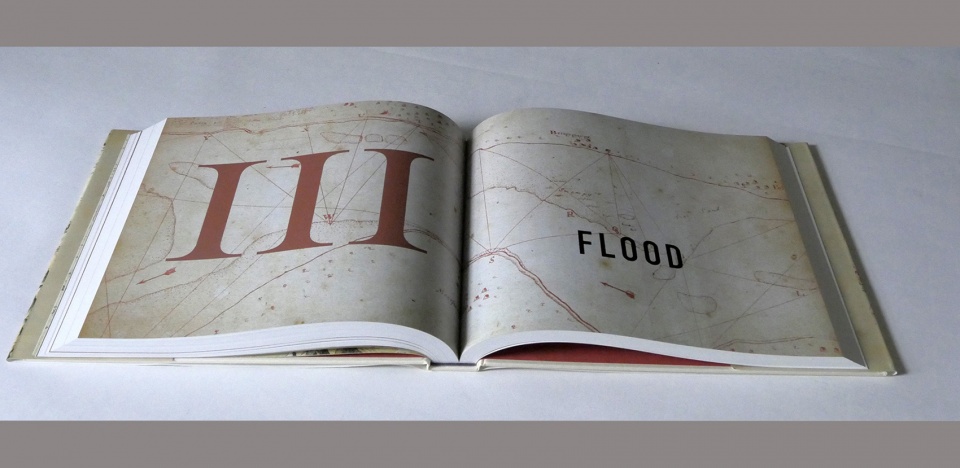
▲《河流的发明》“洪泛” 章节。洪泛仅仅意味着水越过了人类出于将水控制在地面某处的想法而划定的界限。该章节追溯了人类利用河流、尤其是恒河来支配水的想法的来源。Invention of Rivers flood section. Flood is nothing but water crossing a line drawn by humans in an effort to contain it to a place on the earth surface. This section traces the idea of containing water with rivers in general and the Ganges in particular. © Dilip da Cunha
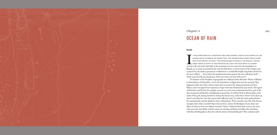
▲《河流的发明》第204-205页。洪水源于暴雨,人们将洪水视为一个由雨水驱动的事件,这从很大程度上加深了人们对征服雨水的执念,以及河流在其想象中的伟大形象。Invention of Rivers pg 204-205. Flood begins with the story of the deluge, a rain-driven event that has contributed in no small measure to the subjugation of rain and the elevation of the river in the imagination. © University of Pennsylvania Press
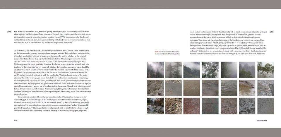
▲《河流的发明》第232-233页。恒河的洪泛指示出“当地人对无处不在的湿润的喜爱”与“将水控制在河流某处的意愿”之间的一种根深蒂固的矛盾关系。该章节揭示了河流与洪泛之间的联系。Invention of Rivers pg 232-233. The floods of the Ganges points to a deep-seated tension between a native’s appreciation of wetness everywhere versus a colonial imposition of waters somewhere in rivers. The section develop the compact of river and flood. © University of Pennsylvania Press
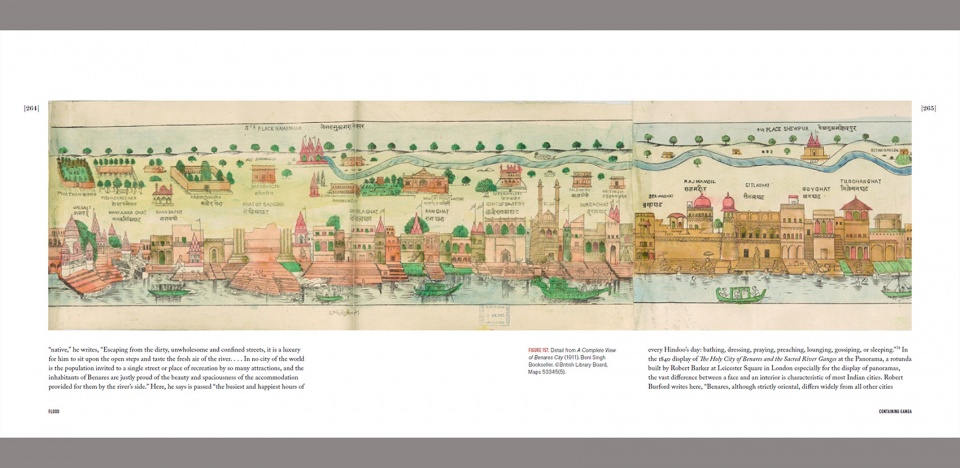
▲《河流的发明》第264-265页。贝拿勒斯被描述为印度典型的河流城市。本页展示了由河流全景图等可视化形象所宣扬的城市形象,同时也描绘了常态下用于应对洪水的基础排水设施。Invention of Rivers pg 264-265. Benares is described as the quintessential river city of India. It is an image promoted by visualizations like the river panorama, but also a drainage infrastructure that has become the norm in the face of flood. © University of Pennsylvania Press
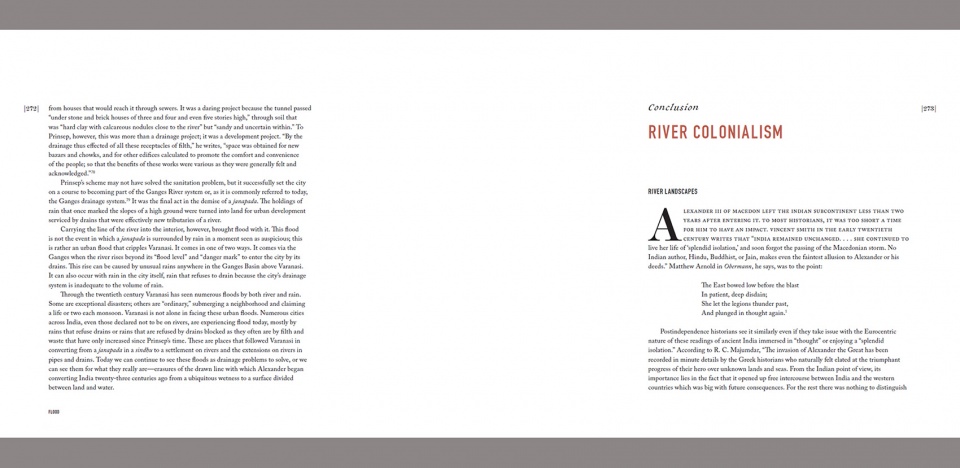
▲《河流的发明》第272-273页。本书的末章阐述了河流在“文化冲突”中的作用。它是锚固于水文循环的不同时间点上的人民之间的冲突,进而也是不同天性之间的冲突。Invention of Rivers pg 272-273. The book concludes with the role that rivers have played in the ‘clash of cultures’ as a clash between people anchored in different moments of the water cycle and by extension, different natures. © University of Pennsylvania Press
PROJECT NARRATIVE
The Invention of Rivers draws attention to one of the most fundamental and enduring acts in the understanding and design of human habitation, namely, separating land and water. The line with which this separation is imaged on maps, etched in the imagination, and enforced on the ground with regulations and constructions has not only survived centuries of rains and storms to become a taken-for-granted presence; it has also been naturalized in the coastline, the riverbank, and the water’s edge. These are places subjected to artistic representations, scientific inquiry, infrastructural engineering, and landscape design with little attention to the act of separation that brought them into being. Today, however, with the increasing frequency of flood and, not unrelatedly, sea-level rise attributed to climate change, the line separating land and water has come into sharp focus with proposals for walls, levees, natural defenses, pumps, land retirement schemes, and recommendations for retreat. These responses raise questions on where the line is drawn, but they also raise questions on the separation that this line facilitates. Is this separation found in nature or does nature follow from its assertion?
The book then, makes the case that separating land from water is an act of design facilitated by a uniquely endowed line in a chosen moment of time in the hydrologic cycle. While this line can be seen at work in a number of places, the book focuses on a particular deployment of it, one that allows us to see and experience a river, an entity much appreciated across the world as a spine of civilization, an ecological wonder, a lifeline, but most of all a natural thing. By presenting the river as a product of human intention rather than nature, the book makes room for worlds without it. In particular, it makes room for rain, which the presence of the river has done much to malign and marginalize. It is, however, in a world of rain that the design of the river was initiated with the invention of the line of separation.
The Invention of Rivers opens with a chapter on ‘river literacy’ followed by three sections: Course, Source and Flood. Each section covers an essential of the river, a prominent feature in its definition. Critical to the sighting and understanding of these essentials is the literacy of the drawn line—its extension in a stroke, its beginning in a point, and its modification by erasure. This literacy has led the success of the river as a design project, spreading it across the world or rather creating the world that has welcomed its spread. Indeed, the capacity of the drawn line to be marked on the ground, reproduced to scale on a map, and inscribed as an image in the mind has made it indispensable to visualizing, understanding and designing habitation. It reaches into a wide array of academic fields that have all contributed in some way to making the river a corporeal thing that can be pictured, explored, mapped, enslaved, engineered, venerated and today granted rights as a living being.
The book concludes with a chapter on ‘river colonialism’. It shows how the river, created with a line, does not stop at putting water to work in the service of land by supplying it, draining it, and increasingly of late, providing it with a riverfront for real estate and development. The chapter goes further to offer another explanation for the ‘clash of cultures’ that continues to divide the world today. It suggests that the river has served conquerors, discoverers, explorers, missionaries, and settlers to not just territorialize the world, but also to colonize peoples who very likely anchored their existence in another moment of the hydrologic cycle. By calling the river into question as a weapon of colonization, the book makes room for rain as an alternative ground of habitation and imagination.
While The Invention of Rivers interrogates the river in general, it takes a closer look at the Ganges in particular. The two have evolved in mutually supportive ways. The river in general is navigated through powerful concepts on the world stage such as the hydrologic cycle, paradise, deluge, city and civilization that have built and reinforced a unique entity of water while the Ganges in particular is navigated through three select geographies of the Indian subcontinent familiar today as mountains, plains, and delta. Although used interchangeably with the word Ganga by scholars, the book makes the case that Ganga and Ganges refer to different realities, each articulated in a distinct moment of the hydrologic cycle such that Ganges is a river and Ganga is rain. While the latter is venerated for its ubiquity in the form of a goddess, the former is an introduction traceable to Alexander the Great. This scholar-monarch who came across the Hindu Kush Mountains in the 4th century BCE, was armed with not just soldiers, but also the discipline of geography that articulates place in terms of an earth surface divided between land and water. It is an articulation that makes place representable in maps; but it also makes it territorializable and its people colonizable. Even though Alexander did not reach what we know to be the Ganges today, he introduced the geographic eye that has ever since sought to contain rain to point sources and channeled courses with consequences that have produced great wealth and development, but also flood. Ganga refuses to conform to Alexander’s eye and the lines of his geographic image and imagination. She floods devastatingly each year, is terribly polluted, and her waters are increasingly contested. Her place is not a geographic surface divided between land and water, it is rather a ubiquitous wetness that reaches from clouds to aquifers. Unlike the Ganges, she does not drain off land, but rather holds in everything—earth, air, water, flora and fauna—for varying extents of time. The people in India celebrate her each year at the start of the monsoon as Ganga’s Descent.
In summary, The Invention of Rivers is an exploration of the art, science and infrastructure that has gone into materializing and naturalizing rivers on the earth surface and the role that the river has, in turn, played and continues to play in colonizing places of rain.
The book is written for a wide audience. It integrates history, art, cultural studies, hydrology, and geography to tell the story of how rivers have been constituted and granted a special role in defining human habitation and everyday practice. It is written in simple language and is richly illustrated with historic maps, photographs and diagrams. The river, after all, touches everyone whether through infrastructure, nature, science, landscape, environment, metaphors of flow, etc.
More: ASLA ; University of Pennsylvania









那么在哪里可以买到呢(掏钱
有幸听过两个作者的关于这个研究lecture 完全不知所云
可能是我水平不够 但是真的像是玩概念的
排版编辑大师
买不到吧
那么,在哪能买到呢?