“这是一个评估气候变化对文化景观影响,以及文化景观对气候变化的适应力的很好的范例”。
-2017年评审委员会“A very good model for assessing a broad range of properties and sites in regard to climate change and adaptability”.
– 2017 Awards Jury来自ASLA对gooood的分享。
Climate Change Impacts on Cultural Landscapes in the Pacific West Region, National Park System by Cultural Landscape Research Group, University of Oregon,更多请至:Cultural Landscape Research Group, University of Oregon on gooood
Appreciation towards ASLA for providing the following description:
项目陈述
PROJECT STATEMENT
该项目旨在评估气候变化对太平洋西部地区的国家公园文化景观的影响,并对未来研究目标提供了一些建议,以确保文化景观在气候变化的情况下,具有一定的适应能力。
The study of climate change impacts on cultural landscapes in the Pacific West Region (PWR), of the National Park System, assessed how these landscapes might be affected by key climate variables, and developed recommendations for future research toward the agency’s goal of ensuring cultural landscapes’ resilience in light of climate change variables.
这项研究包括一个矩阵表格和一份描述了六个案例的研究报告。矩阵表格旨在更新和组织数据,以评估太平洋西部地区文化景观;而案例研究报告则明确了目前文化景观的状况、提出了气候预测变量,并且包含了一些管理策略上的建议,旨在解决当前问题并引导未来研究方向。
Products of this research include a matrix designed to update and organize data needed to evaluate the exposure of inventoried cultural landscapes in the Pacific West Region; and a report describing six case studies, which identifies current conditions, projected climate variables, and recommended management strategies to address current condition needs and areas of future research.
该矩阵表格汇编了当地164个文化景观场所的所有特征和环境对其造成的影响,具体内容包括:目前暴露出的环境危害,以及对温度,降水和海平面变化方面的预测。
The matrix compiles all character-defining features and environmental impacts documented for 164 cultural landscapes across the region, including exposure to current environmental hazards and to projected changes in temperature, precipitation, and sea level.
每个案例研究均涵盖文化景观特征的概括表述,区域气候变化的预测,现有场地条件(现场调查),灾害风险分析(GIS)以及对下一步处理方式的建议。
Each case study includes summaries of cultural landscape characteristics, regional climate change projections, existing conditions (field survey), hazard exposure (GIS) analysis, and recommendations for next steps.
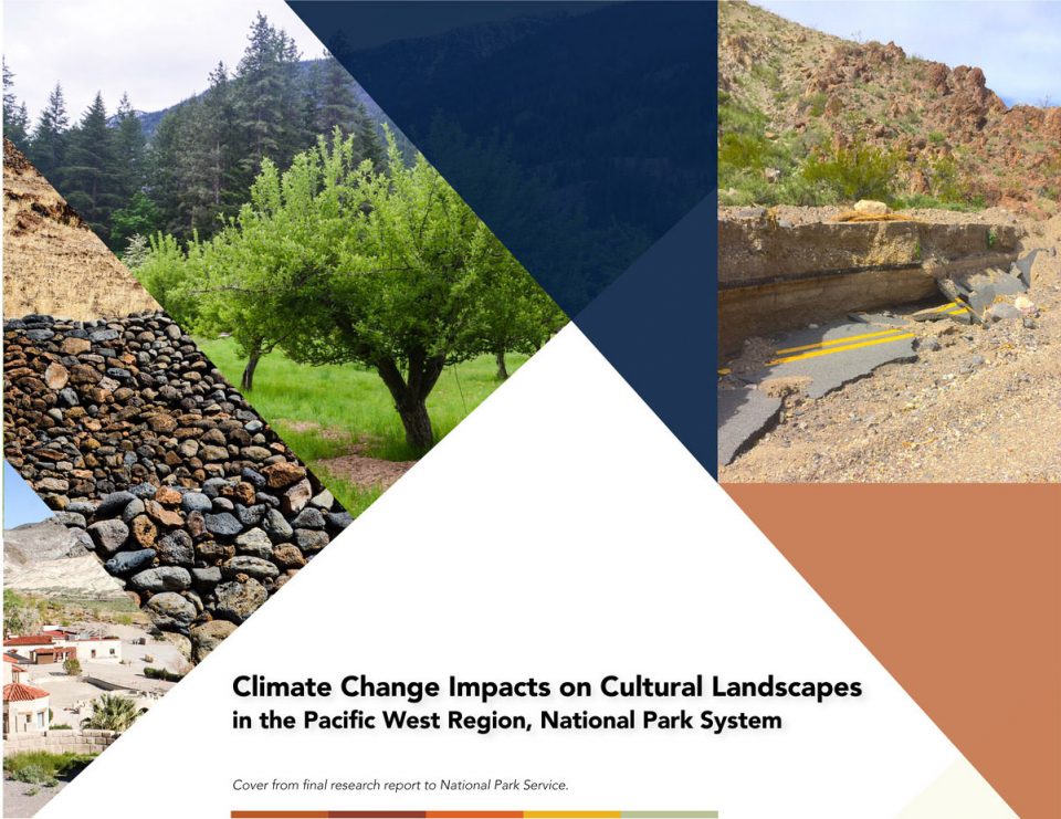
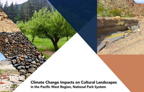
▲国家公园服务(机构)最终研究报告封面。
Cover from final research report to National Park Service.
项目说明
PROJECT NARRATIVE
该研究是由太平洋西部地区(PWR)与国家公园服务(部门)合作完成的,旨在研究气候变化对国家公园文化景观的影响,并对由气候变化和潜在事件对文化景观产生的影响做出回应。通过与气候学家和其他专业人员合作,研究团队利用当地气候预测数据评估了研究区域内的文化景观是如何受到特定气候变化因素影响的。并对未来的研究提出了一些建议,以确保在气候变化时期可以使文化景观具有一定程度的恢复力。
研究成果包括:1.组建数据矩阵表格,以完整的景观清单,来协助评估当地特有的气候问题对景观的影响。2.完成六个案例研究,明确了目前文化景观的状况、提出了气候预测变量,并且包含了一些管理策略上的建议,旨在解决当前问题并引导未来研究方向。该矩阵表格总结了该地区164个文化景观的所有特征和所受到的环境影响。这些由于受环境危害所暴露出的特征,以及关键气候变化方面的预测,将被用在一个评分模型里,用来比较当前环境危害和预测环境变化下的受损情况。对于每个研究案例,均总结出了其特有的文化景观的特征,相关的气候变量预测,当前条件和暴露出的危害。其中还包括了一些管理建议。
文化景观调查与气候适应策略
文化景观清单(CLI)是国家公园系统中包含的所有重要景观的认证数据库。 CLI负责记录文化景观的现有条件,也包括已知的外界影响。关于目前的气候变化预测数据,这个项目对每个文化景观的状况和所受到的影响进行了分析,通过文化景观清单中的管理框架确定和量化了预期气候变化对文化景观的影响。
通过与NPS合作,该团队完善了一份文化资源和气候变化的对应框架,分析了气候变化对美国西部和太平洋岛屿的文化景观的影响。其中的案例研究明确了当前的文化景观条件,并包括预计的气候变化将会如何加剧对文化景观的影响。
项目目标
– 收集并整理太平洋西部地区43个公园内的164个文化景观相关的气候变化预测方面的数据,其中包括气温,降水和海平面变化趋势。
– 明确与164个文化景观相关的预期气候变化情况。
– 对六个案例进行研究分析,评估选定的文化景观的现状和所受到的环境影响。明确具体步骤,以解决目前环境对景观造成的问题,并改善景观的恢复能力。
方法
该项目以一种新的文化景观形式,测试并完善了在应对气候变化方面的管理框架。气候变量脆弱性的基本公式是:
(暴露程度+明感性)/ 适应能力=易损性
气候预测
基于研究地点的可用数据,该小组主要对温度,降水和海平面上升进行了预测,并汇总了不同来源的区域气候预测数据。
危害
地理空间分析评估了与预测有关的危害。 由NOAA,USGS和USFS发布的风险数据的危害包括干旱,火灾,洪水和山体滑坡。
影响
该团队分析了从CLI数据库中提取的,针对每个特定文化景观的所记录的影响因素,包括:破坏、损失的植物物种、侵蚀、暴露在外的元素、害虫/疾病、修剪实践、泄漏、结构恶化、温度/极端热量、温度/平均温度、和植被/入侵植物。 NPS对所有影响文化景观的因素进行跟踪。对于案例研究,每项影响因素都会在现场进行验证和记录。
易损性分析矩阵
根据气候变化预测数据,新设计的脆弱性评估矩阵模拟了特定文化景观的暴露环境。其中包括“可能受到不利影响的地方和环境中的人员,生存方式,物种或生态系统,环境功能,服务和资源,基础设施或经济,社会或文化资产”。(IPCC 2014) 而这些因素补充阐述了:气候变化将对文化景观特征产生不利影响。该矩阵汇总并评估了广泛的数据,这些数据包括地面和地理空间分析,以及气候研究和一些模型。该步骤旨在帮助NPS决策制定者进行进一步的分析,现场评估并制定适当处理办法。矩阵表格中的评分系统包括四项主要标准:当前条件,当前风险,历史风险和预期风险。
– 条件:一个总体的景观规模评估条件包括:解释CLI中描述的状态。目前的暴露情况:在气候风险下,对特定空间内的文化景观特征的识别。这个指定值包括当前的地理空间(GIS)数据。
– 历史曝光:主要通过CLI分析,识别已知的当前影响和历史影响。投影曝光:计算气候预测数据的强度和可信度。数据集由当前的县级气候预测和公园规模级预测组成。
-强度:气候变化下,每个气候变量的的估计值。
– 可信度:气候变化预测中确定性/不确定性的范围。
案例研究
对六个研究案例的三个选择标准:位于太平洋西部的不同的生态区; 展示(例如,古迹,当地语言,设计,民族志)不同类型的文化景观; 公园的工作人员可以参加并协助实地调查和研究。
案例研究地点:Lyons牧场历史街区,红木国家公园(CA); Scotty城堡历史区,死亡谷国家公园(加州); Eugene O’Neill国家历史遗址(CA); Buckner家园,北瀑布国家公园(WA); Pu’ukohola Heiau国家历史遗址(HI); Nez Perce国家历史公园(ID)的巨人之心。
团队成员分析了每个场地的文化景观清单,并从各种已发布和可用的数据源中检索了气候预测数据。这个过程旨在确定潜在的气候压力,以及文化景观的特征和所受到的影响。经NPS地区和公园工作人员协商,实现了数据共享,并为当前的文献和主要资料收集了新的建议,包括邀请工作人员集思广益。该过程包括定量和定性数据。
案例研究内容,包括对各区域和公园工作人员进行现场调查并记录,以更好地了解目前影响文化景观特征的因素。针对气候变化对文化景观的影响,这一过程将有助于明确未来研究的发展方向。 实地考察包括对景观系统,地貌,植被,建筑物,建筑物和其它景观特征的检查,以评估和记录现有条件和受到的外部影响,实地考察还有助于发现公园优先处理事项,加强工作人员竞争力,意识到历史资源和预测数据间的差距。
结果
该项目的研究结果包括一个矩阵表格,在这个矩阵表格中,每个文化景观特征都会被赋予一个“当前曝光”得分,由GIS空间数据可知;“历史曝光”得分,由CLI可知;“预测曝光”得分则来自于对温度,海平面和降水的预测数据。这些类别用于明确哪些特征(以及相关的特征和数量)与环境相关趋势和事件有较高的关联。
未来研究
这项研究主要解决的是一个与“曝光度”相关方程式。未来的研究正在进行,以解决每个景观特征的敏感性和适应能力。下一阶段包括对选定的文化景观的脆弱性评估,以及为确定的非常脆弱的选定文化景观制定适应性战略。
脆弱性研究的下一阶段是令人兴奋的。景观设计师看到了这个框架在NPS之外的明显可转换性。 由于文化景观在行业中发挥着重要作用,因此这项研究将告诉景观设计师如何采取措施,明确受气候变化影响的地方,并制定潜在的缓解策略施以保护。
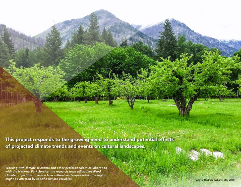
▲通过与国家公园服务(机构)、气候学家及其他专业人员合作,研究团队利用当地气候预测数据评估了研究区域内的文化景观是如何受到特定气候变化因素影响的。
Working with climate scientists and other professionals in collaboration with the National Park Service, the research team utilized localized climate projections to assess how cultural landscapes within the regional might be affected by specific climate variables.
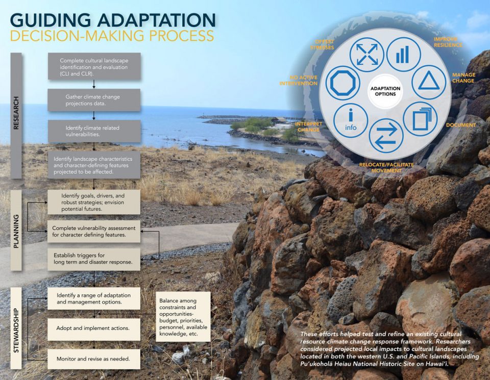
▲指导适应性决策制定过程
这些努力帮助了研究人员测试并完善出了一份关于文化资源和气候变化的对应信息框架。其中的重点研究领域是关于气候变化对美国西部和太平洋岛屿的文化景观的影响,包括夏威夷Pu’ukoholãHeiau国家历史遗址。
GUIDING ADAPTATION DECISION-MAKING PROCESS
These efforts helped test and refine an existing cultural resource climate change response framework. Researchers considered projected local impacts to cultural landscapes located in both the western U.S. and Pacific Islands, including Pu’ukoholã Heiau National Historic Stie on Hawai’i.
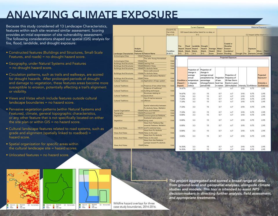
▲分析气候影响
该项目从地面和地理空间分析,以及气候研究和模型等方面收集了广泛的数据。 这项工作旨在帮助NPS决策制定者进行下一步分析、现场评估和并制定适当的处理措施。
ANALYZING CLIMATE EXPOSURE
The project aggregated and scored a broad range of data, from ground-level and geospatial analyses, alongside climate studies an dmodels. This tool is intended to assist NPS decision-makers in directing further analysis, field assessment, and appropriate treatments.
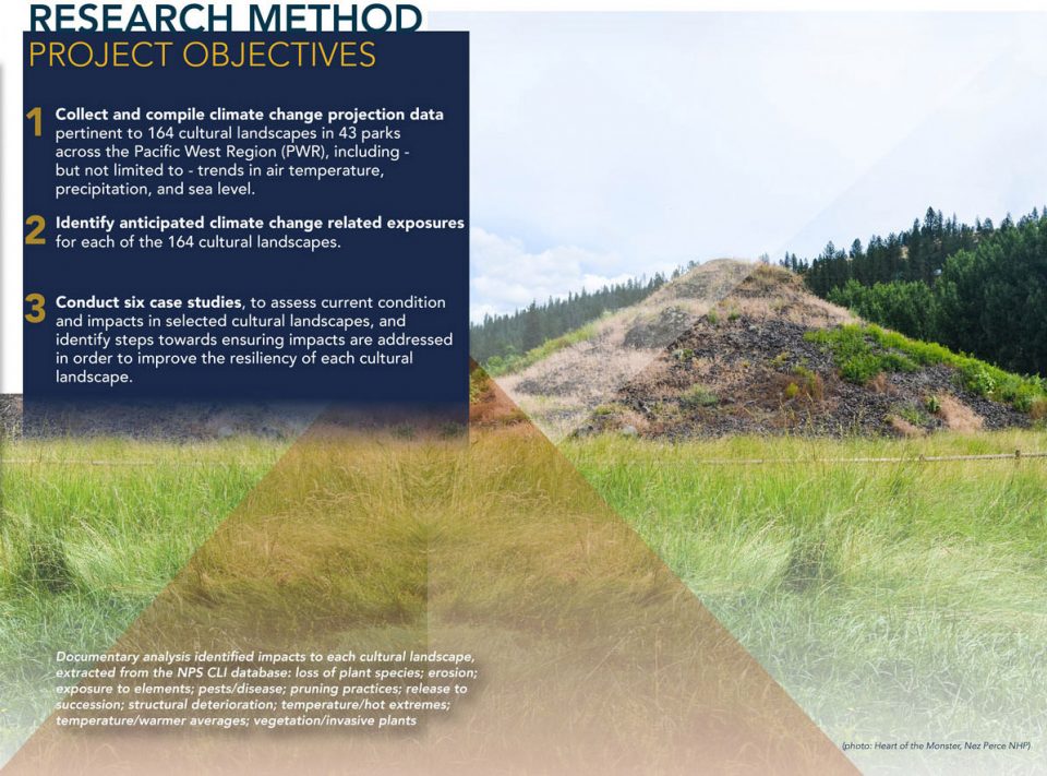
▲研究方法和项目目标
文献分析明确了每种文化景观的受到的气候影响,从NPS CLI数据库中提炼的内容包括:消失的植物物种; 侵蚀程度; 暴露在外的元素; 疾病; 修剪实践; 释放过程,结构性恶化; 温度/极限高温; 温度/平均温度; 植被/入侵植物。
RESEARCH METHOD PROJECT OBJECTIVES
Documentary analysis identified impacts to each cultural landscape, extracted from the NPS CLI database: loss of plant species; erosion; exposure to elements; pesta/disease; pruning practices; release to succession, structural deterioration; temperature/hot extremes; temperature/warmer averages; vegetation/invasive plants.
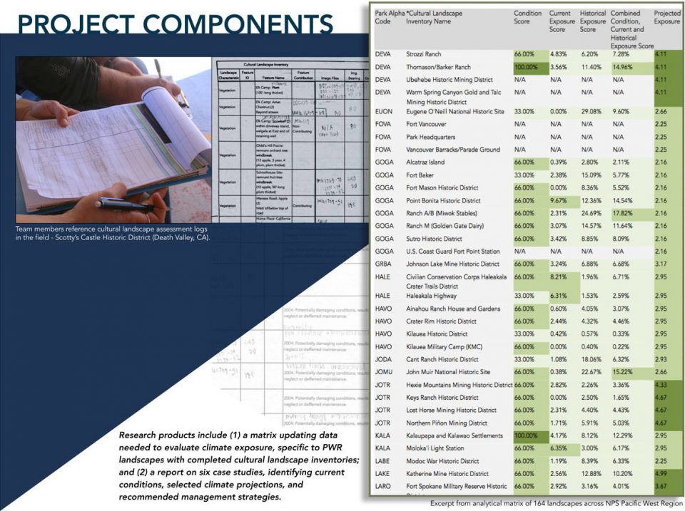
▲反映气候变化程度,NPS,太平洋西部
该小组通过已公布的资料(NPS,IPCC,国家气候评估和USGS NCCV),分别就温度,降水,海平面和风暴对文化景观产生的影响进行了预测。这些预测指导了未来的危害分析,并帮助汇总了文化景观方面将会受到的具体影响。每项研究均根据不同研究地点的需要选择不同的数据变量。
PROJECTING CLIMATE VARIABILITY NPS PACIFIC WEST REGION
The Team adopted projections for temperature, precipitation, sea level, and storms; and compiled regional climate projections from published sources (NPS, IPCC, National Climate Assessment, and USGS NCCV). These projections guided analysis of hazards and documented impacts on cultural landscapes. Variables were selected based on data avilability for the study sites.
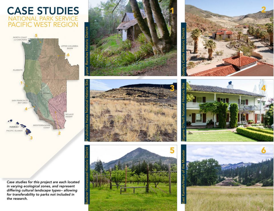
▲案例研究,国家公园服务(机构)太平洋西部地区
这个项目的案例研究分布在不同的生态区,以表现不同的文化景观类型-公园的变化并没有包括在研究中。
CASE STUDIES NATIONAL PARK SERVICE PACIFIC WEST REGION
Case studies for this project are each located in varying ecological zones, and represent differing cultural landscape types–allowing for transferability to parks not included in the research.
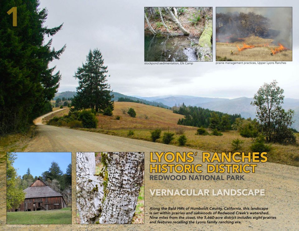
▲里昂的牧场历史区红木国家公园
沿着加尔福尼亚州洪堡的秃山,该景观位于红木溪分水岭的草原和橡树林中。 距离海岸九英里,5,660英亩的地区包括八个草原,并显示出Lyons家庭放牧时代的特点。
LYONS’ RANCHES HISTORIC DISTRICT REDWOOD NATIONAL PARK
Along the Bald Hills of Humboldt County, Calfornia, this landscape is set within prairies and oakwoods of Redwood Creek’s watershed. Nine miles from the coast, the 5,660-acre district includes eight prairies and features recalling the Lyons family ranching era.
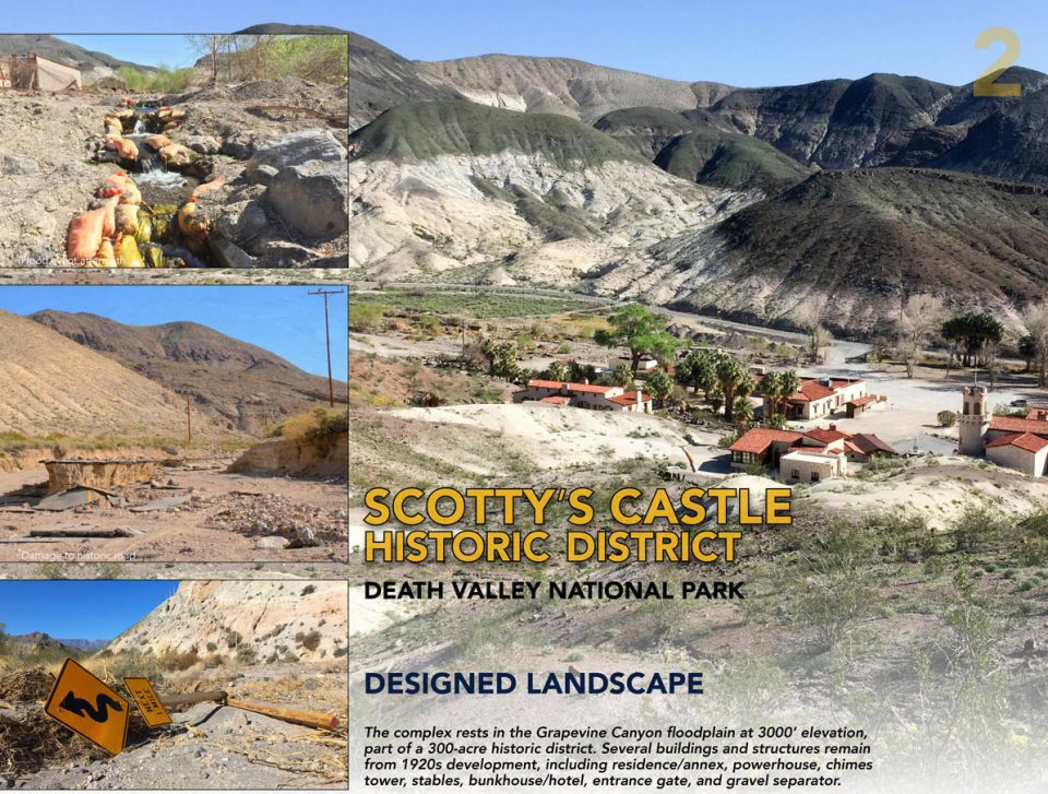
▲斯科特的城堡-历史区域的死亡谷国家公园
设计景观-该建筑群位于3000英尺高的葡萄谷(Grapevine Canyon)河滩上,是300英亩的历史街区的一部分。该建筑群包括住宅/附楼,厂房,钟楼,马厩,双层住宅/酒店,入口大门和砂石分离设备。
SCOTTY’S CASTLE HISTORIC DISTRICT DEATH VALLEY NATIONAL PARK
DESIGN LANDSCAPE The complex rests in the Grapevine Canyon floodplain at 3000′ elevation, part of a 300-acre historic district. Several buildings and structures remain from 1920s development, including residence/annex, powerhouse, chimes tower, stables, bunkhouse/hotel, entrance gate, and gravel separator.
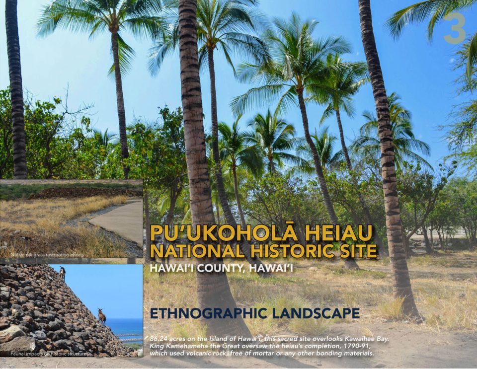
▲PU’UKOHOLHEIAU国家历史保护区夏威夷县,夏威夷
人文景观-在夏威夷岛的这个86.24英亩的神圣遗址上俯瞰Kawaihee海湾,可以看到由Kamehameha国王监督完成的古神殿。该神殿完成于1790-1791年间,其建造材料除火山岩,不包括任何连接砂浆。
PU’UKOHOLĀ HEIAU NATIONAL HISTORIC SITE HAWAI’L COUNTY, HAWAI’L
ETHNOGRAPHIC LANDSCAPE 86.24 acres on the Island of Hawai’l this sacred site overlooks Kawaihee Bay King Kamehameha the Great oversaw the heiau’s completion. 1790-91, which used volcanic rock free of mortar on any other bonding materials.
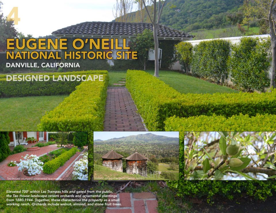
▲EUGENE奥尼尔国家历史遗址,丹维尔,加利福尼亚州
设计景观-陶家的景观位于在拉斯维加斯Trampas山的700英尺高处,面向公共区域,该地保留了从1880年到1944年间的果园和观赏植物。这些特征使这这里看起来像个小型牧场。果园里种有核桃,杏仁和石果树。
EUGENE O’NEILL NATIONAL HISTORIC SITE DANVILLE, CALIFORNIA
DESIGN LANDSCAPE Elevated 700′ within Las Trampas hills and gated from the public, the Tao House landscape retains orchards and ornamental plantings from 1880-1944. Together, these characterize the property as a small working ranch. Orchards include walnut, almond, and stone fruit trees.
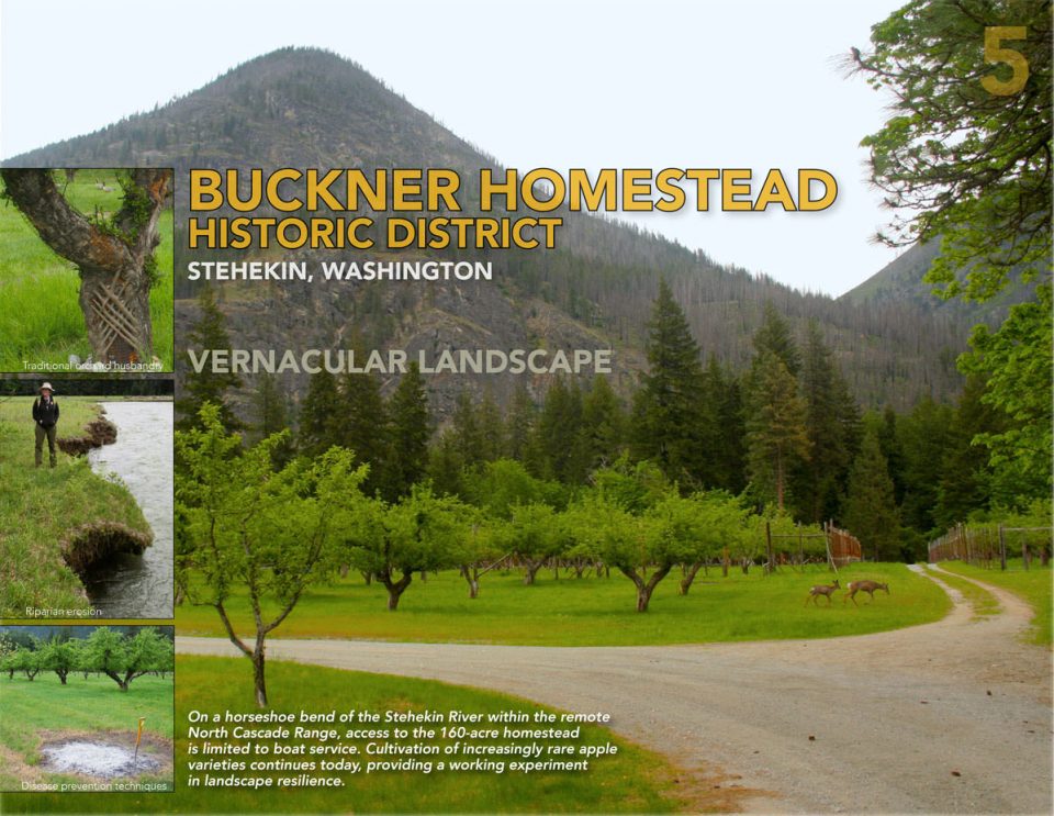
▲BUCKNER HOMESTEAD历史区,STEHEKIN,华盛顿
地方性景观-这片160英亩的基址位于偏远的北部Cascade山脉间的Stehekin河的马蹄形弯道上,仅限于乘船进入。当地种植罕见物种的做法延续至今,为景观复原提供了一个实验性场地。
BUCKNER HOMESTEAD HISTORIC DISTRICT STEHEKIN, WASHINGTON
VERNACULAR LANDSCAPE On a horseshoe bend of the Stehekin River within the remote North Cascade Range, access to the 160-acre homestead is limited to boat service. Cultivation of increasingly rare apply varieties continues today, providing a working experiment in landscape resilience.
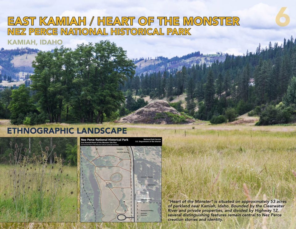
▲东KAMIAH /巨人心脏,NEZ PERCE国家历史公园
人文景观-“巨人心脏”位于爱达荷州卡米亚附近的一个约53英亩的公园内。 四周被克利尔沃特河和私人产业围绕,12号高速公路横穿其中,其中几个放映Nez Perce的显著特征清晰可见。
EAST KAMIAH / HEART OF THE MONSTER NEZ PERCE NATIONAL HISTORIC PARK
ETHNOGRAPHIC LANDSCAPE “Heart of the Monster ” is situated on approximately 53 acres of parkland near Kamiah, Idaho. Bounded by the Clearwater River and private properties, and divided by Highway 12, several distinguishing features remain central to Nez Perce creation stories and identify.
PROJECT NARRATIVE
The study of climate change impacts on cultural landscapes in the national parks of the Pacific West Region (PWR), responding to the growing need to understand potential effects of projected climate trends and events, was conducted in collaboration with the National Park Service. Working with climate scientists and other professionals, the research team utilized localized climate projections to assess how cultural landscapes within the region might be affected by specific climate variables. Research informed recommendations for future research toward the agency’s goal of ensuring cultural landscapes’ resilience in the era of climate change.
Products of this research include a matrix designed to update and organize data needed to evaluate the exposure of inventoried cultural landscapes in the Pacific West Region; and a report describing six case studies, which identifies current conditions, projected climate variables, and recommended management strategies to address current condition needs and areas of future research.
The matrix summarizes all character-defining features and documented impacts for 164 cultural landscapes across the region. Summarizing exposure of these features to known environmental hazards and key projected climate changes, the matrix includes a model used to score each cultural landscape feature, enabling future comparisons between sites’ exposure to both current risk and projected climate change.
Each case study summarizes cultural landscape characteristics, selected climate change projections, existing conditions, and exposure hazards. They include recommendations for responsible stewardship.
Cultural Landscape Inventory and Climate Adaptation Strategies
The Cultural Landscapes Inventory (CLI) is a certified database of all significant landscapes in the National Park System. CLI’s document the conditions of cultural landscapes, including known impacts. In this project, both condition and impacts for each cultural landscape were analyzed regarding current climate change projection data, identifying and potentially quantifying anticipated climate change impacts through the existing stewardship framework of the CLI.
Partnering with NPS, the team refined the cultural resource climate change response framework, analyzing projected climate change impacts to cultural landscapes located in the western United States and Pacific Islands. Case studies identified current cultural landscape conditions, including how each condition could exacerbate potential effects of projected climate change.
PROJECT OBJECTIVES
Collect and compile climate change projection data for 164 cultural landscapes in 43 parks across the Pacific West Region, including, but not limited to, climate change trends in air temperature, precipitation, and sea level.
Identify anticipated climate change related exposures specific to each of the 164 cultural landscapes.
Conduct six case studies, assessing current condition and impacts in selected cultural landscapes, and identifying steps towards ensuring impacts are addressed, to improve the landscape’s resiliency.
METHODS
This project tested and refined an existing framework for managing the projected effects of climate change, in a new cultural landscape format. For each landscape, the basic formula for determining vulnerability to climate variables is:
(exposure + sensitivity) / adaptive capacity = vulnerability
Climate Projections
Due to the availability of data for study sites, the team primarily considered projections for temperature, precipitation, and sea level, compiling regional climate projections from a variety of peer-reviewed sources.
Hazards
Geospatial analysis evaluated hazards associated with projections. Hazards include drought, fire, flood, and landslide—derived from established risk data published by NOAA, USGS, and USFS.
Impacts
The team analyzed documented impacts to each specific cultural landscape, extracted from the CLI database, including disruption; loss of plant species; erosion; exposure to elements; neglect; pests/diseases; pruning practices; release to succession; structural deterioration; temperature/hot extremes; temperature/warmer averages; and vegetation/invasive plants. Impacts are tracked by NPS for all cultural landscapes. For case study, each impact was verified and documented in the field.
Vulnerability Assessment Matrix
The newly designed vulnerability assessment matrix models exposure of character-defining cultural landscape features, according to climate change projection data. Exposure describes “the presence of people, livelihoods, species or ecosystems, environmental functions, services, and resources, infrastructure, or economic, social, or cultural assets in places and settings that could be adversely affected” (IPCC 2014), amended here to frame how climate change might adversely affect the cultural landscape features. The matrix aggregates and scores a broad range of data, including ground-level and geospatial analyses, alongside climate studies and models. This tool is intended to assist NPS decision-makers in directing further analysis, field assessment, and appropriate treatments. There were four major criteria included in the scoring system within the matrix: condition, current exposure, historical exposure, and projected exposure.
Condition: an overarching, landscape-scale assessment of condition, including interpretation of status described in the CLI. Current Exposure: a spatially-specific identification of cultural landscape features at risk to a climate hazard. This assigned value includes current geo-spatial (GIS) data.
Historical Exposure: identification of known current and historical impacts, primarily through CLI analysis. Projected Exposure: a calculation of intensity and confidence of climate projection data. Datasets are comprised of current climate projections by county, and by park scale (where available).
Intensity: estimated magnitude of climate change per climate variable.
Confidence: range of certainty/uncertainty in the climate change projections.
Case Studies
Six case studies were selected using three criteria: each is located in a different Pacific West Region eco-region; all cultural landscape types were represented (i.e., historic site, vernacular, design, ethnographic); park staff were available to participate and assist with fieldwork and research.
Case study sites: Lyons Ranches Historic District, Redwood National Park (CA); Scotty’s Castle Historic District, Death Valley National Park (CA); Eugene O’Neill National Historic Site (CA); Buckner Homestead, North Cascades National Park (WA); Pu’ukohola Heiau National Historic Site (HI); Heart of the Monster, Nez Perce National Historical Park (ID).
Team members analyzed the Cultural Landscape Inventory for each site and retrieved climate projection data from a variety of published and available data sources. This process shaped a determination of potential climate stresses and impacts on identified cultural landscape characteristics and features. Consultation with NPS regional and park staff enabled data sharing, collecting additional observations, and gathering new recommendations for current literature and primary source materials, as well as inviting further staff advice. The process included both quantitative and qualitative data.
Case studies included field investigation and documentation of each site with regional and park staff, and gaining a better understanding of current impacts at work in contributing cultural landscape features. This further helped clarify opportunities for future studies of attribution of known impacts to climate change. Fieldwork, including visual inspection of landscape systems, topography, vegetation, buildings, structures, and other landscape features to assess and document condition and impacts, offered insights into park priorities, competing demands for staff expertise and funding, and the acknowledged gaps in available historical and projected climate data.
RESULTS
This study produced a matrix within which each cultural landscape contributing feature was assigned a “Current Exposure” score, which was informed by the GIS spatial data, a “Historical Exposure” score, informed by the CLIs and a “Projected Exposure” score, informed by the projected climate data on temperature, sea level, and precipitation. These categories identify which features (and by extension, how many features) have a high exposure to climate related trends and events.
FURTHER RESEARCH
As this research primarily addressed one piece of the equation, exposure,future research is underway to address the sensitivity and adaptive capacity of each contributing feature. The next phase includes vulnerability assessments for selected cultural landscapes and preparation of adaptation strategies for selected cultural landscapes that are identified as highly vulnerable.
The next phase of our research addressing vulnerability is exciting. As landscape
architects we see a clear transferability of this framework beyond NPS. As cultural landscapes play a role within the profession, this research informs how we may take steps toward identifying places exposed to climate change and potential mitigation strategies to protect them.
Lead Researcher:
Robert Z. Melnick, FASLA;
Research Team Members:
Veronica Malinay, Associate ASLA; Noah P. Kerr; Alison Lewis, Associate ASLA
More:Cultural Landscape Research Group, University of Oregon,ASLA,更多请至:Cultural Landscape Research Group, University of Oregon on gooood









这样的分析整理好棒