“这个沿海总体规划不仅仅是一份关于降低风险与修复工作的投资指导文件,它一种真正关注到场地和实地理解的沟通工具。”
– 2024年ASLA评审委员会评语“This Coastal Master Plan isn’t just a plan that guides investments in risk reduction and restoration efforts, it’s a communication tool that is really thinking about comprehension on the ground.”
– 2024 Awards Jury
来自 ASLA 对gooood的分享。
2023 Coastal Master Plan: A Plan for Louisiana’s Coastal Communities|SCAPE / Landscape Architecture DPC
项目陈述
Project Statement
路易斯安那州正面临土地流失危机。在过去的一个世纪里,该州的地貌经历了巨大的变化,这给许多路易斯安那居民带来了挑战。2023年的《沿海总体规划》是一份动态的文件,它指导并总结了该州在减少风险和沿海恢复项目方面的全州投资策略。
景观设计师主导了该项目的视觉设计,包括:重新设计整体规划的图形标识,改善项目和数据的可视化效果,增强阅读理解,并重新聚焦于以社区为中心的叙事结构。该计划揭示了减少沿海风险和恢复项目背后的过程,并传达了与这些景观及其依赖的生计相关的价值。
Louisiana is facing a land loss crisis. Over the past century, the state has experienced massive changes to its landscape that pose challenges to many Louisianans. The 2023 Coastal Master Plan is a living document that guides and summarizes the state’s coastwide investments in risk reduction and coastal restoration projects.
Landscape architects led the document’s visual communications strategy: reframing the overall plan’s graphic identity, improving project and data visualizations, enhancing reading comprehension, and refocusing on a community-centric narrative structure. The plan demystifies the processes behind coastal risk reduction and restoration projects and communicates the value of the landscape and the livelihoods tied to it.
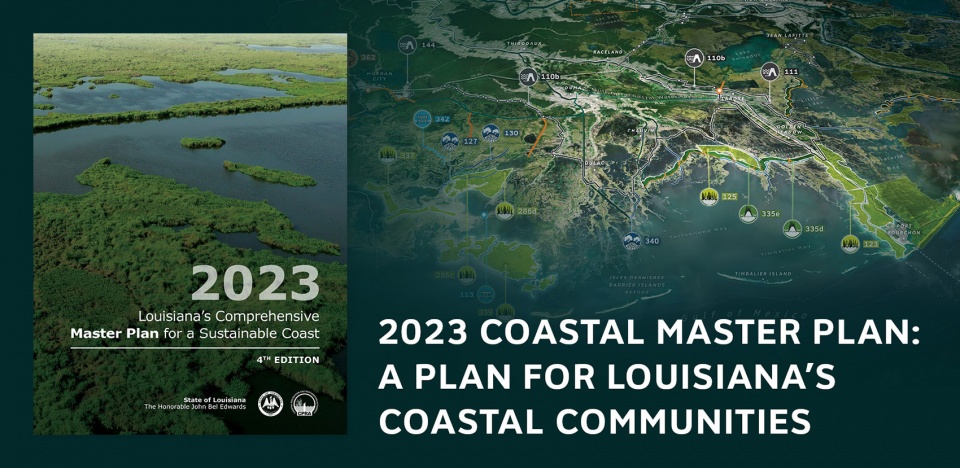
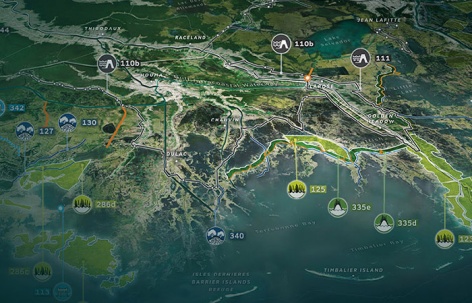
▲2023年《沿海总体规划》:路易斯安那州沿海社区规划,路易斯安那州的沿海正在迅速变化。2023年《沿海总体规划》指导了全州范围内针对降低风险与海岸线修复的投资计划,2023 Coastal Master Plan: A Plan for Louisiana’s Coastal Communities: Louisiana’s coast is rapidly changing. The 2023 Coastal Master Plan guides coastwide investments in risk reduction and restoration projects. © Map: SCAPE
项目说明
Project Narrative
自20世纪30年代以来,路易斯安那州已经失去了超过2000平方英里的土地,流失的土地被墨西哥湾吞噬,这一损失由人类活动和环境因素引起,并因气候变化和暴风雨而加剧。2005年飓风卡特里娜和丽塔摧毁了路易斯安那的沿海地区后,路易斯安那州立法机关成立了沿海保护与恢复管理局(CPRA),任务是协调联邦、州和地方的恢复工作。自2007年以来,CPRA开发了一系列《沿海总体规划》,帮助评估和规划沿海各类项目,这些规划方案汇聚了科学家、工程师、环境专业人士、政策制定者和路易斯安那州公民的共同专业知识,以应对气候变化后的未来挑战。这些规划推动了超过214亿美元的投资,投入到这一关键性的景观保护工作中。
在2023年《沿海总体规划》中,景观设计师主导了整套文件的视觉设计和图形标识,以及面向公众和社区参与的宣传材料,包括:模型输出地图、区域航拍图、说明性图表、数据可视化和每个项目、教区、社区和地区的实际信息。这项合作为期三年,主要目标包括提升规划的视觉可访问性、理解力,并将地区和地方风貌融入到整体叙事结构中。
该规划的一个重大变化是重新构建对变化景观的展示方式。在以前版本的规划总图中,土地流失通常以红色标识出来。而在本项目中,景观设计师将则使用蓝色和绿色来表示土地变化。这种色彩的变化传达了一个信息,即变化是不可避免的,但社区能够适应这种变化。
团队还重新设计了图标,使其对视觉障碍者更友好,并更新了工程图表,帮助更好地展示景观的潜力。文档的内容根植于人们的实际经验,清楚地表明,普通路易斯安那居民如何为未来做好适应性准备。
该项目包括总体规划文档及其执行摘要、量身定制的情况说明书、在线数据浏览端口和关于规划的两部视频。每一项宣传材料都帮助当地领导人和居民了解与他们自身息息相关的信息,并根据信息作出决策。
情况说明图表涵盖了将受到规划影响并因此收益的区域、教区、社区和项目层面的数据概览。在线数据浏览端口则提供了更详细的信息,用户可以查看高分辨率的收益数据,搜索项目,了解沿海实施情况等。在线数据浏览端口面向两种不同类型的用户:首次使用者可以查看可用信息的概览,而回访用户可以探索多个数据集,更好地满足他们的需求。视频则解释了该规划如何帮助居民为变化的景观做好准备,政府进行规划时应该如何应对不确定性,以及每种项目类型在景观中的最佳置入方式。
总的来说,该总体规划作为全州生态恢复和降低风险的长期投资指南,与促进沿海地区可持续商业和娱乐活动的相关措施同时进行。该规划在2023年春季获得了沿海保护与恢复管理局和路易斯安那州立法机关的一致批准,是组织集体行动和资金筹集的关键工具,旨在保护和恢复沿海地区。
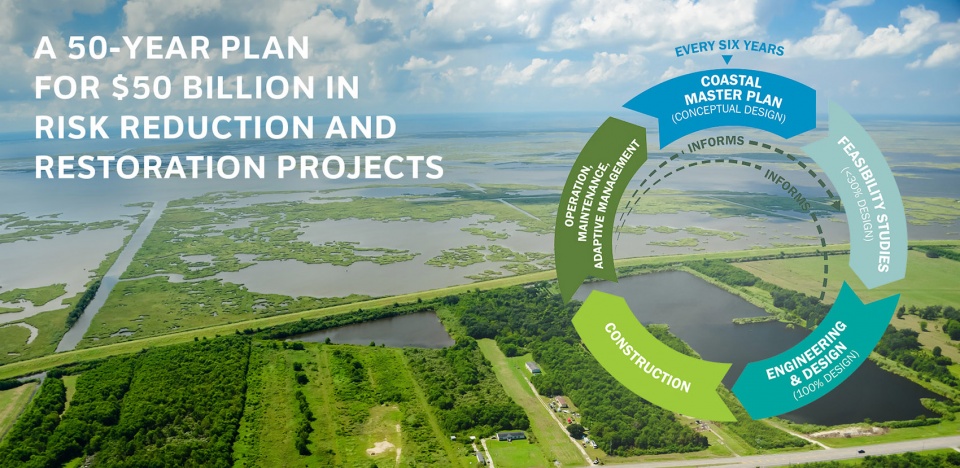
▲涉及500亿美元投资的降低风险与海岸线恢复的50年规划:自2007年以来,该规划推动了超过214亿美元的沿海保护与恢复项目投资,A 50-Year Plan for $50 Billion in Risk Reduction and Restoration Projects: Since 2007, the plan has driven investment of over $21.4 billion in coastal protection and restoration projects. © Photo: CPRA; Diagram: SCAPE
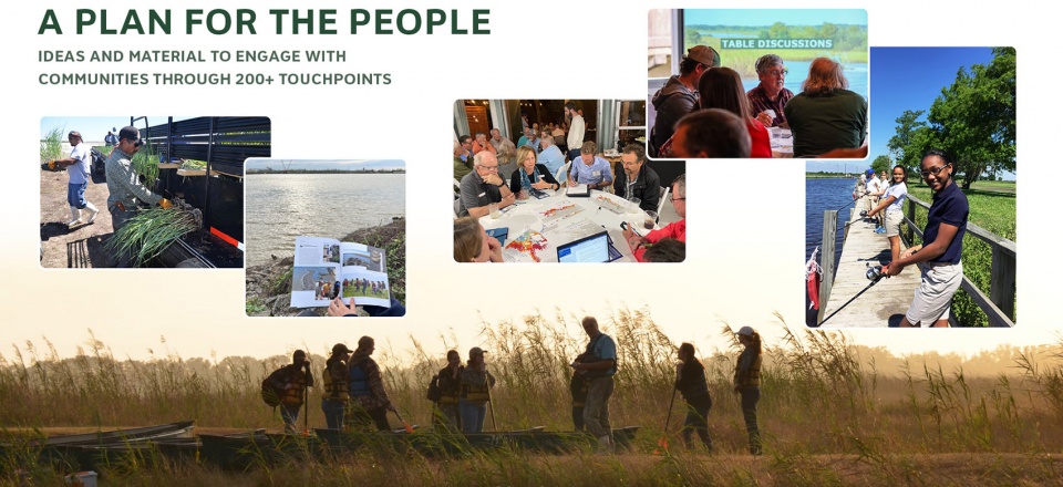
▲以人为本:该规划基于真实的经验。团队咨询了大量居民、地方官员、专家等相关人士的意见,A Plan for the People: The plan is grounded in lived experience. The team consulted a broad network of residents, local officials, experts, and more. © Second photo from left: Jennifer Schecter; Other photos: CPRA
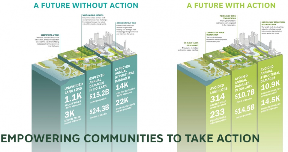
▲赋能社区采取行动:该规划将复杂的信息转化为易于理解的图形和文字,为路易斯安那州居民提供了明确的行动步骤,Empowering Communities to Take Action: The plan translates complex information into accessible graphics and language — providing Louisianans with clear steps toward action. © SCAPE
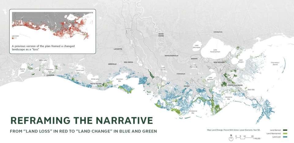
▲重塑叙事:变化是不可避免的。本次规划采用绿色和蓝色表示“土地变化”,代替了之前的红色调识,以避免悲观情绪并激励行动积极性,Reframing the Narrative: Change is inevitable. Instead of showing land “loss” in red, the plan shows land “change” in green and blue to avoid cynicism and inspire action. © Top left: CPRA; Center: SCAPE
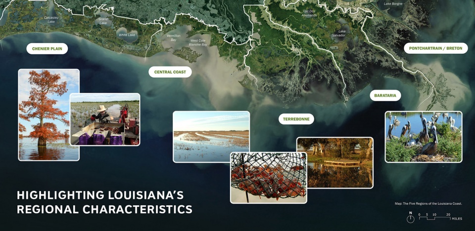
▲突出路易斯安那州的地域特征:在整体规划过程中,团队与路易斯安那州的居民会面,讨论每个地区的具体问题,Highlighting Louisiana’s Regional Characteristics: Throughout the master plan development process, the team met with residents across Louisiana to discuss issues specific to each region. © Map: SCAPE; Photo 2, 3, 4, and 5 from left: Burt Tietje; Photo 1 and 6 from left: CPRA
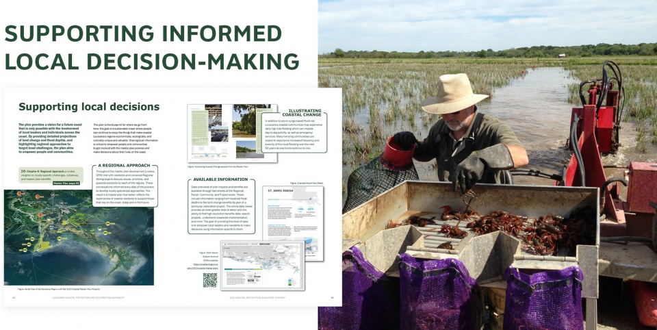
▲支持地方决策的知情基础:通过根据各地区的特点定制建议,该规划更好地反映了沿海居民的实际经验,Supporting Informed Local Decision-Making: By tailoring recommendations to each region, the master plan better reflects the experiences of coastal residents. © Photo: Burt Tietje
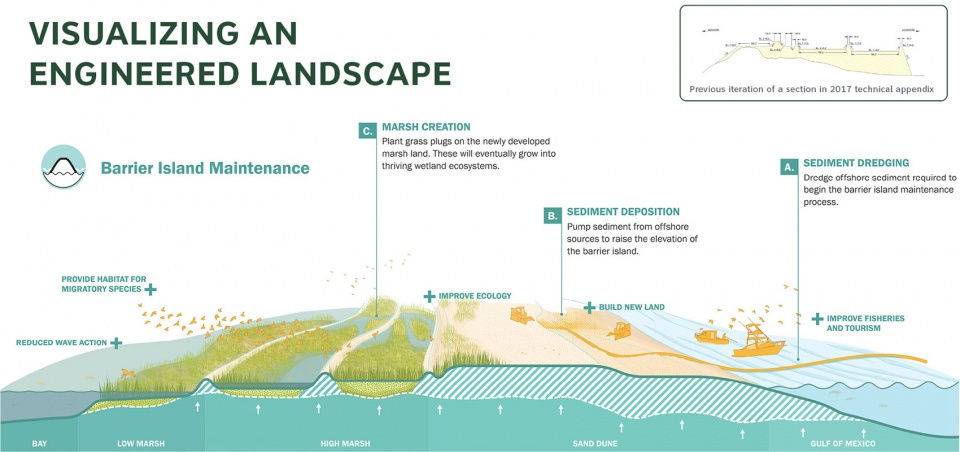
▲将工程化景观可视化:团队开发了可实施的项目类型,每个项目都配有示意图,清晰展示了工程解决方案的潜力,Visualizing an Engineered Landscape: The team developed implementable project types, each with an illustrated diagram that clearly demonstrates the potential of engineering solutions. © Top right: CPRA; Center: SCAPE
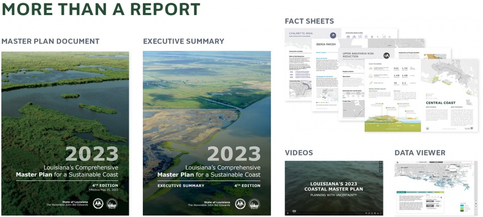
▲不仅仅是一份报告:除了主规划文件外,团队还开发了执行摘要、情况说明书、在线数据浏览器和互动视频,More Than a Report: Along with the master plan document, the team developed an executive summary, fact sheets, an online data viewer, and engaging videos. © CPRA and SCAPE
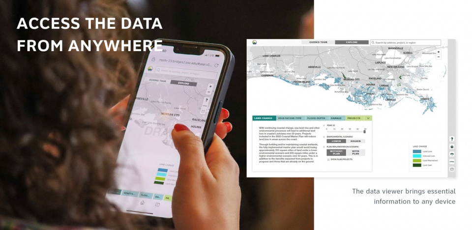
▲随时随地获取数据:在线数据浏览器允许用户查找高分辨率的效益数据、搜索项目、了解全州实施情况等,Access the Data from Anywhere: The online data viewer allows users to find high-resolution benefits data, search projects, understand coastwide implementation, and more. © Photo: CPRA; Data Viewer: SCAPE and Pittsburgh Supercomputing Center
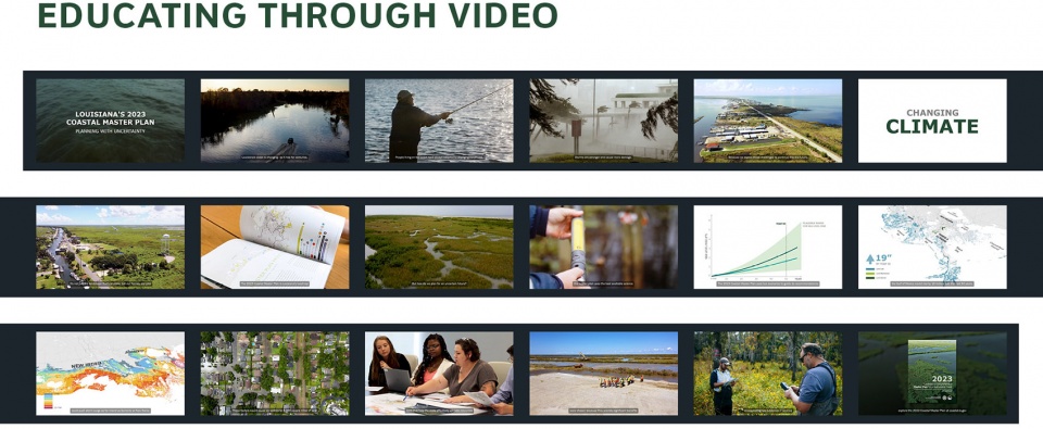
▲通过视频进行教育:两个简短且富有吸引力的视频解释了该规划的目的及其提议项目的效益,Educating Through Video: Two short, engaging videos explain the purpose of the plan and the benefits of the projects it proposes. © CPRA and SCAPE
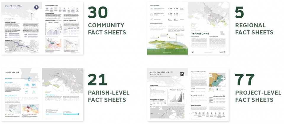
▲情况说明书:区域、教区、社区和项目级别的事实情况说明书,使特定区域的数据易于查找,Fact Sheets: Regional, parish, community, and project-level fact sheets make regional-specific data easy to find. © CPRA and SCAPE
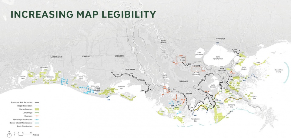
▲提高地图可读性:团队重新设计了地图可视化,改善了颜色和图标的可读性,Increasing Map Legibility: The team redesigned map visualizations to improve legibility of colors and icons. © SCAPE
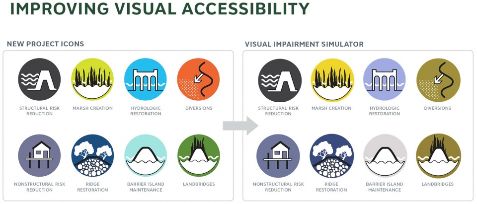
▲改善视觉可达性:团队重新设计了项目图标,使其对视力障碍者更加友好,Improving Visual Accessibility: The team redesigned project icons to make them accessible for people living with visual impairments. © SCAPE
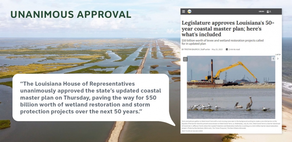
▲一致通过:在审批过程中,该规划获得了沿海保护与恢复管理局和路易斯安那州立法机关的一致支持,Unanimous Approval: During its approval process, the plan garnered unanimous support from the Coastal Protection and Restoration Authority and the Louisiana Legislature. © Photo: CPRA
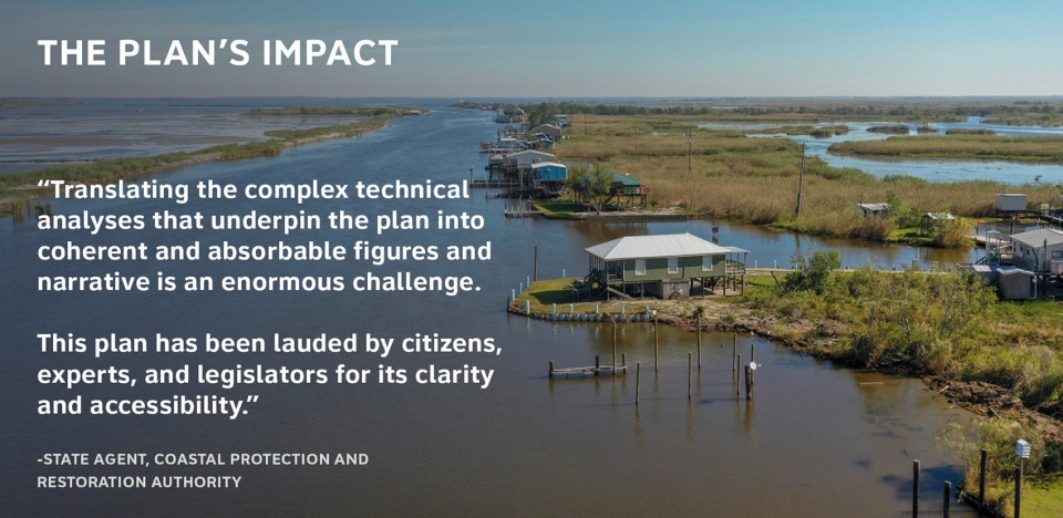
▲规划的影响:该规划因其易于理解的设计和叙事方法而备受称赞,The Plan’s Impact: The plan is celebrated for its accessibility and narrative approach. © CPRA
Project Narrative
Since the 1930s, Louisiana has lost over 2,000 square miles of land to the Gulf of Mexico due to a suite of anthropogenic and environmental factors—a staggering loss exacerbated by climate change and intensifying storms. After Hurricanes Katrina and Rita devastated coastal Louisiana in 2005, the Louisiana Legislature created the Coastal Protection and Restoration Authority (CPRA), tasking it to coordinate federal, state, and local restoration efforts. Since 2007, the CPRA has developed a series of Coastal Master Plans to help evaluate and plan the wide variety of projects across the coast, harnessing the combined expertise of scientists, engineers, environmental professionals, policymakers, and Louisiana citizens to prepare for and respond to a climate-changed future. The plans have driven investment of over $21.4 billion in this critical landscape.
For the 2023 Coastal Master Plan, the landscape architects led an overarching visual communications strategy and graphic identity underpinning the document, as well as collateral for outreach and engagement—including model output maps, aerial regional views, explanatory diagrams, data visualizations, and fact sheets for each project, parish, community, and region. The broader goals of this three-year collaboration included enhancing the plan’s visual accessibility, comprehension, and weaving regional and local identity into the overall narrative.
A major shift in the plan was reframing the communication of a changed landscape. In previous iterations of the plan, land loss was shown on maps in red. The landscape architects reframed this to show land change in blue and green. This shift in visualization communicates that change is inevitable, but communities are able to adapt.
The team also redesigned icons to make them accessible to people with visual impairments, and updated engineering diagrams to visualize the potential of the landscape. Lived experience grounds the document, making clear how the everyday Louisianan can adapt for the future.
The project included the master plan document along with an executive summary, tailored fact sheets, an online data viewer, and two videos about the plan. Each piece of collateral empowers local leaders and residents to make decisions using information specific to them.
The fact sheets consist of data overviews of plan impacts and benefits at the Regional, Parish, Community, and Project levels. The online data viewer provides an even greater level of detail with the ability to find high-resolution benefits data, search projects, understand coastwide implementation, and more. The data viewer addresses two distinct types of users: first-time users can view an overview of the available information, while return users can explore multiple data sets to better fit their needs. The videos explain how the plan can help residents prepare for a changing landscape, what it means to plan with uncertainty, and how each project type is best utilized in the landscape.
Overall, the master plan functions as a long-term guide to restoration and risk reduction investments throughout the state, undertaken in parallel to related efforts to promote sustainable commercial and recreational activities across the coast.
The plan was unanimously approved by both the Coastal Protection and Restoration Authority and the Louisiana Legislature in Spring of 2023, and is a key tool in organizing collective action and funding centered on protecting and restoring the coast.
Project Credits
Kate Orff, FASLA, Principal-in-Charge, SCAPE
Nans Voron, Design Director, SCAPE
Despo Thoma, Director of Resilience, SCAPE
Andrew Wright, ASLA, Associate, SCAPE
Liz Camuti, Senior Designer, SCAPE (former team member)
Ryan Pryandana, Designer, SCAPE
Louisiana Coastal Protection & Restoration Authority (CPRA), Client
Arcadis, N.A., Prime
Pittsburgh Supercomputing Center, Data Viewer development









规划图就是好看
DK
搞出来再说
rz