感谢 深规院联创所 + Mandaworks,对gooood的分享。更多关于他们:Mandaworks on gooood,UPDIS on gooood
Appreciation towards UPDIS + Mandaworks for providing the following description:
《霞客湾科学城战略规划与概念性城市设计》国际方案竞赛,由中国城市规划学会受江阴市自然资源和规划局(主办方)委托承办,规划研究与设计范围涵盖长江沿岸总面积约80.3平方公里的城市设计与生态发展规划设计。
The International Competition for Strategic Planning and Conceptual Urban Design for Xiakewan Science City was or- ganized by the Urban Planning Society of China and encompasses 8000 hectares of urban and ecological development alongside the Yangtze River.
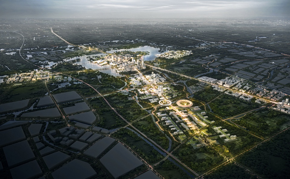
▼整体方案效果图,Overall of the project © MANDAWORKS & UPDIS
霞客湾科学城
Xiakewan Science City
霞客湾科学城位于长江以南,太湖之滨,处于城市与生态发展的关键十字路口。新的科学城将与当地的自然环境深度融合,旨在在最大程度上保护、改善和优化现有生态系统,并使健康的生态系统在新城建设中发挥重要作用。
Located south of the Yangtze River, and on the banks of Tai Lake, Xiakewan Science City is positioned at a critical in- tersection of urban and ecological development. The new Science City will be deeply integrated with its local natural environment, protecting, enhancing, and maximising the health of the existing ecosystems in which the new city will be constructed.
▼总平面图,master plan © MANDAWORKS & UPDIS

▼场地分析图,Site analysis diagram © MANDAWORKS & UPDIS
蓝色框架
Blue Framework
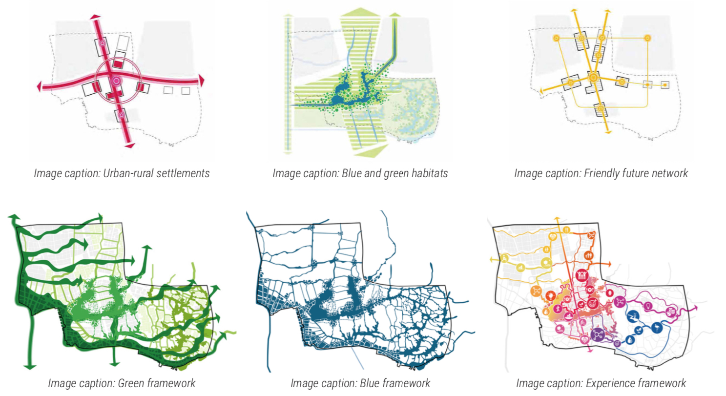
项目的蓝色框架网络系统受到自然的启发,模拟了植物根茎的形式与结构,以长江作为新城市发展的主要航道,以水文系统作为支撑整个城市网络的“根”,从而创造出连续且富有弹性的生态系统。设计继承并延续了江阴传统城市发展模式的规划逻辑,将城市空间围绕水路组织在一起。
The blue network is inspired by nature, learning from the form and structure of plant roots. The Yangtze River serves as the main waterway for the new urban development and is supported by the vast web of “roots” that create the connected and resilient system. The structure inherits and continues the logic of Jiangyin’s traditional city model that is organised around its relationship to its waterways.
▼以水文系统为基础的城市规划策略,Urban planning strategies based on hydrological systems © MANDAWORKS & UPDIS
全新的水路网络系统结合了现有的水域,并引入高效的清洁以及排水系统,从而达到了改善水质的目的。精心的设计将城市工程与生态方案完美融于一体,进一步强化了城市亲水的性质,为当地提供了高质量的城市环境与生态环境。
The new network improves water quality by combining existing regional water bodies and strengthening them with the introduction of efficient cleaning and drainage systems. Further quality improvements are achieved through the careful combination of engineering and ecological solutions.
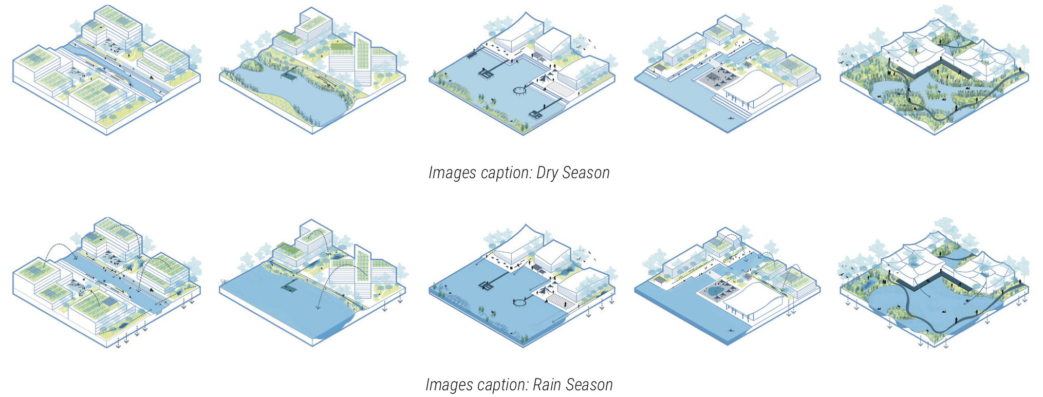
▼旱季与雨季情况分析,Dry Season vs Rain Season © MANDAWORKS & UPDIS
▼河道分析动图,River analysis gif © MANDAWORKS & UPDIS
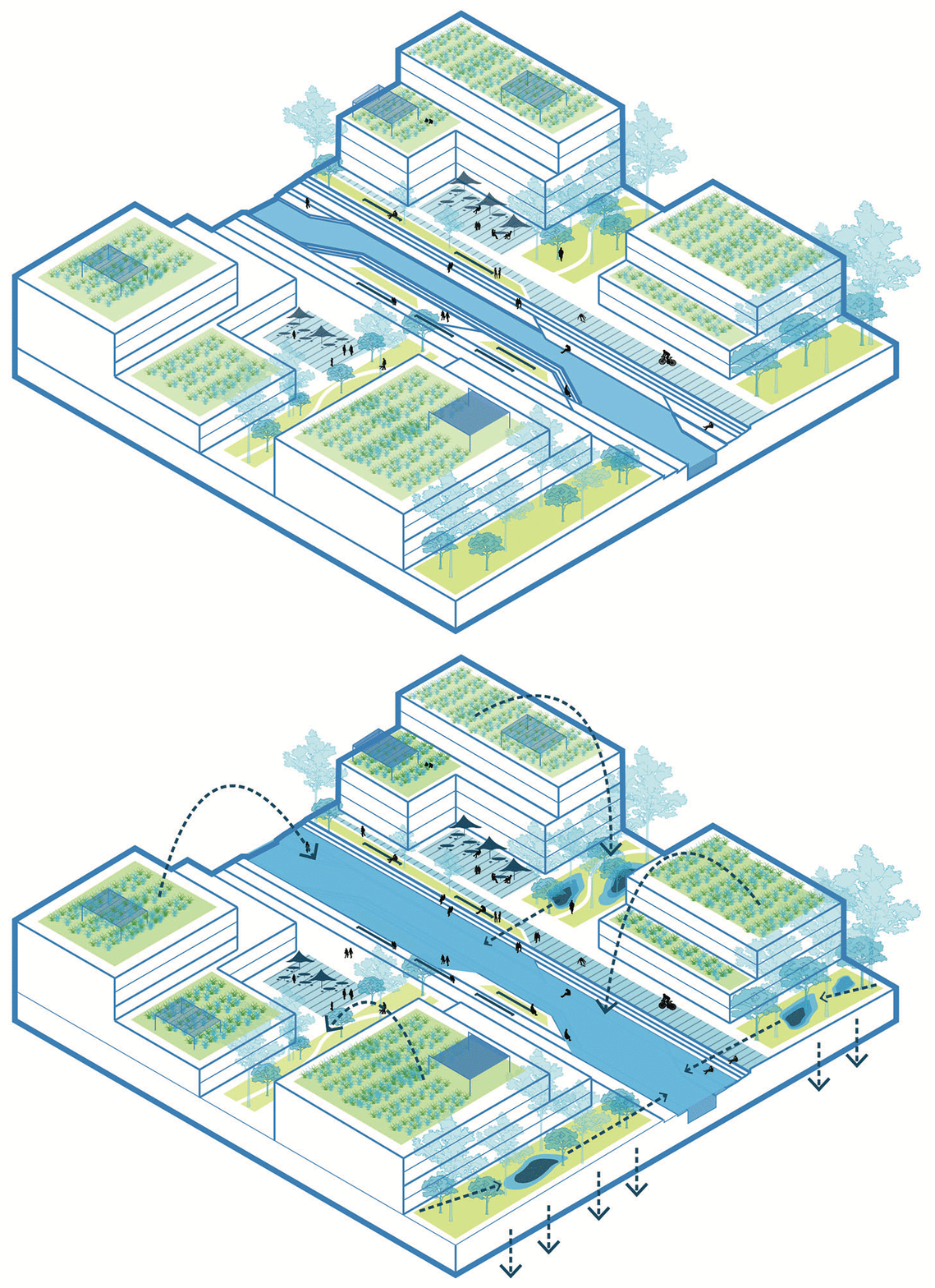
创建霞客湖水质净化系统、保留现有水文网络、保护和开发文林湿地,以及将现有的鱼塘整合到更广阔的生态网络中,这一系列措施都是项目蓝色框架网络中的重要组成部分。
The Xiake Lake water purification system, retention of existing hydrological networks, protection and development of the Wenlin Wetlands, and integration of existing fishponds into the broader ecological network all play an important role in creating the blue network.
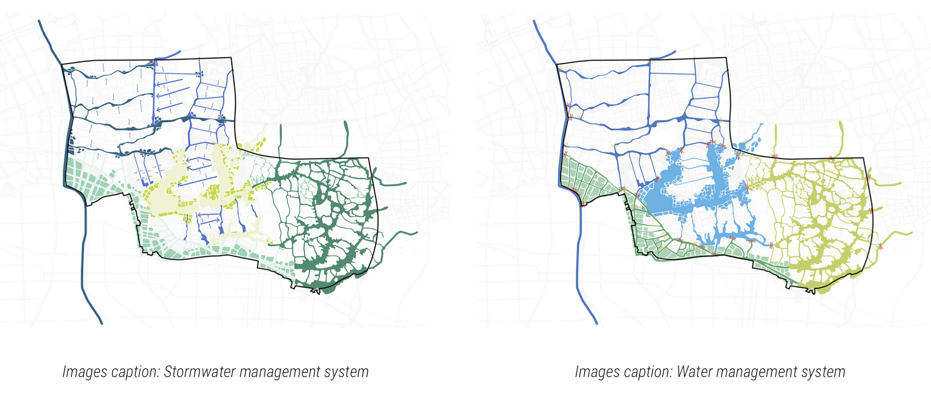
▼水文系统,the site’s water network © MANDAWORKS & UPDIS
绿色框架
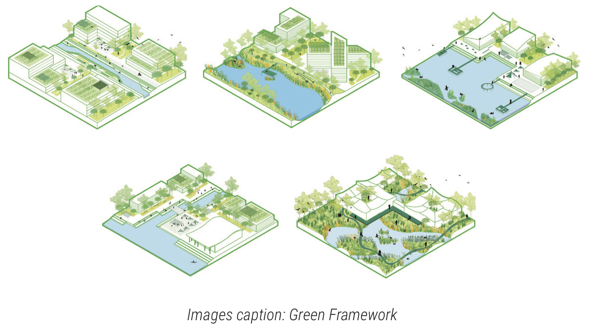
Green Framework
绿色框架网络紧密遵循场地的水文脉络,旨在创造可持续的弹性城市景观架构,同时达到支持与进一步优化水系的目的。森林环绕着城区并渗透到城市肌理当中,将自然的气息引入整个城市结构内部。
The Green Framework closely follows the site’s water network, creating a continuous resilient landscape structure that supports and elevates the water systems. The forests wrap around and intersect urban areas to introduce natural qualities to the urban structure.
▼绿色框架网络紧密遵循场地的水文系统,The Green Framework closely follows the site’s water network © MANDAWORKS & UPDIS
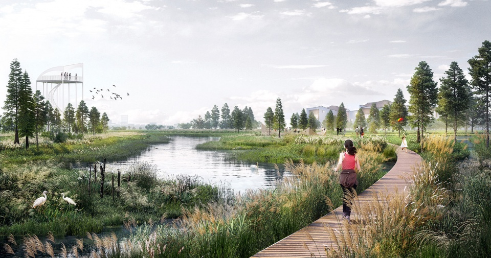
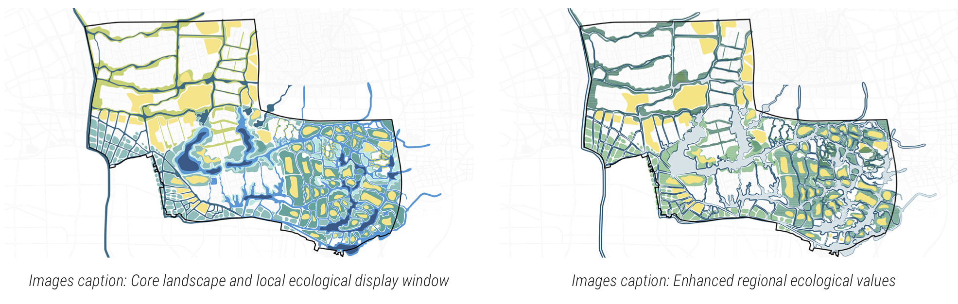
通过生态池塘、湿地和森林,中央湖区增强了整片城市区域核心位置的生态多样性,并创造出一个以环境为重点的城市发展模式的优秀范本。
With its ecological ponds, wetlands and forests, The Central Lake area enhances biodiversity in the core of the site, creat- ing a showcase of environmentally focused urban development.
▼绿色框架,The Green Framework © MANDAWORKS & UPDIS
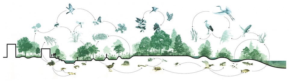
▼生态系统分析图,Ecosystem analysis diagram © MANDAWORKS & UPDIS
弹性景观
Resilient landscape
本项目的生态策略是通过对现有景观质量与自然资源进行深入分析和评估后而形成的。绿色和蓝色交织的网络结合了现有的以及新增的森林、池塘、湿地,形成一个强健并有弹性的生态系统。
▼生物多样性与弹性景观策略,Biodiversity and resilient landscape strategies © MANDAWORKS & UPDIS
The ecological strategy for the project evolved through deep analysis and evaluation of the existing landscape qualities and assets. The Intertwined green and blue networks combine existing and new forests, ponds, wetlands to form a robust and resilient ecosystem.
▼绿色和蓝色交织的网络形成一个强健并有弹性的生态系统,The Intertwined green and blue networks form a robust and resilient ecosystem © MANDAWORKS & UPDIS
体验框架
Experience Framework
在总体规划中,设计师为科学城拟定了“一湾四岸”的景观模式,将一系列充满活力的公共空间与城市蓝色绿色网络交织在一起,在不损害自然环境的情况下,为人们提供了充足的社交活动场所。这种规划方式将市民的城市生活集中在霞客湾的中心,有效地限制了人们进入周围湿地区域活动,从而保护与加强了当地的自然生态系统,同时为前来参观天然湿地的游客们提供了富有诗意的参观体验。
▼不同季节场景分析图,Autumn / Winter vs Spring / Summer © MANDAWORKS & UPDIS
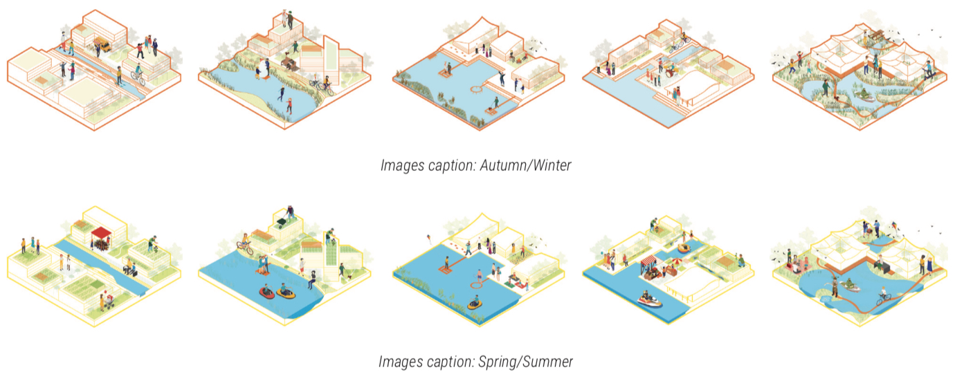
▼不同季节带来不同的活动,Different seasons bring different activities © MANDAWORKS & UPDIS
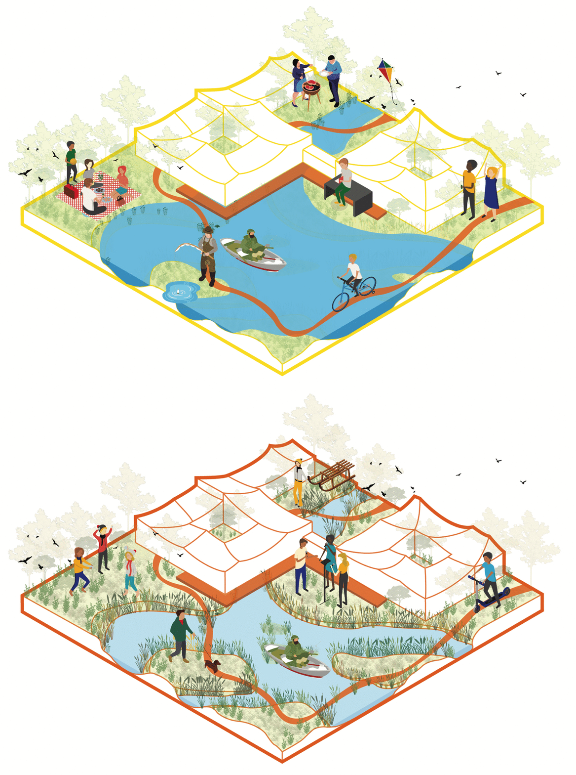
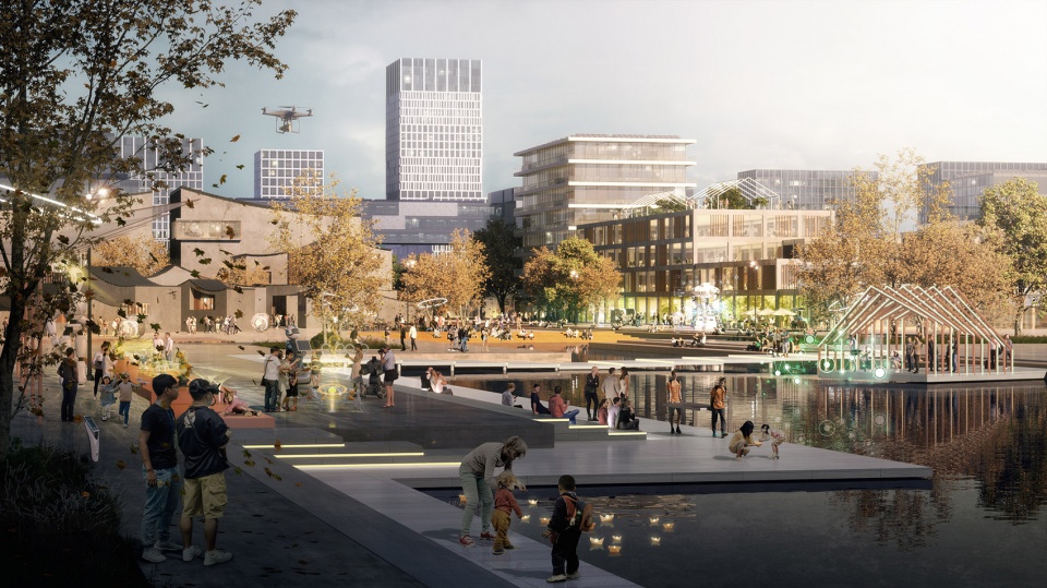
The masterplan provides the new Science City with one bay and four banks. A series of vibrant public spaces trace the green and blue networks, supporting without compromising the natural systems. The structure concentrates urban life in the center of Xiakewan while limiting human activities and access in the surrounding wetland areas. This spatial division allows for the preservation and enhancement of local ecosystems while creating a poetic experience for those visiting the natural habitats.
▼城市生活集中在霞客湾的中心,The structure concentrates urban life in the center of Xiakewan © MANDAWORKS & UPDIS
一湾四岸
One bay, four banks
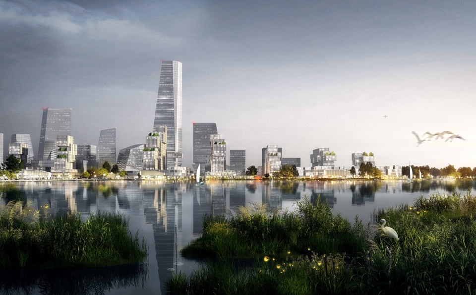
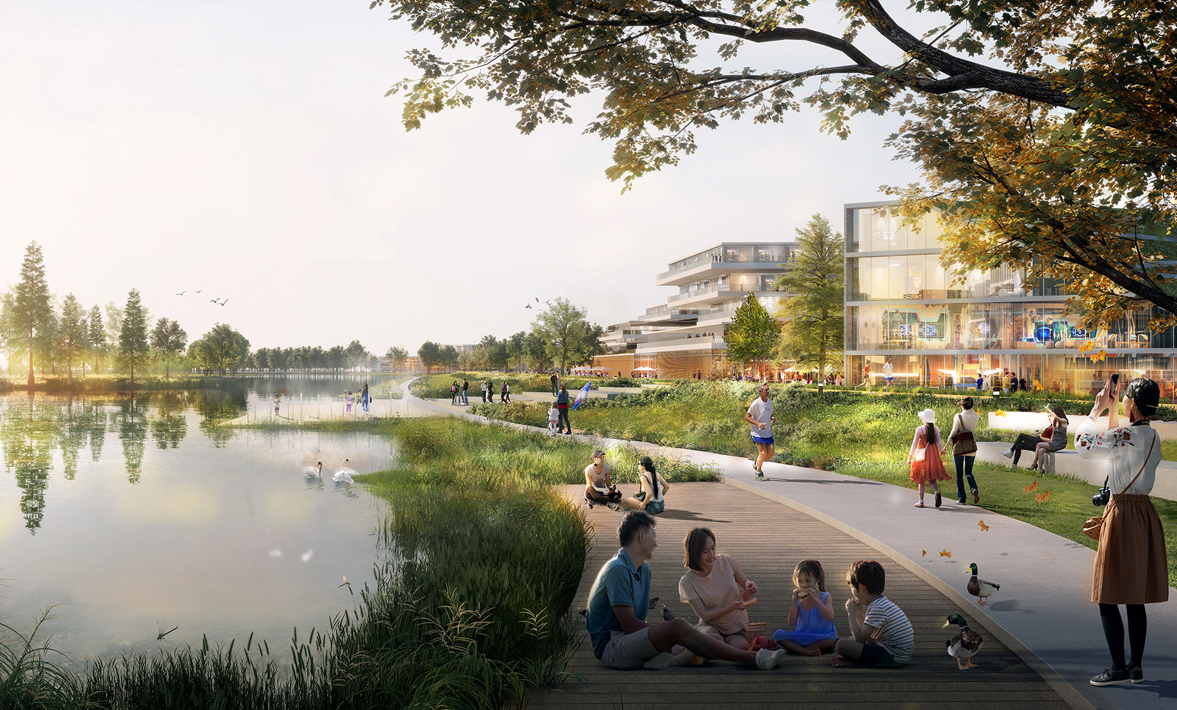
“一湾四岸”的规划策略将当地的农业景观、自然修复以及未来的住宅开发联系在一起。水湾与水岸为霞客湾的居民们带来丰富的娱乐休闲目的地,同时也赋予了新城中心一种清新自然的水乡风情。
Xiake Lake, with its one bay and four banks, connects agricultural landscapes and natural restoration areas with future residential developments. The bay and banks create urban leisure and recreational destinations to be enjoyed by Xiakewan inhabitants and integrate the qualities of the rural landscape into the new urban centre.
▼“一湾四岸”的规划策略,Xiake Lake, with its one bay and four banks © MANDAWORKS & UPDIS
蓝绿交织的生态走廊
Weaving corridors
蓝绿交织的生态走廊贯穿整个开发区,将邻里、社区以及生态区编织在一起。设计师将这种规划策略应用于密集的城市空间周围,同时赋予这些周边空间丰富的城市功能,包括:社区服务、娱乐、商业,以及公共文化设施等。充满活力的水岸空间成为繁荣城市生活的催化剂。
Blue-green corridors running through the development weave together neighbourhoods, districts, and ecological zones. Design strategies are applied to spaces surrounding the urban cluster, enriched by city-making program, including com- munity services, entertainment facilities, commerce, cultural and public institutions. The activated water bank becomes a catalyst for a thriving urban life.
▼蓝绿交织的生态走廊,Blue-green corridors © MANDAWORKS & UPDIS
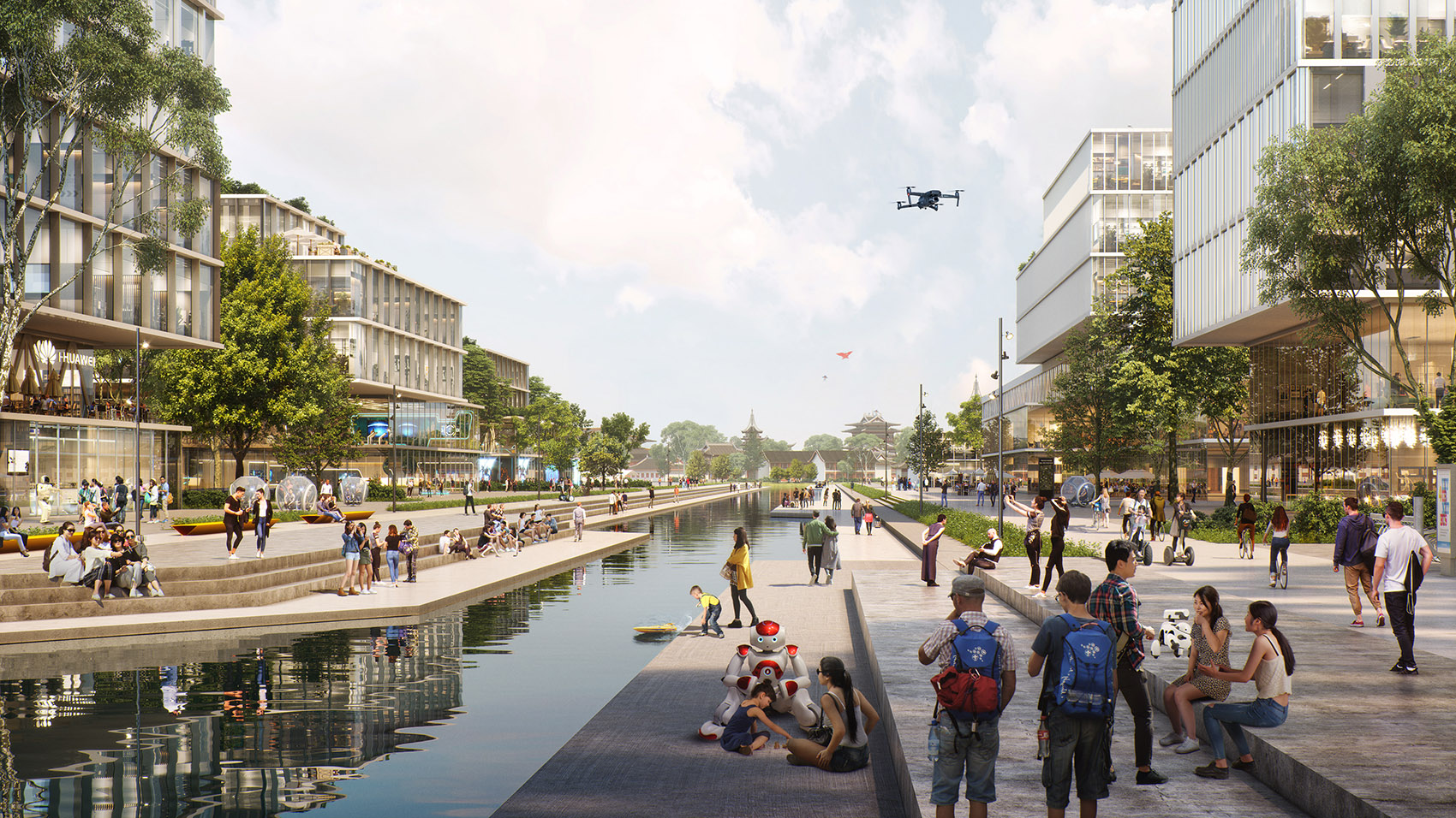
芦苇荡里的村庄
Reed villages
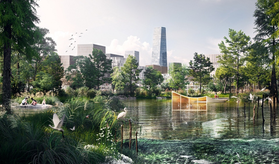
创新居住区的设计理念旨在进一步强调出项目的“亲水性”,公共区域与共享区域均集中并围绕在湿地的边缘。在诗情画意的河流景观之中,全新的居住社区将以一种无拘无束、令人难忘的姿态迎接着人们的到来。
Innovative settlements are designed to embrace the water, with public and shared spaces gathered around the wetlands’ edge. The new communities take on a memorable, unbounded character embedded in the poetic river landscape.
▼项目强调“亲水性”,the proposal emphasis on “water” © MANDAWORKS & UPDIS
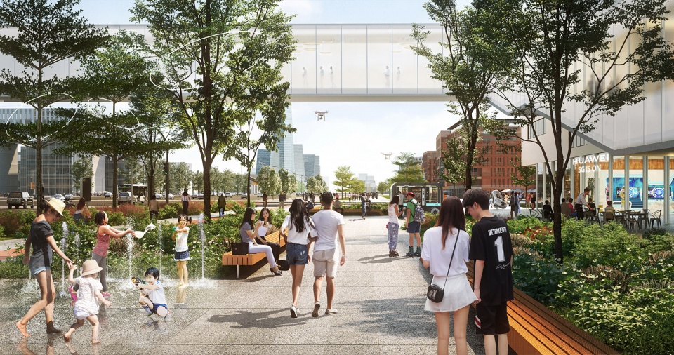
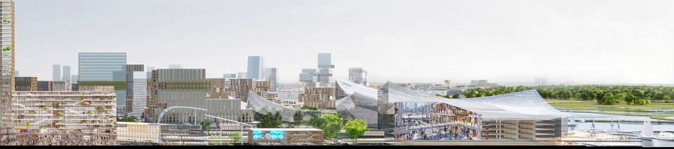
▼剖面图,section © MANDAWORKS & UPDIS
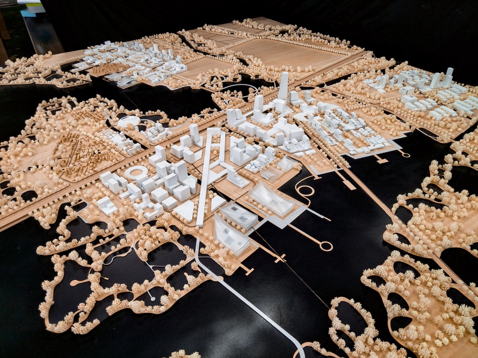
▼模型,model © MANDAWORKS & UPDIS
Type: International Urban Design Competition
Location: Jiangyin, China
Assignment: Masterplan
Client: Jiangyin Municipal Natural Resources and Planning Bureau
Size: 8020 hectares
Office: 深规院联创所 + MANDAWORKS
More:Mandaworks ,UPDIS。



跪求这个效果图公司!
也是
蛮不错
你是不是有病
我想知道任何一个景观项目都要从生态的多样性去想吗?虽然是景观,但是生物并没有这么多,所以还要从生物多样性分析吗?
应该参考设计任务书吧,确实有要求的肯定要分析。然后比如街道景观,就没必要分析生态了
不错